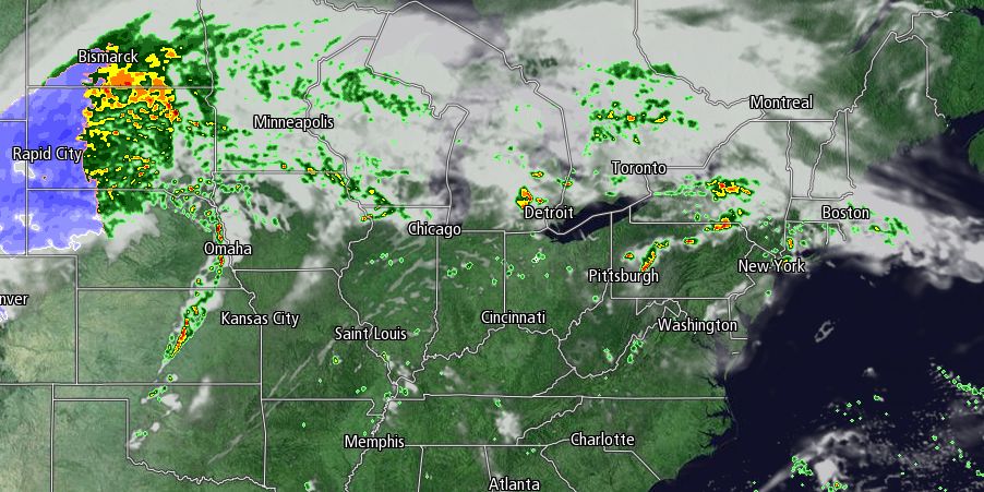
Much of Southern New England received the first measurable rain since September 22 on Friday. There is the chance of a few more scattered showers Friday night with partly to mostly cloudy skies and temperatures falling into the mid 50s by dawn Saturday.
After a cloudy start, Saturday will become partly cloudy in the afternoon. It will be a seasonable day, with highs in the mid to upper 60s. Clouds will thicken again Saturday night. Patchy fog and mist may develop with temperatures dropping into the 50s.
Sunday’s forecast is tricky. Clouds will be stubborn in the morning, and there may be some showers, especially inland, as a warm front lifts to the north. Highs will be in the upper 60s to low 70s. Any showers should move through by late Sunday, with partly cloudy skies Sunday night. It will by dry early next week before a cold front picks up the moisture from Tropical Storm Karen and brings showers from late Monday into, at least, early Tuesday. Clouds will thicken Monday, and showers are possibly by late in the day. Highs will be in the upper 60s to low 70s. Showers are likely Monday night.
The exact track of Tropical Storm Karen is still uncertain, and so is its impact in Southern New England. Right now, it looks like it will enhance the showers Monday into Tuesday while weakening over the Mid-Atlantic states. The big questions revolve around the forecast for the middle of next week. Showers may linger through Wednesday if the remnants of Karen stall over or just off the Mid-Atlantic coast. At this point, our forecast is for the showers to stay away from Southern New England as high pressure moves in from Canada. Look for fair, dry weather from Tuesday afternoon through the middle of next workweek.


