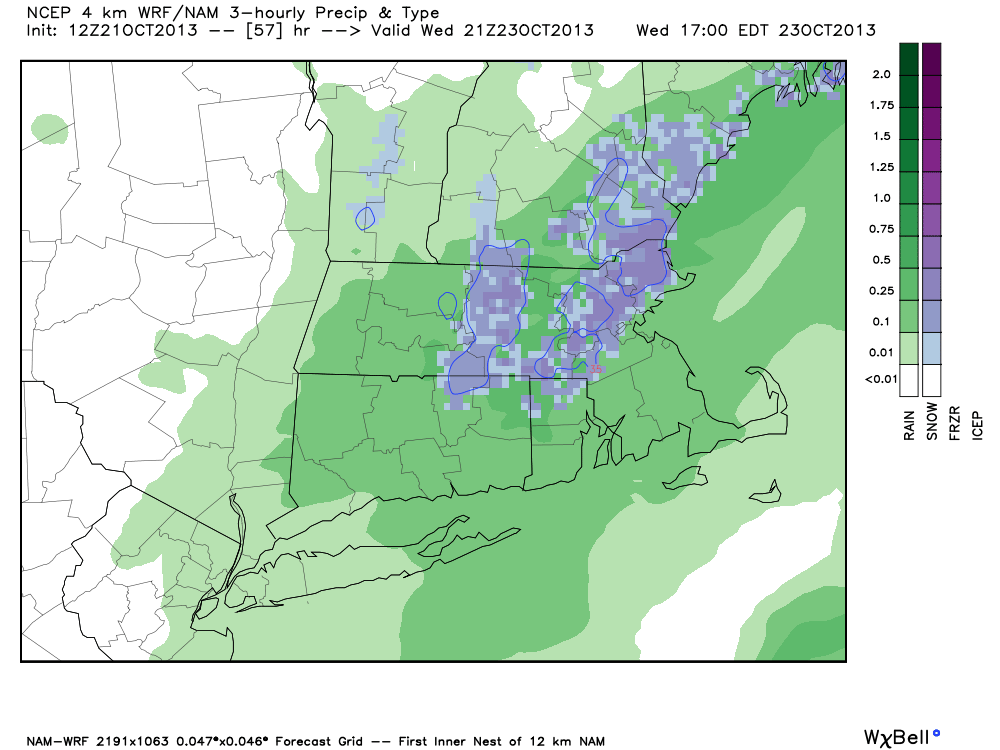
The high-resolution NAM model with a forecast for snow and rain for SNE Wednesday afternoon. It looks raw and chilly on Yawkey Way prior to game one of the World Series.
A quick-moving storm system may bring the first snowflakes of the season to interior Southern New England on Wednesday. The storm will combine with cold air rushing in behind it to bring chilly rain to, at least, Southeastern New England on Wednesday. It’s possible that enough cold air will get involved at higher elevations to allow for the rain to mix with or change to snow in some places. The best chance of seeing snow if the storm takes a track closer to the coast is in the Berkshires. If the storm swings a little farther south, there could be some snow in parts of RI and SE MA. The temperature will likely stay above freezing in all of Southern New England, and accumulation anywhere but the grass is unlikely.
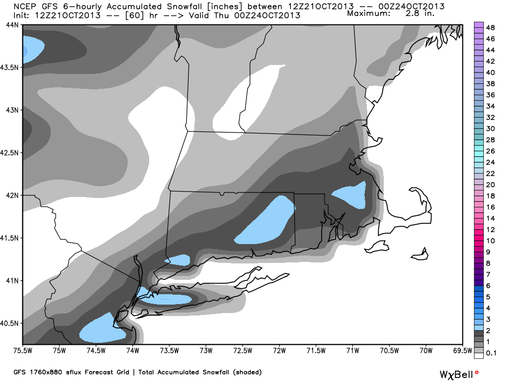
Check out some of the computer model graphics below for more on the snow potential.
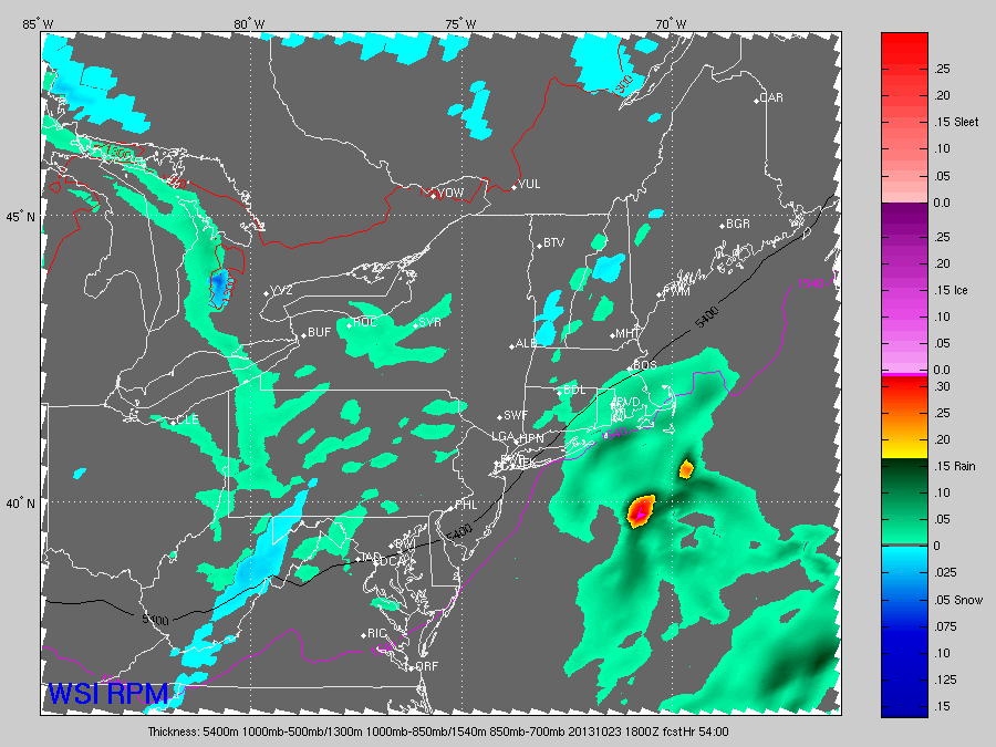
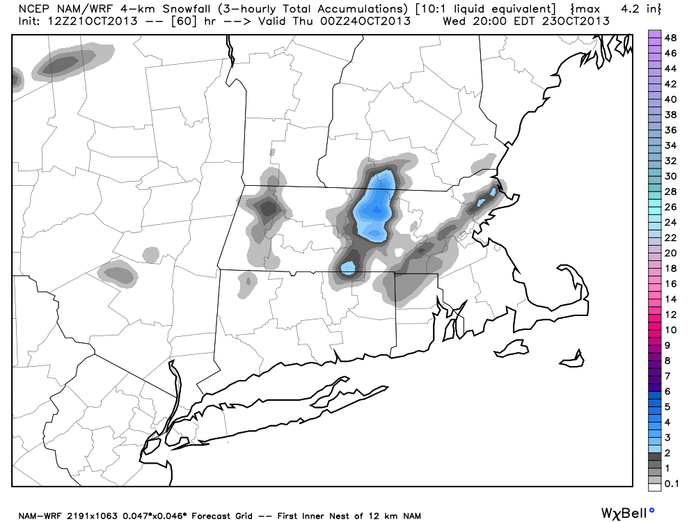
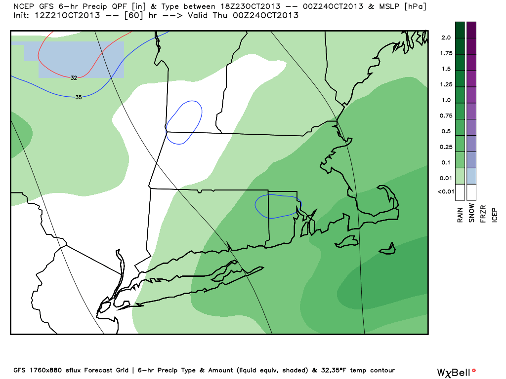
The high-resolution NAM model with a forecast for snow and rain for SNE Wednesday afternoon. It looks raw and chilly on Yawkey Way before game one of the World Series.The WSI RPM model keeps the precipitation as chilly rain in SNEThe high-resolution NAM model has a believable snow forecast for Southern New England based on its projected storm track. The highest elevations of Central and Western SNE could pick up a couple of inches.The GFS model is lower resolution than the NAM, and the projected precipitation type on this map is rain – even though the model proceeds to produce accumulating snow in the I-95 corridor. Notice the blue circle in N RI – that’s the 35° temperature contour. Brrr! The bottom line is there is the potential for some wet snow mixed in with the rain, but we do not expect it to accumulate in the I-95 corridorThe GFS model shows accumulating snow in the I-95 corridor, but the temperature is likely to be well above freezing. While flakes may mix with the rain, it is unlikely there will be accumulating snow.