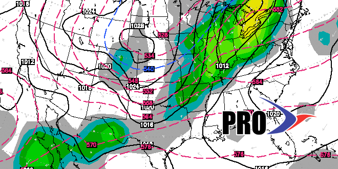
By now you should be well aware of the big chill that is heading for Southern New England in a couple of days. We have been talking about it for a while, and it will likely be a shock to the system because it has been so mild lately. Highs near 50 and lows in the 30s will be commonplace from Wednesday through the weekend. The only shot at steady precipitation (mainly rain, but some snow is possible) through the end of the week is Wednesday as a storm swings out to sea south of Southern New England. Passing showers may move through late Saturday into early Sunday, but it does not look like a big deal.
The weather will improve a bit early next week ahead of the next potential foul weather system that could arrive in the middle of the week. The pattern looks fairly active, and another storm may roll through late in the week or sometime during the first weekend of November. Overall, after getting to near normal early next week, the pattern looks like it will stay cooler than normal. Unfortunately, that means we’ll likely see a chilly Halloween in Southern New England. It may not be brutally cold, but I don’t have high hope for an unseasonably mild night for trick or treating.


