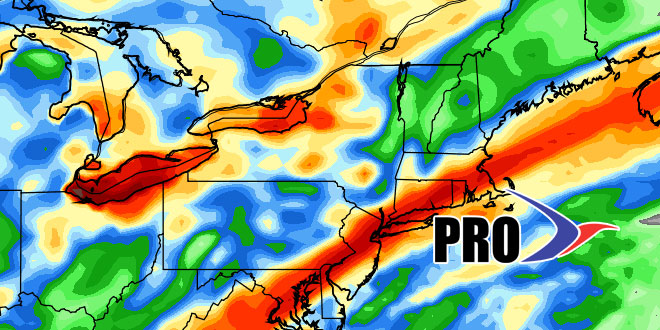
There has only been about 25% of the normal precipitation in the past month in Southern New England. While the dry stretch has provided some absolutely gorgeous days, we’re at the point where we could use some rain. It looks like the remnants of Tropical Storm Karen will bring some rain early next week. If the track of the remnant low is over Southern New England, it could be a really good soaking Monday night into Tuesday. It is unclear at this juncture where Karen will make landfall on the Gulf Coast, so it’s a little early to talk about the exact track after landfall. In any event there should be some rain early next week.
After the rain, it looks like we’re heading for another extended stretch of dry weather in Southern New England. The weather will be fair from Wednesday into, and possibly through, the Columbus Day weekend. It will not be as warm as this current stretch, but it should be a bit warmer than normal for early to mid October. The next shot at rain after early next week is early the following week. We continue to expect a pattern change to cooler weather for the last ten days or so of October.


