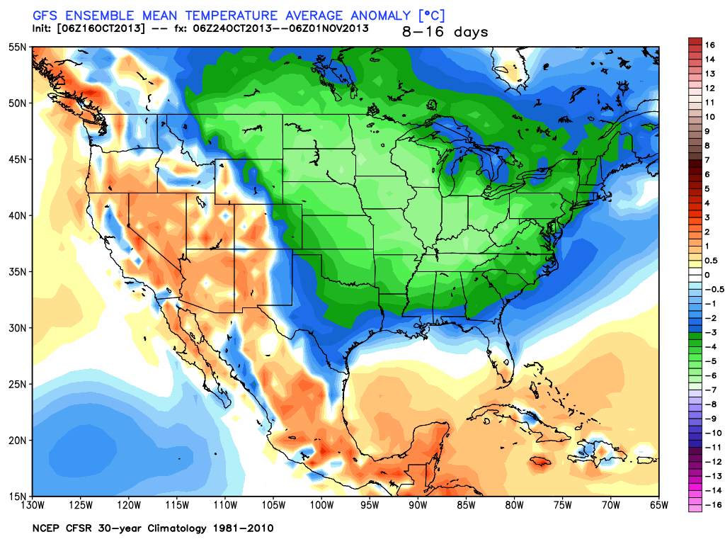
The Eastern United States is in for a rude awakening as a major pattern change will send the month of October from unseasonably warm to very cool in the next couple of weeks. The chilly weather has been in the Western United States so far this month, with the Northeast and Great Lakes enjoying temperatures 3-6° warmer than normal. It will not be long, however, before the dip in the jet stream responsible for the cool weather moves east into the Midwest then the Eastern Seaboard.
The coldest weather, relative to normal, will likely be felt in the Midwest and Southeast. The long-range models show an extended period of mostly chilly weather for the Northeast beginning in about a week and lasting through the end of the month. The high temperature will struggle to get out of the 50s most days from October 24-31. Believe it or not, that is not too far below normal, but it will probably seem colder because of the unseasonably mild weather so far this month. With all the chilly air in the Northeast, it’s possible that there could be significant interior Northeast (outside of Southeastern New England) snow before the end of October for the third straight year.
Sign up for Right Weather Pro for twice weekly updates on the Long Range (2 week) forecast.


