If you think about it, we have had an amazing stretch of weather dating back to Labor Day weekend. The last time there was widespread heavy rain in Southern New England was on Labor Day. September was cooler than normal, but featured plenty of clear, cool nights and sunny mild days. October is running about 4° warmer than normal, with only about 20% of the normal amount of rain. The lack of rain in the last seven weeks has not had a big impact on the lawns or foliage season. To my eye, this is one of the best foliage seasons in New England in the past decade or more.

That’s enough happy talk. Brace yourself for a major change in the weather in the next 10 days. The transition begins in the upcoming week with a cold front moving through Tuesday night. It is possible a storm develops along the front as it gets offshore. If this occurs, you can expect a chilly rain Wednesday night and Thursday. If not, you can just expect a chill! We’re not talking about extremely cold weather in the Northeast, but compared to the month so far it will come as a shock to the system.
The temperature will fall into the 30s at night and struggle to get into the 50s during the day regardless of any stormy weather from Wednesday through next weekend. It will likely drop to 32° or below in most of Southern New England late in the workweek or next weekend. The weather looks generally fair through next weekend. Check out the meteograms below for the temperature drop heading into next weekend.
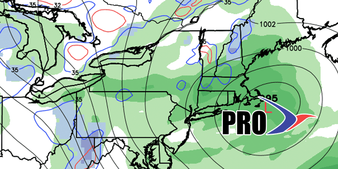
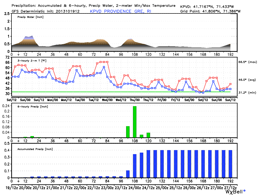
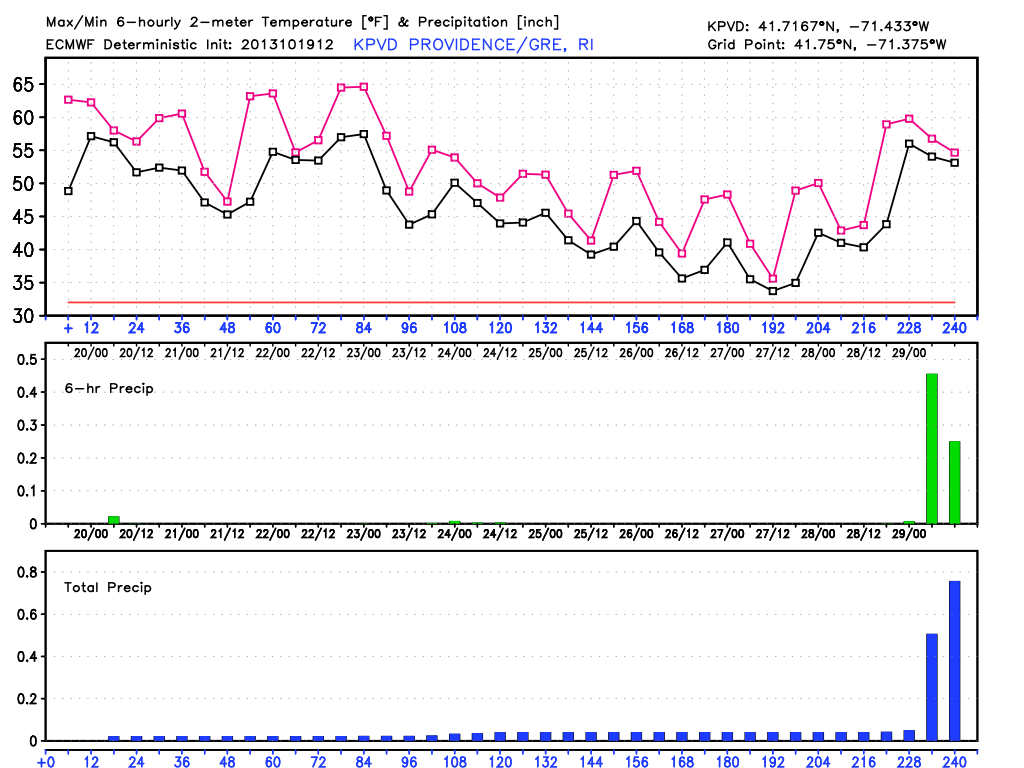
The Wednesday night-Thursday storm is by no means a lock to occur. The ECMWF model was the first to hint at it, but it has since backed off with just a few showers on Thursday. The GFS model continues to advertise a steady, chilly rainstorm for Southeastern New England, with the chance of wet snow in Western MA. Obviously, I’m hoping the Red Sox make the World Series, but regardless of who wins the ALCS, the first two games of the series will be played Wednesday and Thursday night in some chilly weather. It would be near freezing in Detroit, and in the 40s with the chance for rain in Boston Wednesday night. Brrrr!
So, it’s possible the “stormy” part of the chilly and storm forecast does not occur this week, but we still believe there will be one or two storms in the following week, which could spell trouble for trick or treaters. Remember, the past two years have featured some wild weather on October 29. Two years ago was the freak snowstorm, and last year was Sandy. This year, it looks like a decent chance of chilly rain around that time, with the potential for another storm later in the week – possibly impacting Halloween. Right now, there is no snow in the forecast for Southeastern New England, but with anomalously chilly air in place, storm tracks will have to be watched very closely.
Thanks for subscribing to Right Weather Pro. We’ll keep you updated as the weather action picks up. Have a great weekend and go Sox! (Pats, too)


