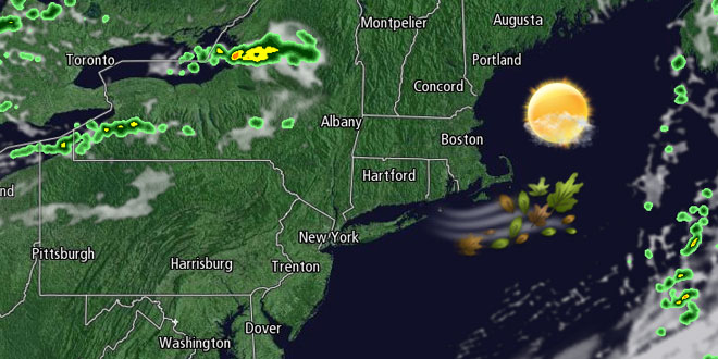
A few showers are possible Saturday night as a cold front swings through Southern New England. The weather behind the cold front is not particularly cool. The cold fronts that move through in the upcoming week will not be so forgiving. The unseasonably mild October will take a sharply colder turn by the mid to late workweek.

Sunday will be a mostly sunny, breezy, and dry day. Highs will be in the low to mid 60s with a 10-25 mph west wind. The weather looks great for the Patriots vs. Jets game in New Jersey. Sunday night will be clear and seasonably cool. The temperature may dip into the 30s in the countryside. It will be in the low to mid 40s in the cities and near the coast by dawn Monday.
The early part of the workweek looks dry and rather mild. Monday will bounce back from a cool start to reach the low to mid 60s under mostly sunny skies. It will not be as cool Monday night as Sunday night. Lows will be in the 40s to low 50s. The wind will swing around to the southwest on Tuesday as a cold front approaches from the west. It will stay mild ahead of the front, and highs in the 60s are likely. The cold front will push offshore by Wednesday morning. The temperature will drop into the 40s Tuesday night.
The coolest weather of the season to date is in the forecast for the mid to end of the workweek. There is uncertainty about the potential for chilly rain Wednesday into early Thursday. A storm may develop close enough to the coast to bring cool, breezy rain to Southern New England on Wednesday. In a worst-case scenario, the rain would continue Wednesday night before ending around dawn Thursday. It’s possible the storm will not materialize, and the weather will stay chilly and dry through the end of the workweek. Regardless of the storm, you can expect highs in the low 50s and lows in the 30s Wednesday to Friday.
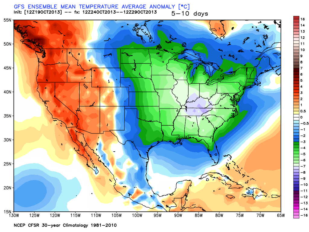
It will stay cool into, and possibly through, next weekend. The low temperature Saturday morning will be near or below freezing inland, and it will be in the 30s near the coast. Saturday afternoon looks bright, but chilly, with the temperature struggling to reach 50°. After a cold start, the temperature will climb into the 50s next Sunday.


