We are one day closer to the potential midweek pre-Thanksgiving storm, but the computer models continue to disagree on how the weather in the Eastern United States will play out. The GFS is even farther offshore with a front delivering relatively light rain/snow to SNE Tuesday night, followed by a second storm that swings well out to sea on Wednesday into Thursday. The ECMWF continues to bring the storm close to or over SNE, with mainly rain. The Canadian model is even farther inland than the ECMWF. The NAM is trending inland, too – but only goes out to 84 hours. The JMA (Japanese) model was on board with that scenario yesterday, but now it looks a bit more like the GFS than anything else.
If it weren’t for the JMA, we’d be very confident in a rainy Wednesday forecast. As it is, we’re moderately confident that the storm will track close enough to SNE to bring steady, possibly heavy, rain on Wednesday.
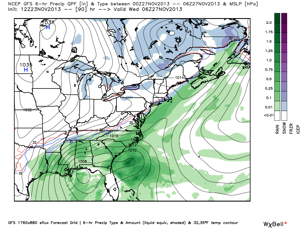
GFS
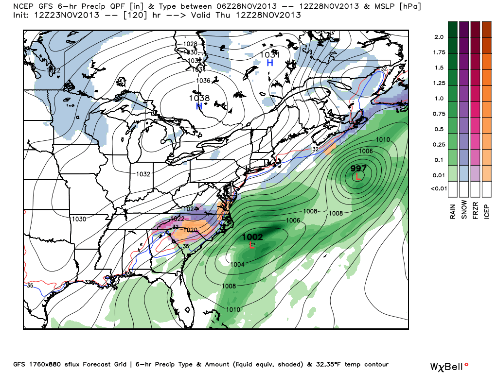
12Z GFS – This is the map Tuesday night. Notice the snow over SNE from the front passing through. The storm getting organized in the Gulf of Mexico is taken out to sea on Wednesday. We think the storm will move up the coast.12Z GFS – Storm heading out to sea early on Thanksgiving. Cold, dry, blustery in SNE.12Z GFS Snow Total – Through Wednesday afternoon the GFS has light snow totals in RI and SE MA with the first system that forms along the passing front. 2″ or less for all of SNE, and with melting on contact it would probably only be a dusting.
ECMWF
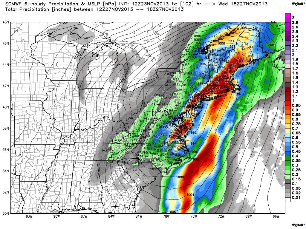
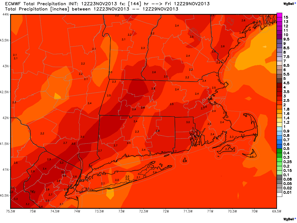
12Z ECMWF – This scenario has one system moving up the coast during the day on Wednesday. SNE is on the warm side of it, and there is moderate to heavy rain all day.12Z ECMWF – Rainfall totals from the storm. An impressive 2-3″ for most of SNE. This would be the biggest soaker since early-September.12Z ECMWF Snow Totals – Snow is kept out of nearly all of SNE because the storm tracks right over SNE. This is the scenario we find most plausible at this time.
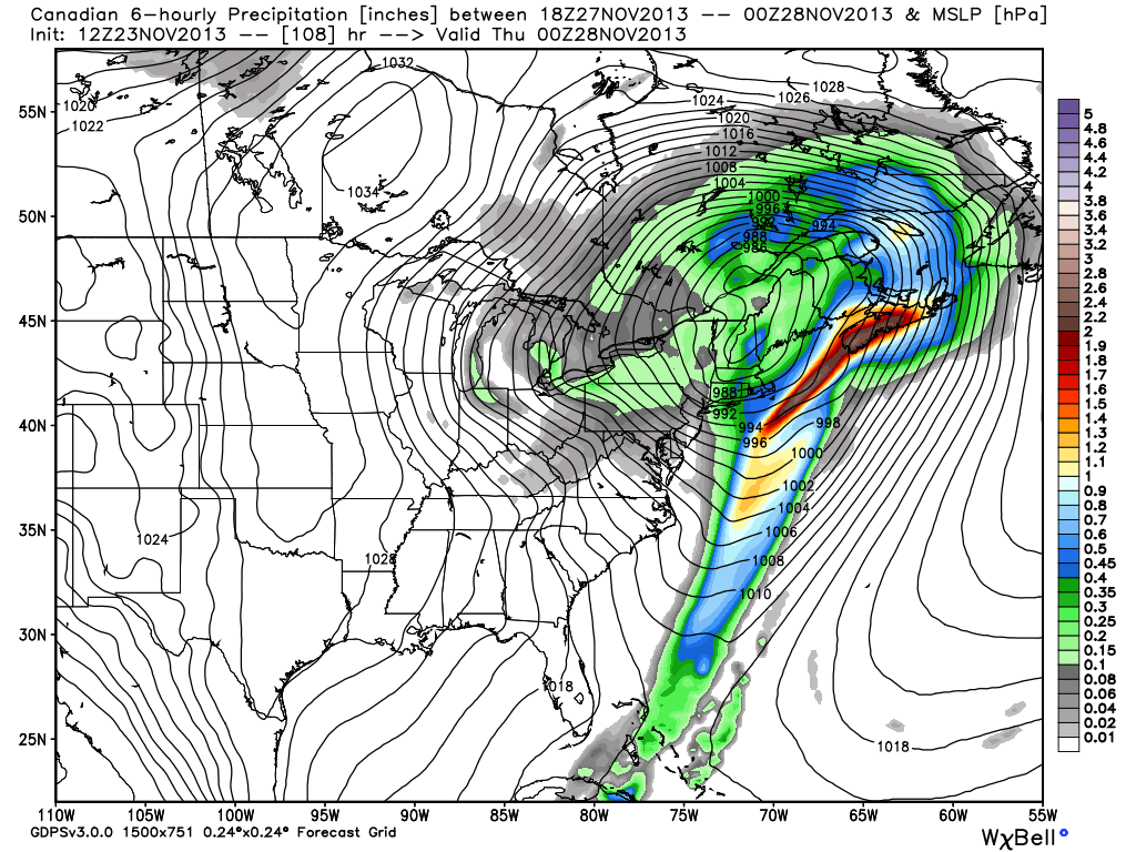
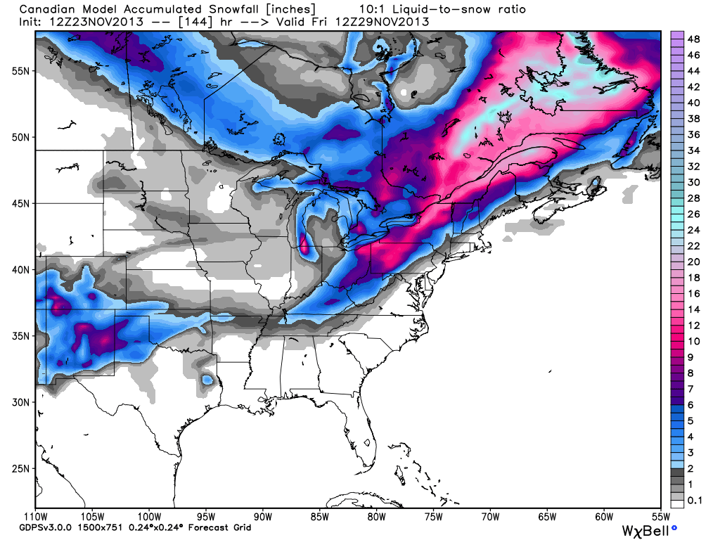
Canadian
12Z Canadian Model – Storm track is right up the coast bringing moderate to heavy rain to the Eastern Seaboard. Precipitation shuts off as colder air arrives on the back side of the storm. Closest to the ECMWF solution.12Z Canadian – Snow totals – Snow is confined to the interior Northeast and northern-most mountains of Northern New England. No snow in RI or SE MA
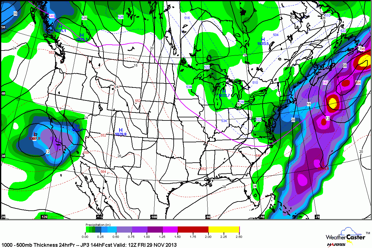
JMA
12Z JMA – weak system forms along front on Tuesday. Stronger system getting organized over the SE US. This is actually closest to the GFS scenario at this point. JMA, however, brings the second system closer to the Northeast than the GFS12Z JMA – Chilly rain or wet snow in SNE as the second storm moves east of the Mid-Atlantic Wednesday into Wednesday night.12Z JMA – This is the precipitation forecast from 7 am on Thanksgiving to 7 am on Friday. Basically, if this is right, the high school football games would be played in cold rain, mixed precipitation or snow.
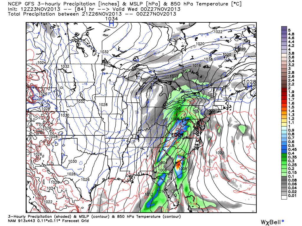
NAM
12Z NAM – the model only goes out to 84 hours, but you can clearly see that it is taking the system up the Appalachians putting SNE on the mild side of it.
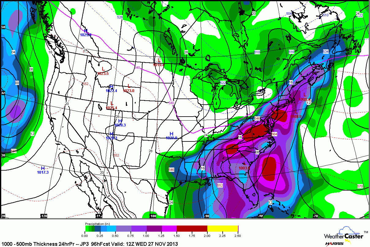
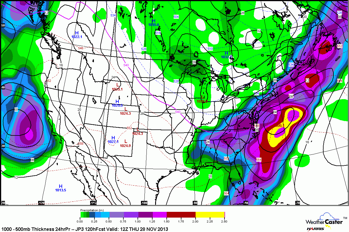
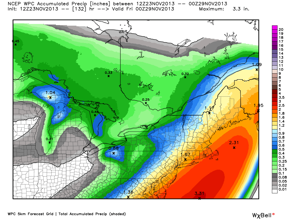
WPC
NCEP WPC precipitation forecast – NOAA Weather Prediction Center is favoring a track between the GFS and the ECMWF. In this scenario, Worcester County westward would get some snow. Still mainly or all rain in RI and SE MA