The models are trending toward a big rainmaker for the Eastern Seaboard, with snow in the interior Northeast – well outside of Southern New England. The GFS has finally come around to the ECMWF, Canadian, and NAM. It’s the scenario we have been heavily favoring for a few days. Soaking rain for RI and SE MA. This will likely be the last Computer Model Trends update for this storm.
GFS
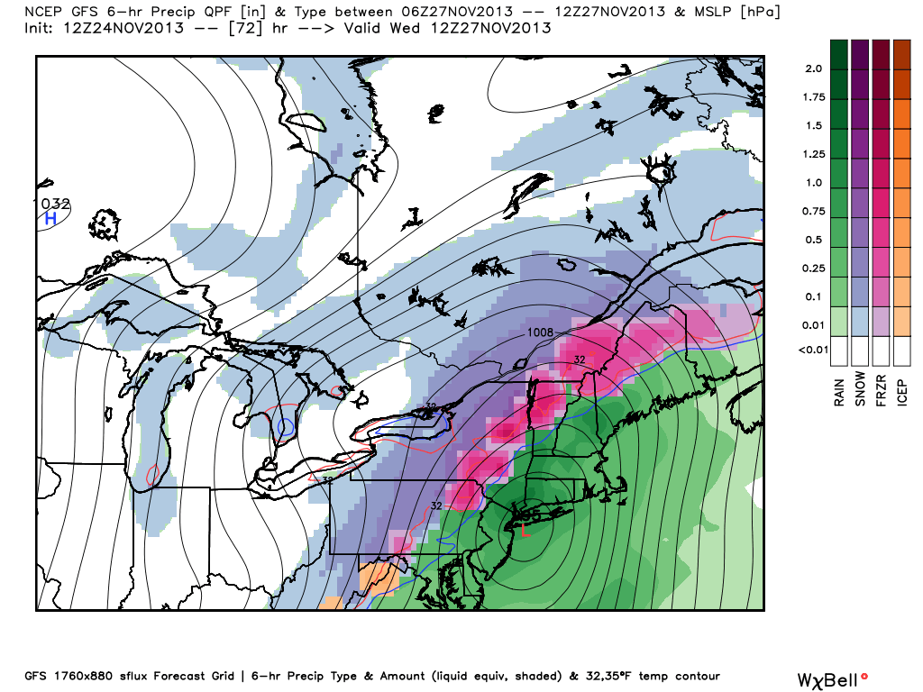
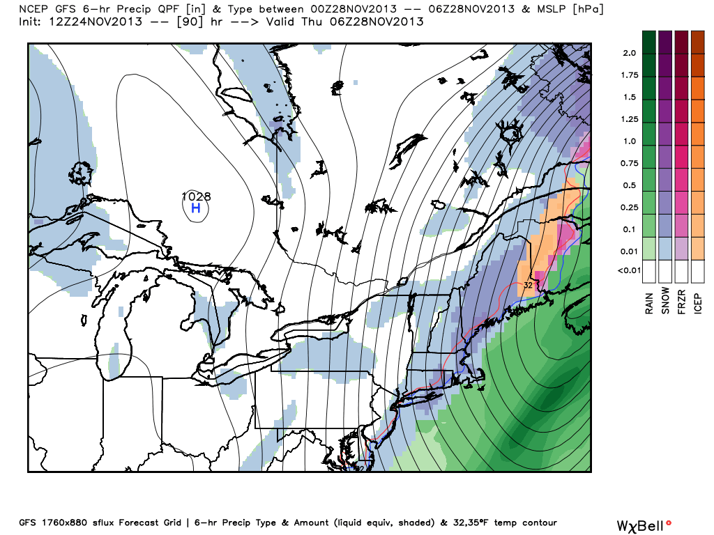
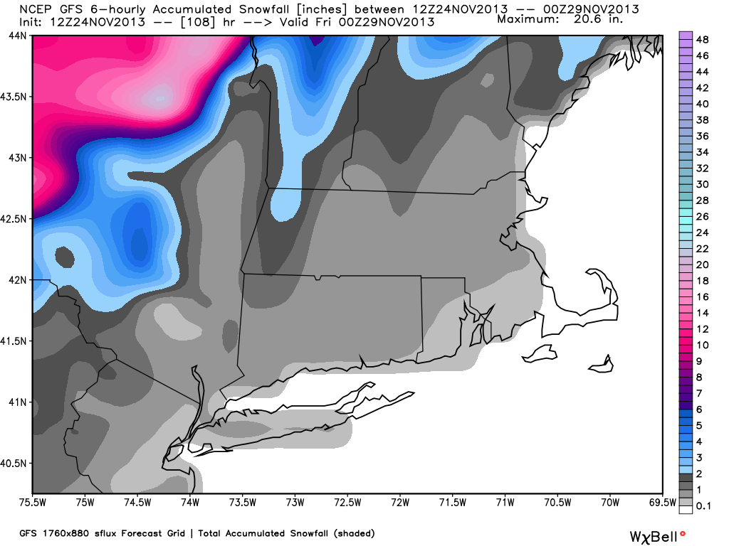
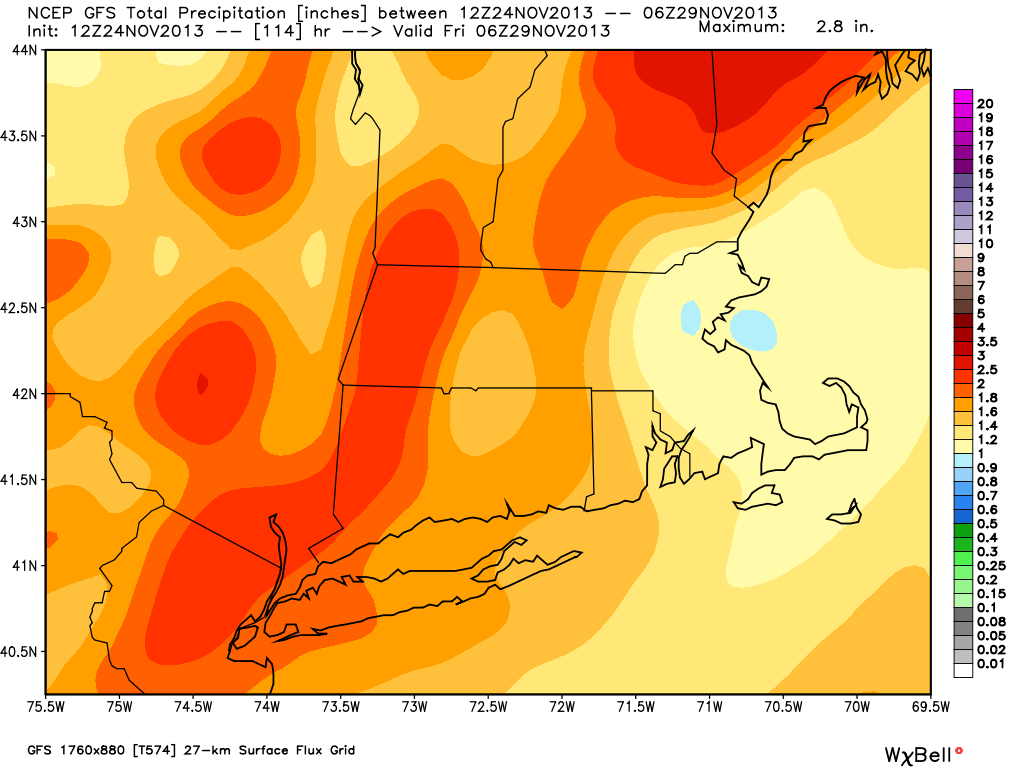
GFS 12Z Sunday – Finally bowing to the other models, the GFS brings the storm over SNE. Wet, windy and mild! It’s track is faster than the other models, with the heavy rain late Tuesday night instead of during theGFS 12Z Sunday – still wants to end it as wraparound snow Wednesday night. I’ll believe it when I see it, especially in SNEGFS 12Z Sunday – Snow forecast has shifted well inland. Light snow over Southeastern New England is from wraparound Wednesday night. It would have a tough time accumulating on a wet ground, if it occurs at allGFS 12Z Sunday – 1-2.5″ of rain in most of SNE. Seems about right, and I especially like the lower totals in E MA.
ECMWF
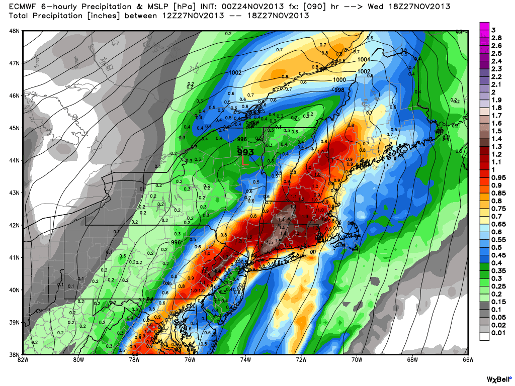
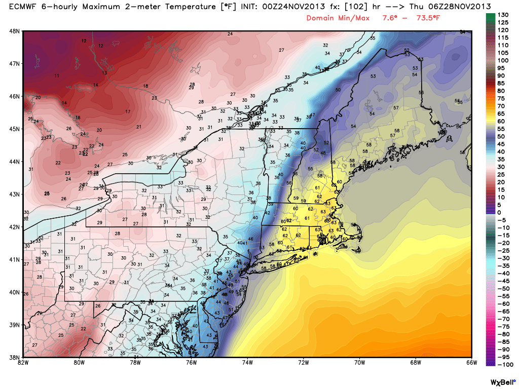
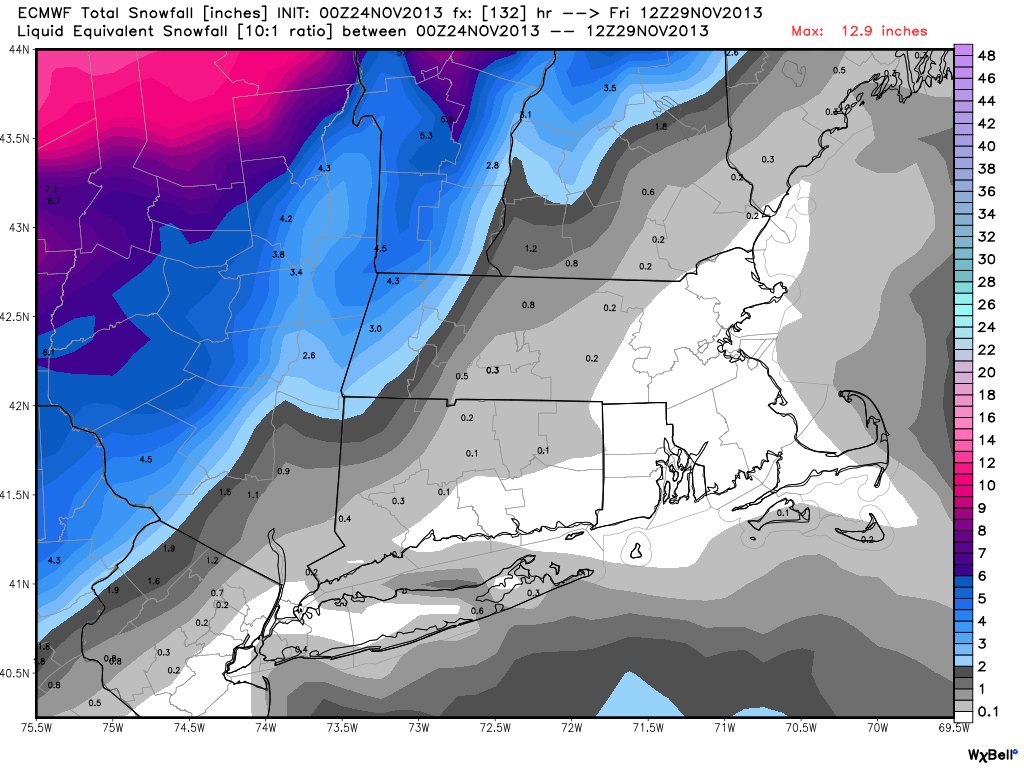
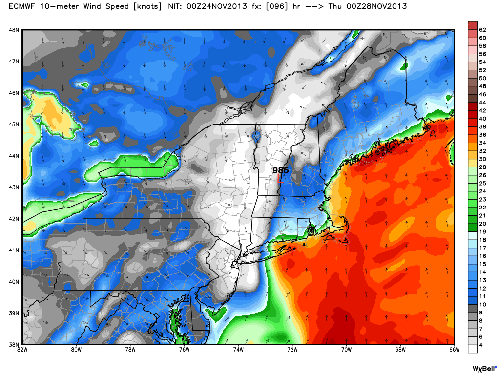
ECMWF 00Z Sunday – Storm track to the west of RI puts Southeastern New England on the wet, windy, and very mild side of the storm.ECMWF 00Z Sunday – Well into the 60s on the eastern side of the storm in SNEECMWF 00Z Sunday – 2-3″ of rain for Southern New EnglandECMWF 00Z Sunday – No snow for RI or SE MA. Nothing significant until you get to the mountains of NY and Northern New EnglandECMWF 00Z Sunday – Strong winds likely if the storm takes this track. Could be some 60 mph gusts near the SNE coast
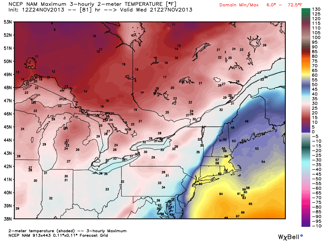
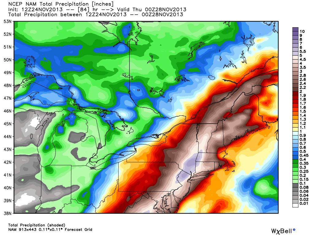
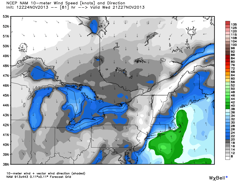
NAM
NAM 12z Sunday – Temperatures reach the 60s in Southeastern New England late Wednesday – sharply colder on the west side of the stormNAM 12z Sunday – HEAVY rain. Around half a foot in SE NY!NAM 12Z Sunday – Strong sustained winds near the coast Wednesday, even stronger gusts likely
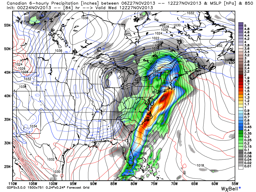
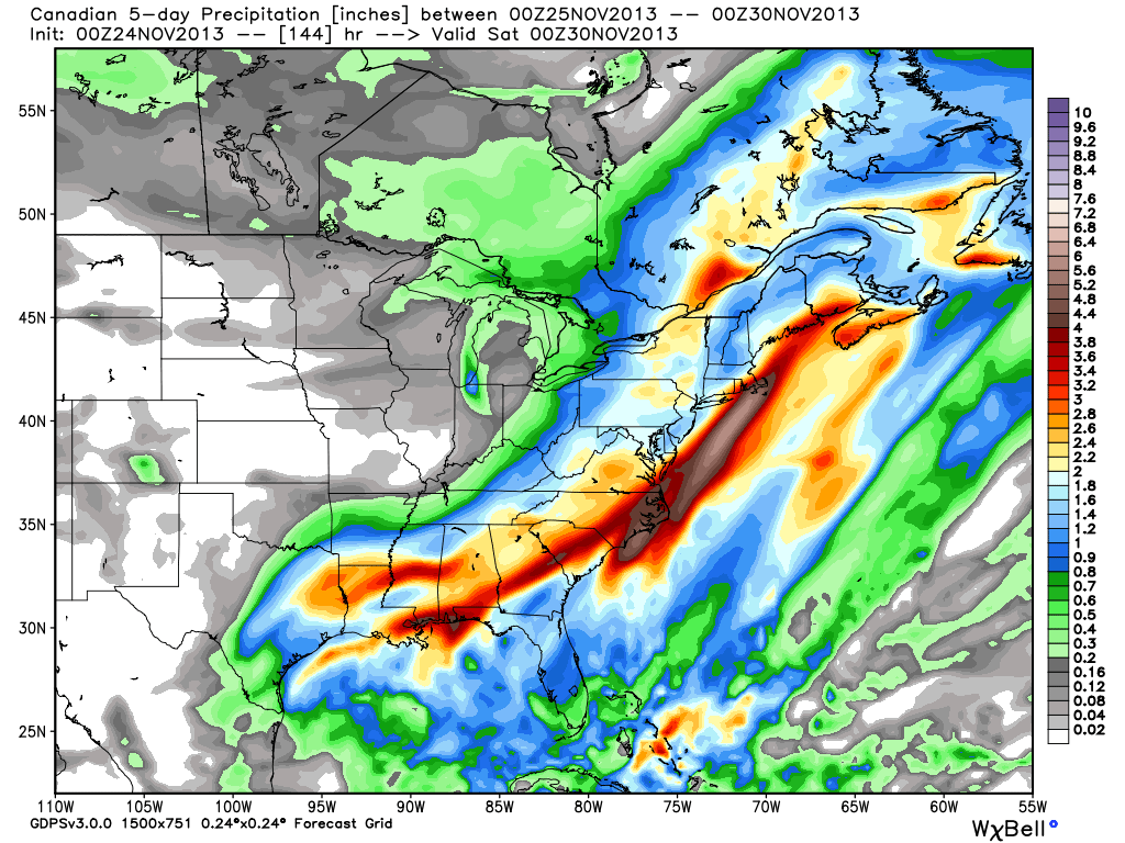
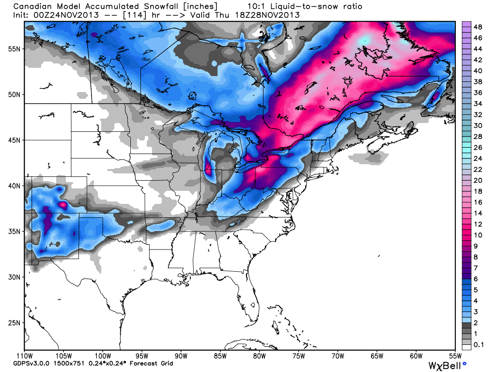
Canadian
Canadian 00Z Sunday – Inland track means rain and wind for Southeastern New EnglandCanadian 00Z Sunday – strip of heavy rain over SNECanadian 00Z Sunday – Snow confined to the interior Northeast with an inland storm track
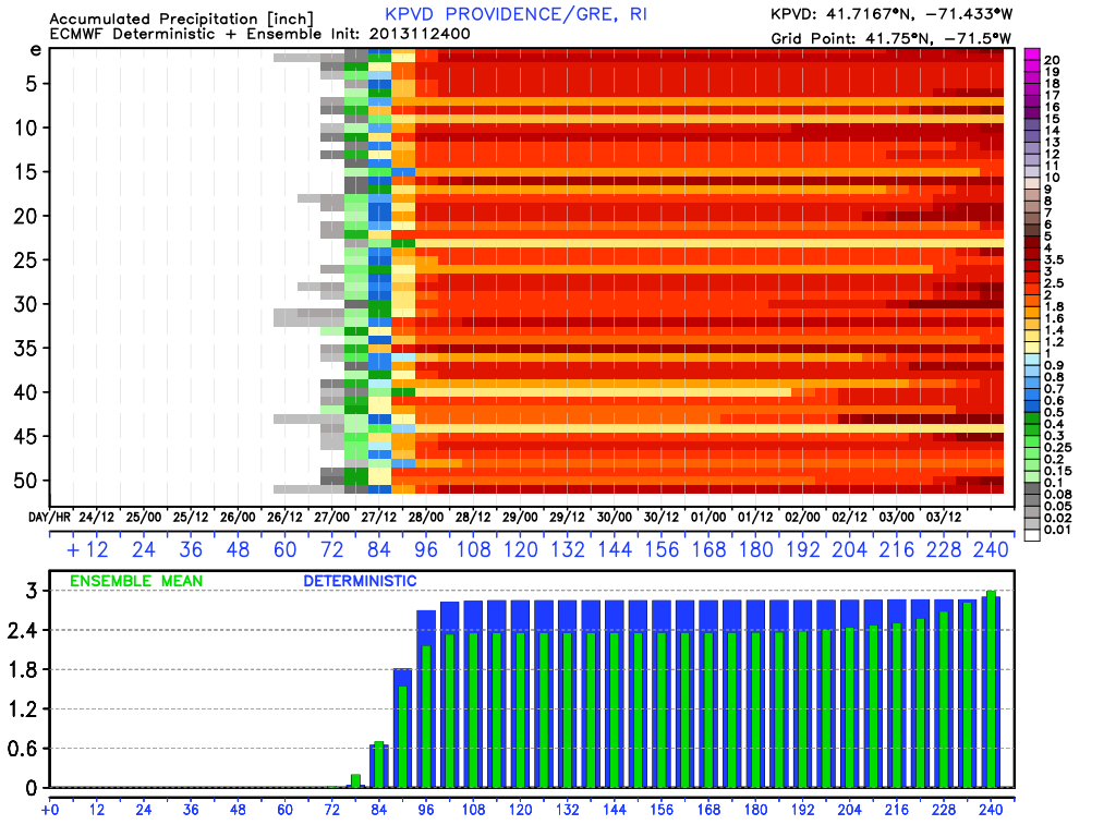
European Ensemble
EPS 00Z Sunday – Most members predicting 1.5-3″ of rain for SNE
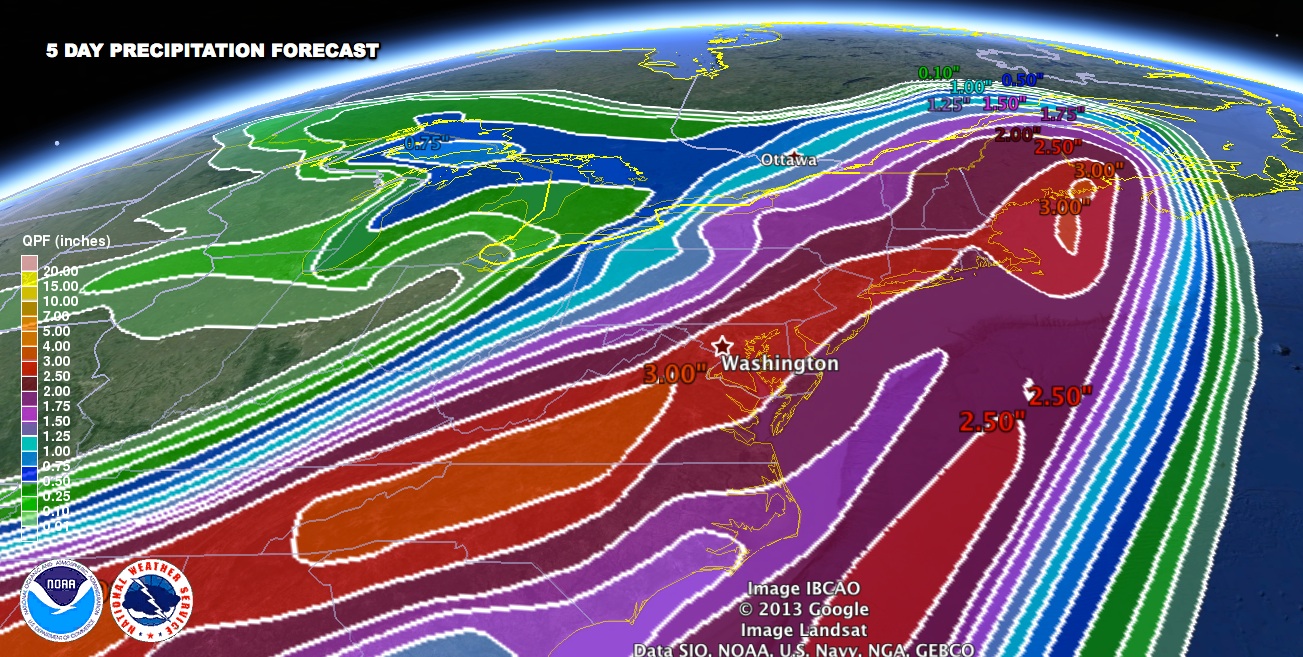
WPC Rain Forecast
NOAA Weather Prediction Center 72 Hour Precipitation – Heavy rain for the Eastern Seaboard
The Bottom Line
A wet, windy, and mild storm is heading for Southern New England Tuesday night through Wednesday. The main threats are for 2-3″ of rain in the hardest hit areas, and wind gusts over 50 mph near the coast. We will continue to keep you updated on the storm potential in the next couple of days.