Long Range ForecastRight Weather Pro

Long Range Forecast – November 28

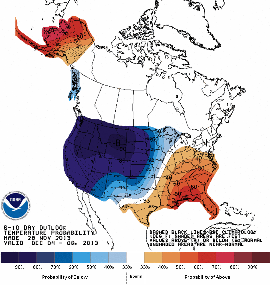
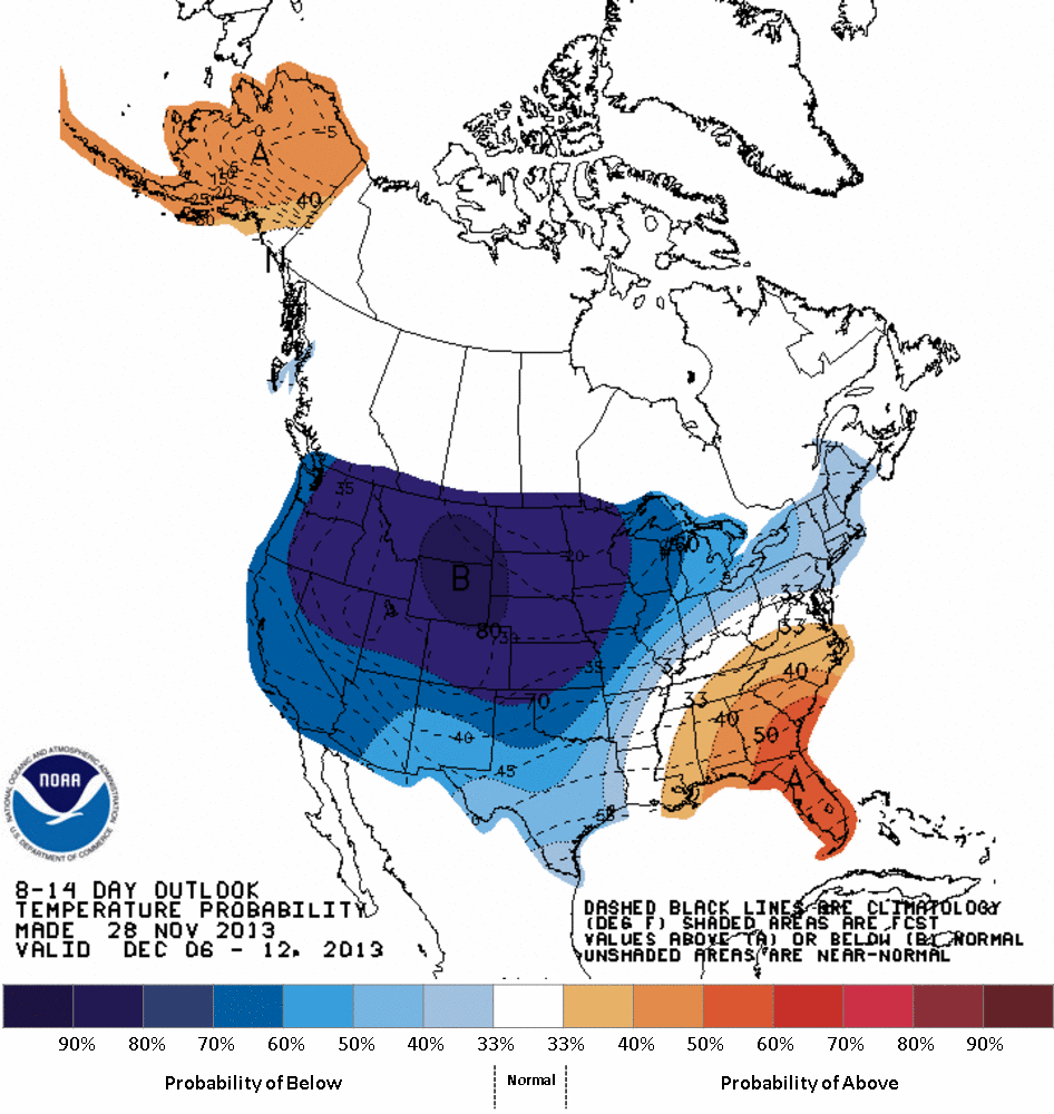
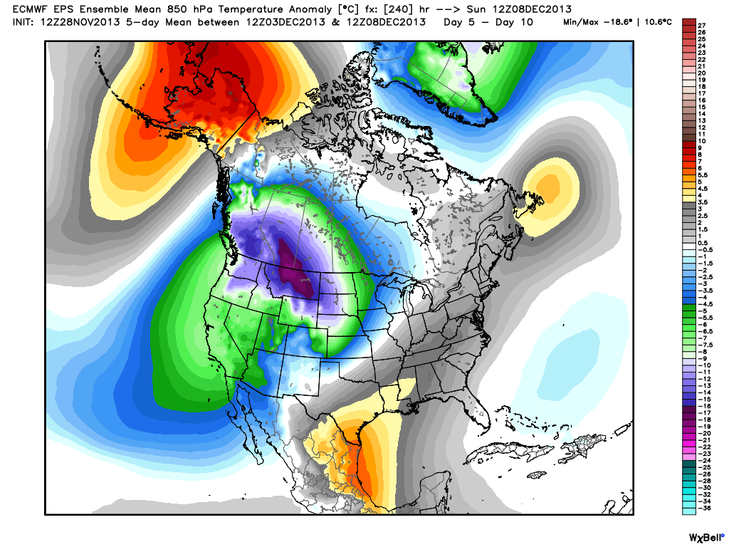
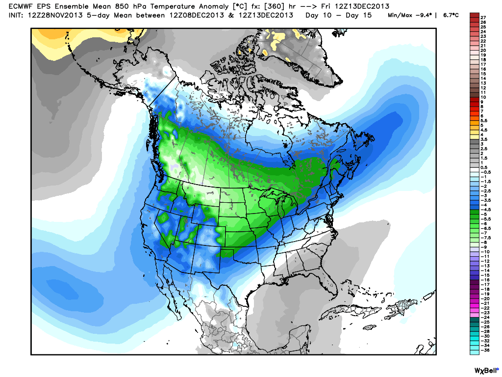
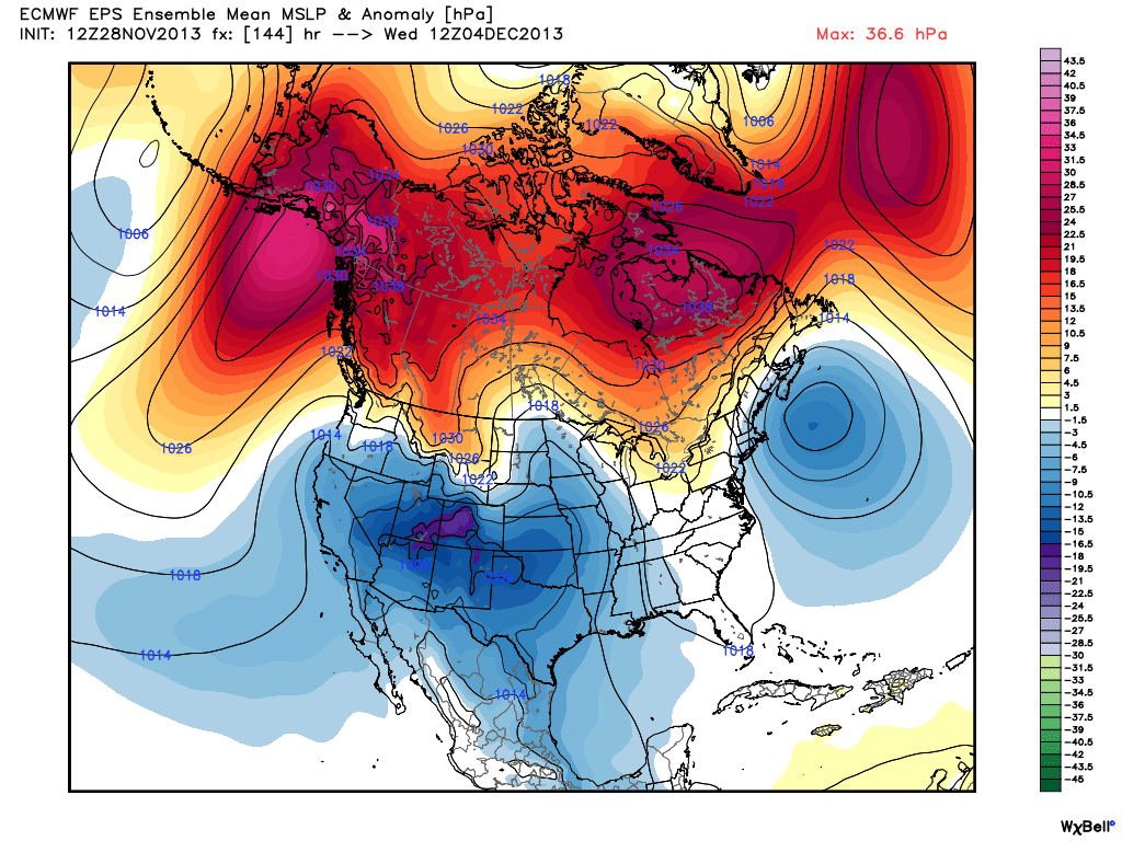
I hope you had your fill of family, food, and football on Thanksgiving. I sure did, and it was a great day. The weather pattern looks pretty interesting from coast to coast over the next couple of weeks. In the last Long Range Forecast we talked about a huge Alaskan ridge that would help to spill cold air into the United States. It looks like the brunt of that cold air will be in the Western United States in the next couple of weeks. Eventually, some of it will head east. (hint, hint for the winter forecast which will be out soon)

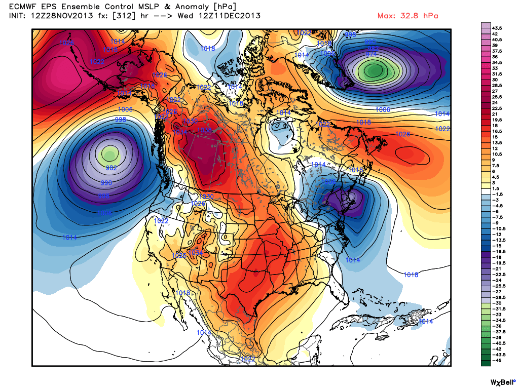
In the meantime, we’ll keep our eye on a sneaky system that could clip eastern New England with snow and/or rain on Tuesday/Wednesday. The GFS model is out to sea with it, but the European keeps it close enough for some precipitation. The following system late next week looks milder with rain for Southern New England. The last few runs of the European and GFS show a significant storm around December 12. I usually don’t get too excited about a 348 hour forecast, but I’ll be looking to this range of the forecast for the next few runs to see if it’s still there.

No video today, but all the graphics are here for you to take a look at.

2013-11-28-headlines

COLD arrives in the Western US

610prcp.new

COLD out west
COLD out west

814prcp.new

EPS Mean 0-5 day 850mb temperature anomaly - Cold in the Northeast through the weekend. Look at the cold air coming down the west coast of Canada
EPS Mean 0-5 day 850mb temperature anomaly – Cold in the Northeast through the weekend. Look at the cold air coming down the west coast of Canada
EPS Mean 5-10 day 850mb temperature anomaly - a slight "warm-up" in the Northeast. Storm track may be west of SNE late next week aiding the milder air in getting to SNE
EPS Mean 5-10 day 850mb temperature anomaly – a slight “warm-up” in the Northeast. Storm track may be west of SNE late next week aiding the milder air in getting to SNE. Big time cold hits the Pacific NW.
EPS Mean 10-15 day 850mb temperature anomaly -
EPS Mean 10-15 day 850mb temperature anomaly – Cold is still centered in the west, but it’s bleeding east.
EPS mean keeping a storm close enough for at least a minor impact in the middle of next week.
EPS Control with a Northeast storm Dec 11/12. GFS also hip to this idea...for now.
EPS Control with a Northeast storm Dec 11/12. GFS also hip to this idea…for now.

Fred Campagna

President and Chief Meteorologist - Right Weather LLC AMS Certified Consulting Meteorologist #756 AMS Certified Broadcast Meteorologist #126

Related Articles

Back to top button