Several computer models advertising an early-season winter storm kickstarted the hype machine on Wednesday. 2011 and 2012 both featured early snow storms in Southern New England, and the prospect of a third straight year with snow before Thanksgiving had social media buzzing. So, what’s the latest on the potential for a Nor’easter in the middle of next week? Let’s take a look at the computer model trends.
GFS Model
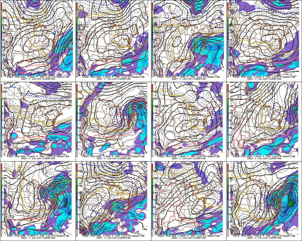
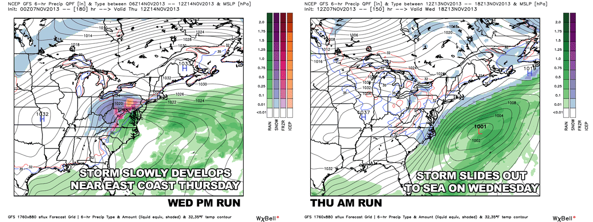
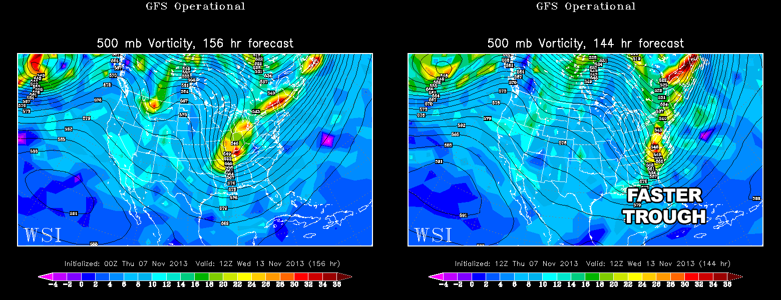
After a few consecutive runs with a whopper storm for the Mid-Atlantic and Northeast, the 12Z November 7 run on of the operational GFS kept the storm offshore with NO impact in Southern New England. Basically, the newer run is a lot quicker with the shortwave disturbance heading for the East Coast in the middle of next week. It has a large area of high pressure moving southeast from Canada and the storm that forms off the Carolina coast moves northeast away from the coast. Prior runs had the trough sharpening up before reaching the coast. The result was a slower-developing storm that hugs the coast as it moves north late next workweek.

ECMWF Model
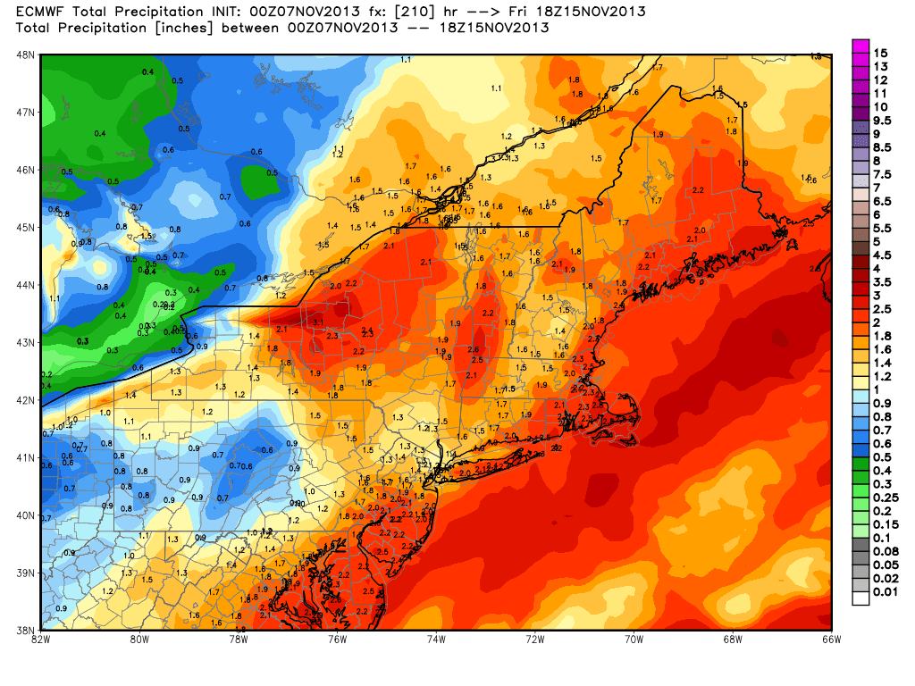
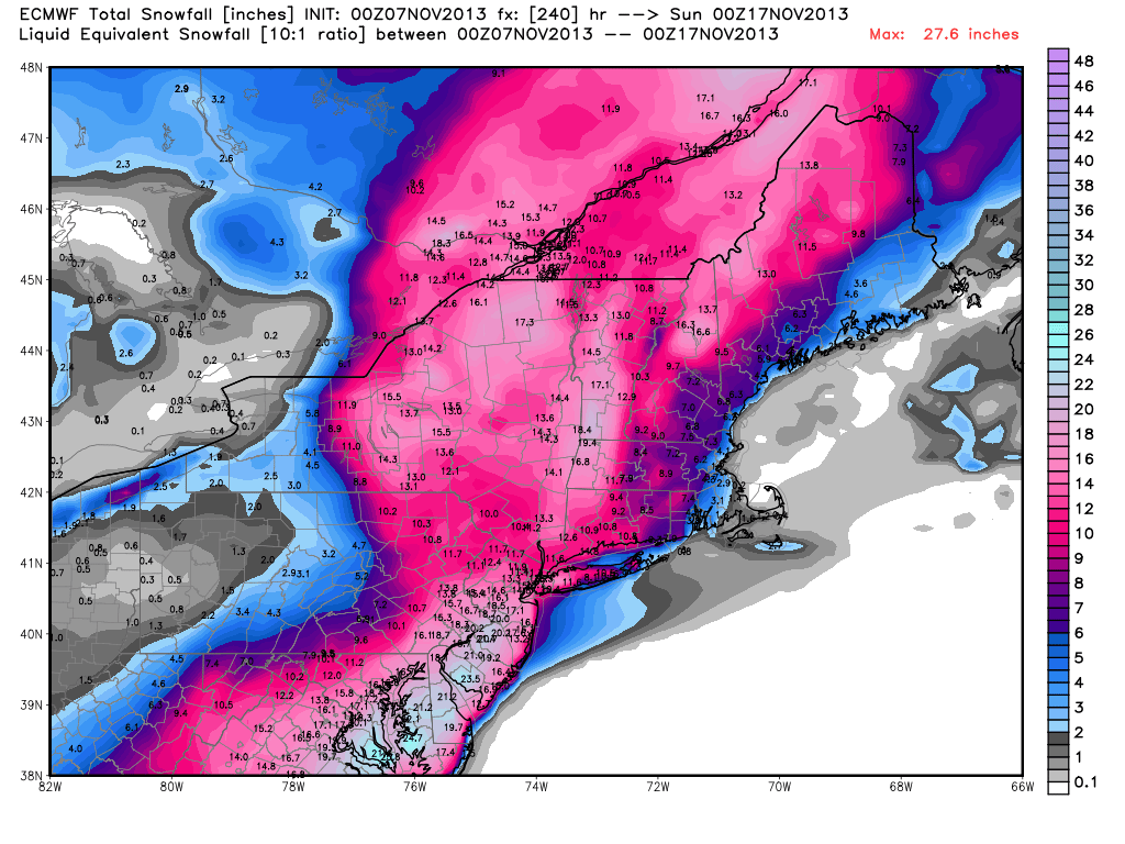
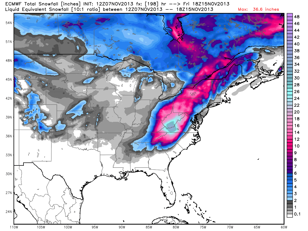
The ECMWF (European) model latched onto a stormy solution with its 00Z November 7 run. The operational run brings a major early-season Nor’easter to the Mid-Atlantic in Northeast. The track of the storm is close enough to the coast that there is more rain than snow in Southeastern New England. This solution is drastically different from the most recent GFS run, and it will be very interesting to see what the ECMWF shows in its 12Z November 7 run due Thursday afternoon. We’ll update the graphics when it comes in. In the meantime, check out the epic 00Z run.
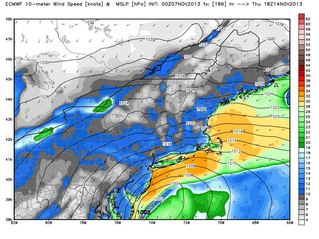
UPDATE: The 12Z ECMWF is a huge departure from the GFS. It has a slow-moving strong storm that whips the East Coast with wind and rain. It brings very heavy snow to the Appalachians from North Carolina to Northern New England. Southeastern New England gets rain and wind.

Canadian Model
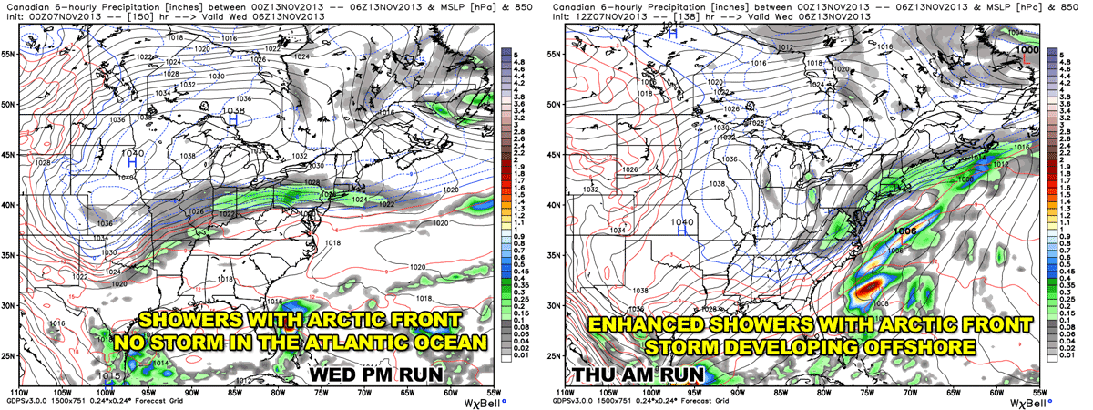
The latest run of the Canadian model is closer to the latest GFS than it is to the ECMWF, but it’s overall solution is an outlier. The Canadian has the storm develop in the Atlantic Ocean at the same time that the Arctic cold front is crossing Southern New England. The storm begins on Tuesday and ends by midday Wednesday. While the progressive pattern has merit, the timing seems too quick. Also, the precipitation with the Arctic front seems overdone in the Northeast. The center of the storm is way offshore, and a more likely scenario would have one round of rain/snow showers Tuesday followed by dry weather.
The previous run of the CMC model had some showers with the Arctic front, but no sign of the storm in the Atlantic Ocean. Now it’s seeing the potential for a storm, but it may be too quick with developing it.
The Bottom Line
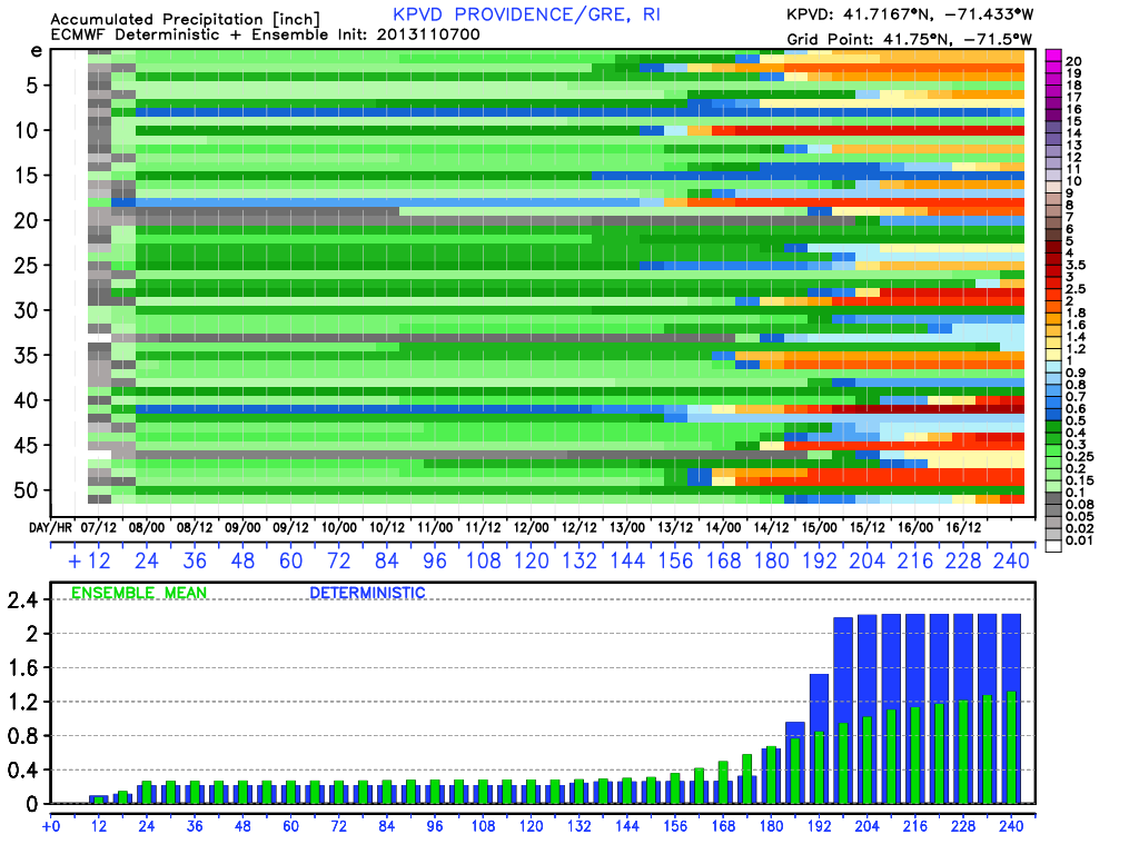
The jury is still out on this one! The NAO is positive, and the progressive solution would seem most likely. That would mean a miss for SNE, with dry and chilly weather through the midweek. However, the ECMWF has a good track record in the medium range, and the latest run has a cut-off storm system that lashes the East Coast with wind/rain. It brings snow to the interior Northeast. It should also be noted that while the operational GFS jumped off the storm bandwagon, there are some ensemble members with a solution close to the European model.