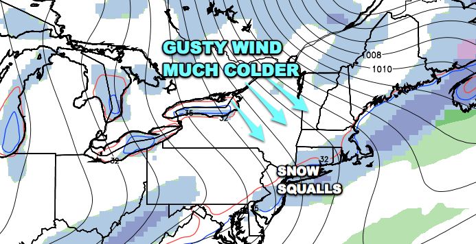
A strong Arctic cold front will plow through the Northeast on Tuesday bringing much colder weather and possibly snow squalls to New England. The front is slated to come through late Monday night or Tuesday morning. Temperatures ahead of the front will be in the low 40s, but the temperature will drop quickly through the 30s as the front passes and the wind shifts to come out of the west-northwest.
It appears that showers will develop after the front passes as the cold air charges in. It may be cold enough, especially inland, for the showers to be snow instead of rain. The squalls would not produce more than 2″ of snow in the hardest hit areas, but the combination of 15-30 mph wind and snow could impact travel – especially inland where it will be colder. The temperature may not reach 40° on Tuesday afternoon.


