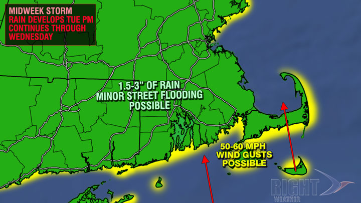
A poorly timed storm will move up the Eastern Seaboard Tuesday through Wednesday. While the storm is likely to bring heavy rain instead of snow to the big cities of the Mid-Atlantic and Northeast, it still has the potential to cause travel delays. The storm will bring the heaviest rain since Labor Day weekend to Southern New England. The storm will track over or west of Southern New England, and that puts the coast on the windy side of the storm. The potential exists for 50+ mph gusts at the coast late Tuesday night and Wednesday. The wind will be out of the south, bringing in very mild air. Highs may reach 60° in spite of the rain on Wednesday.

The rain will begin Tuesday night and continue through the day on Wednesday. The heaviest rain is likely Wednesday morning. 1.5-3″ of rain should fall in Southern New England. The rain may change to snow, especially in interior SNE, before ending Wednesday night. Significant accumulations are not expected. It looks brisk and chilly on Thanksgiving. Highs will be in the 30s.


