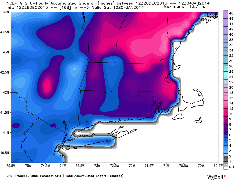
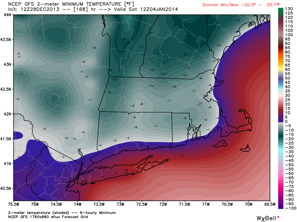
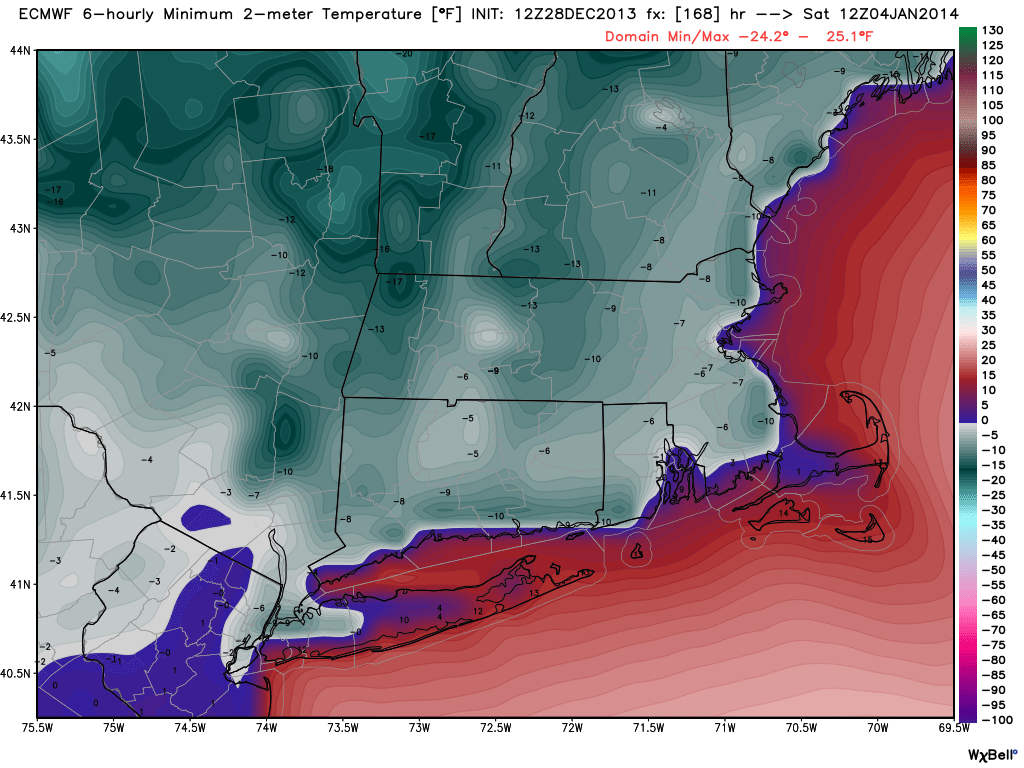
The potential for a snow storm in the Northeastern United States late next week is increasing with every passing computer model run. The Saturday morning runs are more or less in agreement that there will be a moderate to major storm from the Mid-Atlantic to New England between late-Thursday and early Saturday. The models are also in fair agreement that the storm will be followed by the coldest weather of the season, if not the past several years, in SNE. Here is a look at what each model is forecasting for late next week.
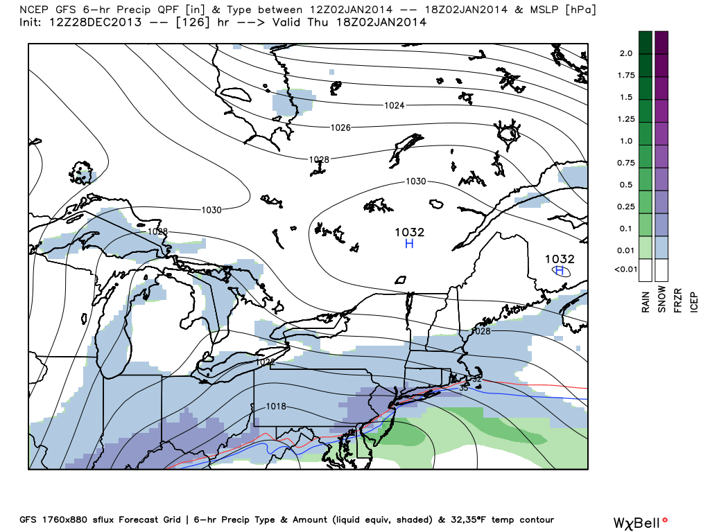
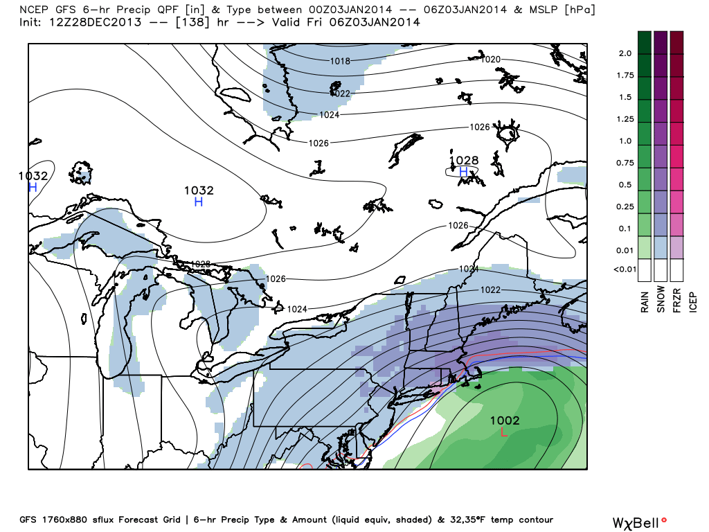
GFS Model
The GFS model has had a storm of some sort in the Thursday-Friday timeframe for a few consecutive runs. It has snow ahead of the main system on Thursday, with the bulk of the snow coming Thursday night into Friday morning.
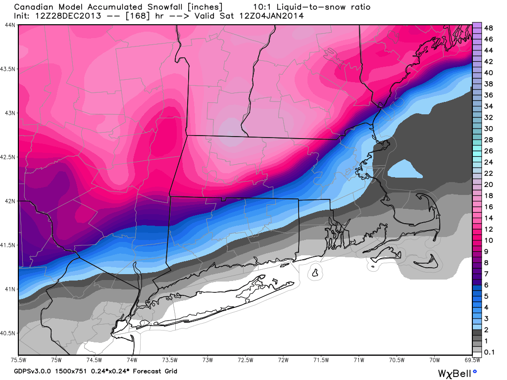
Canadian Model

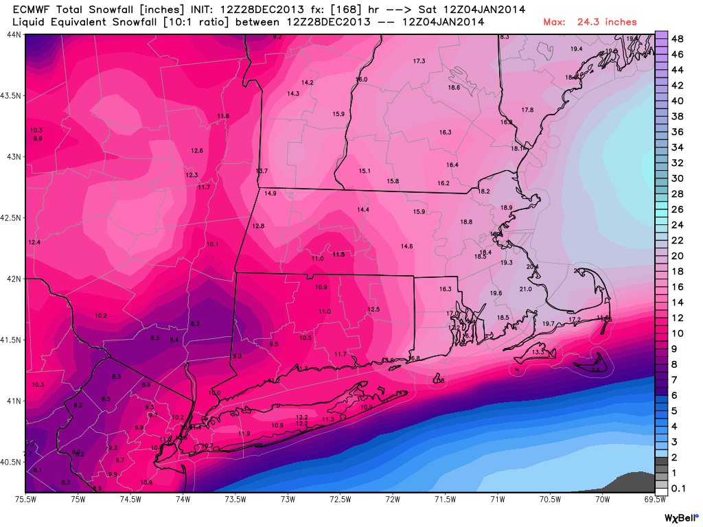
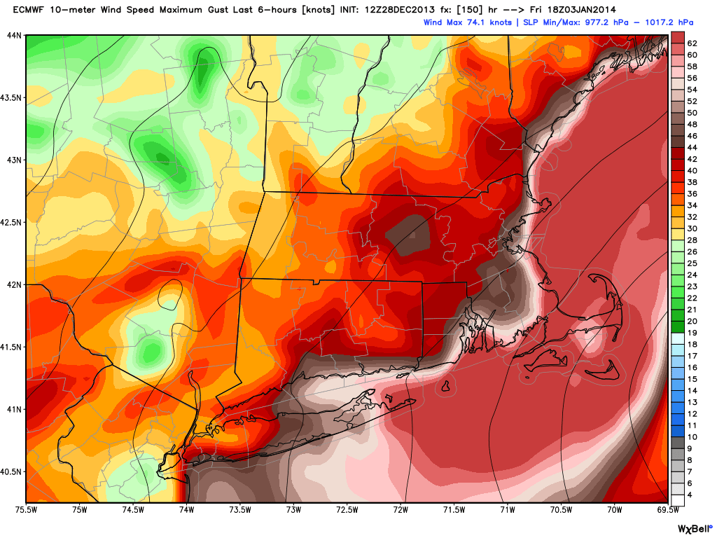
ECMWF Model
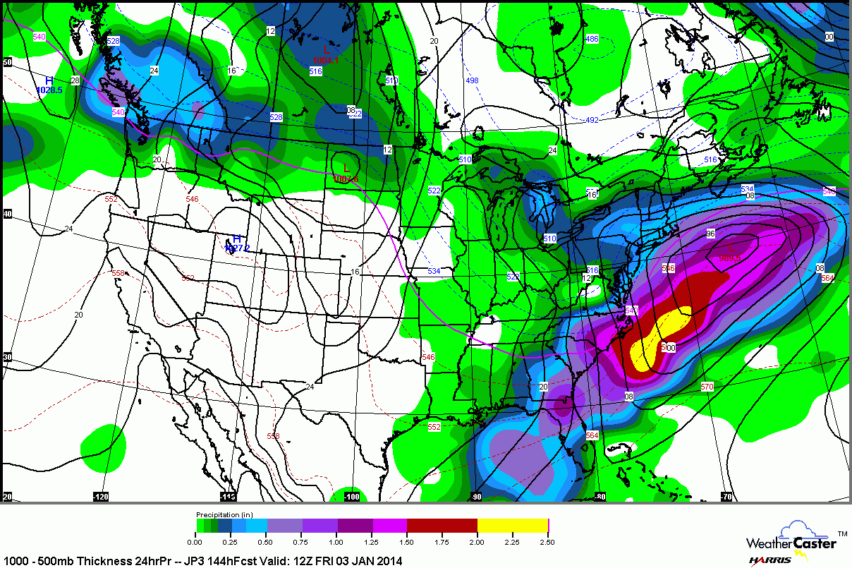
The European model is the most impressive with a raging Nor’easter or blizzard for Southern New England. The height of the storm would be Thursday night, with more than a foot of snow on the ground by Friday morning.

JMA Model
GEFS Ensemble

The Bottom Line
There is still a long way to go before next Thursday, and this is the first model run where most of the computer models agree on a significant storm. The ECMWF has a good track record in the 4-6 day period, and it also has the most impressive storm. You’ll probably hear the hype machine start to crank up this weekend, and it will be at full throttle if the models do not change their tune by early in the week. At this point, it looks like a decent bet that there will be some snow Thursday-Friday, but the timing, track, and totals are still questionable. There is the potential for a whopper snow storm, but a moderate storm or mixed precipitation event are also still on the table.


