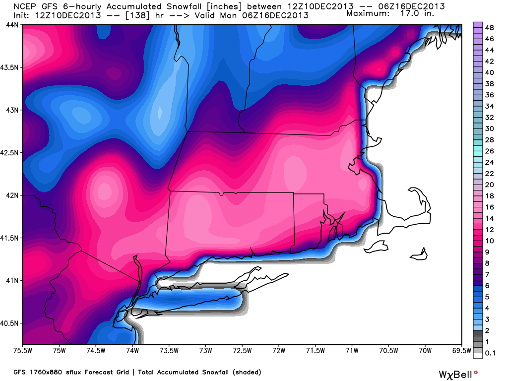
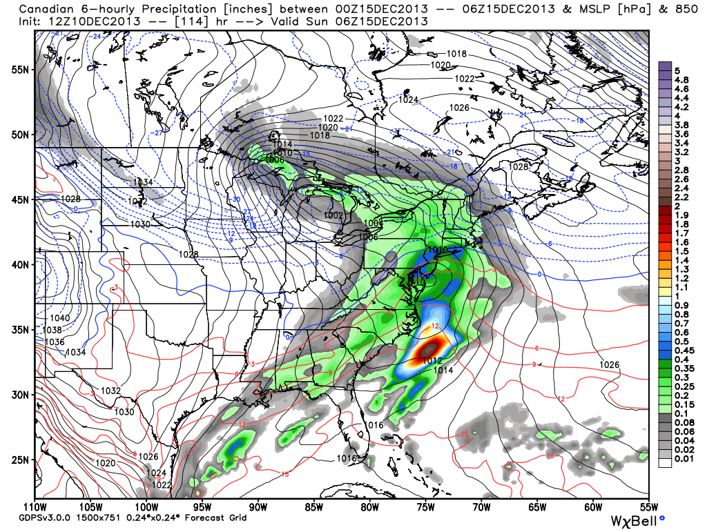
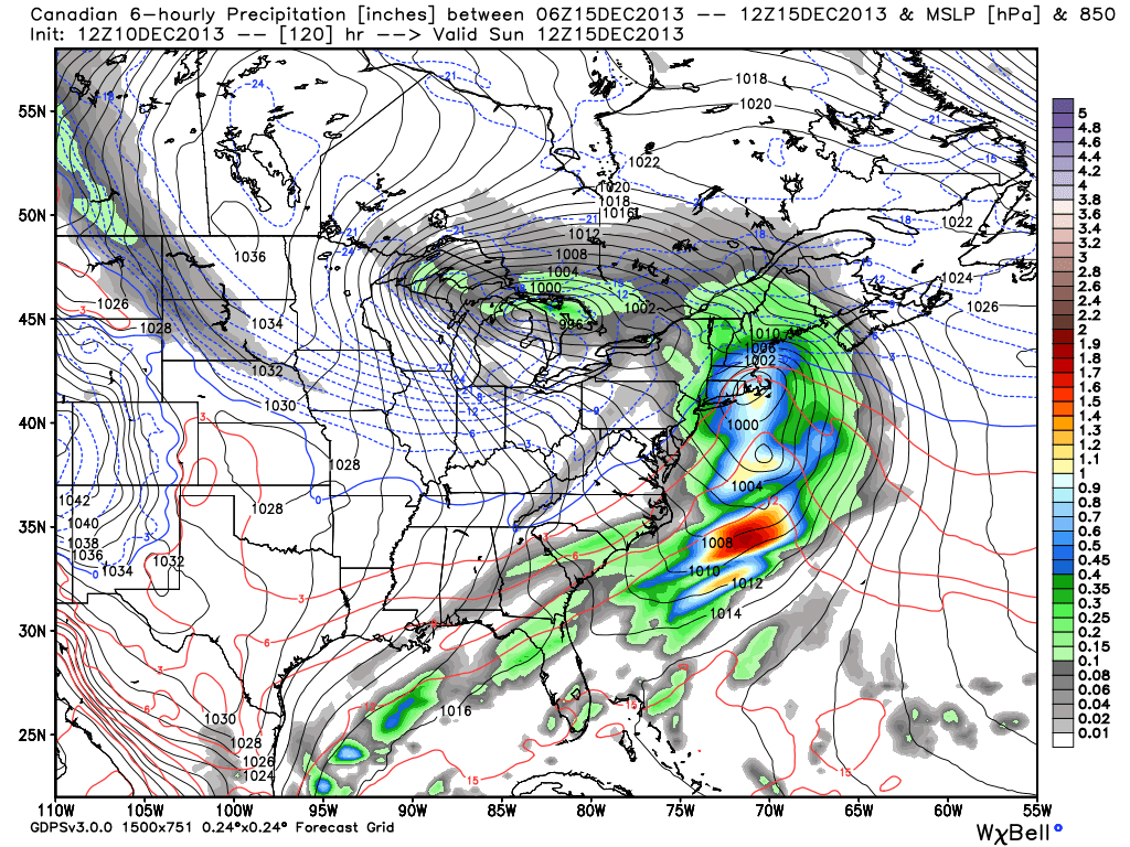
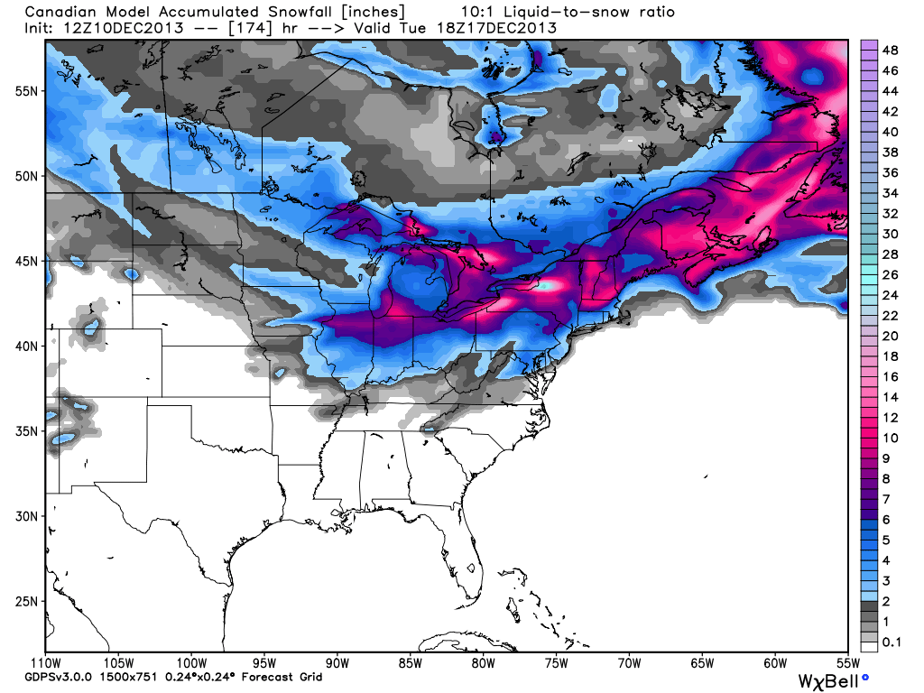
The Tuesday storm was never expected to be a big one, but it is having a hard time living up to its meager expectations. Most areas will likely be close to the 1″ end of our 1-3″ forecast range. The areas we thought had an outside chance of seeing 4″ will probably see 2-2.5″. In some ways these minor systems are the worst for snow lovers because if they under-perform, you’re left with basically nothing. This weekend, however, the potential exists for a storm that could under-perform and still leave significant snow on the ground. The computer models are in agreement that there will be a storm Saturday night into Sunday. There are track differences, and resulting precipitation-type issues. The potential exists for anywhere from a blockbuster (12″) storm to a wintry mix that changes to rain. Let’s get a look at the computer models…
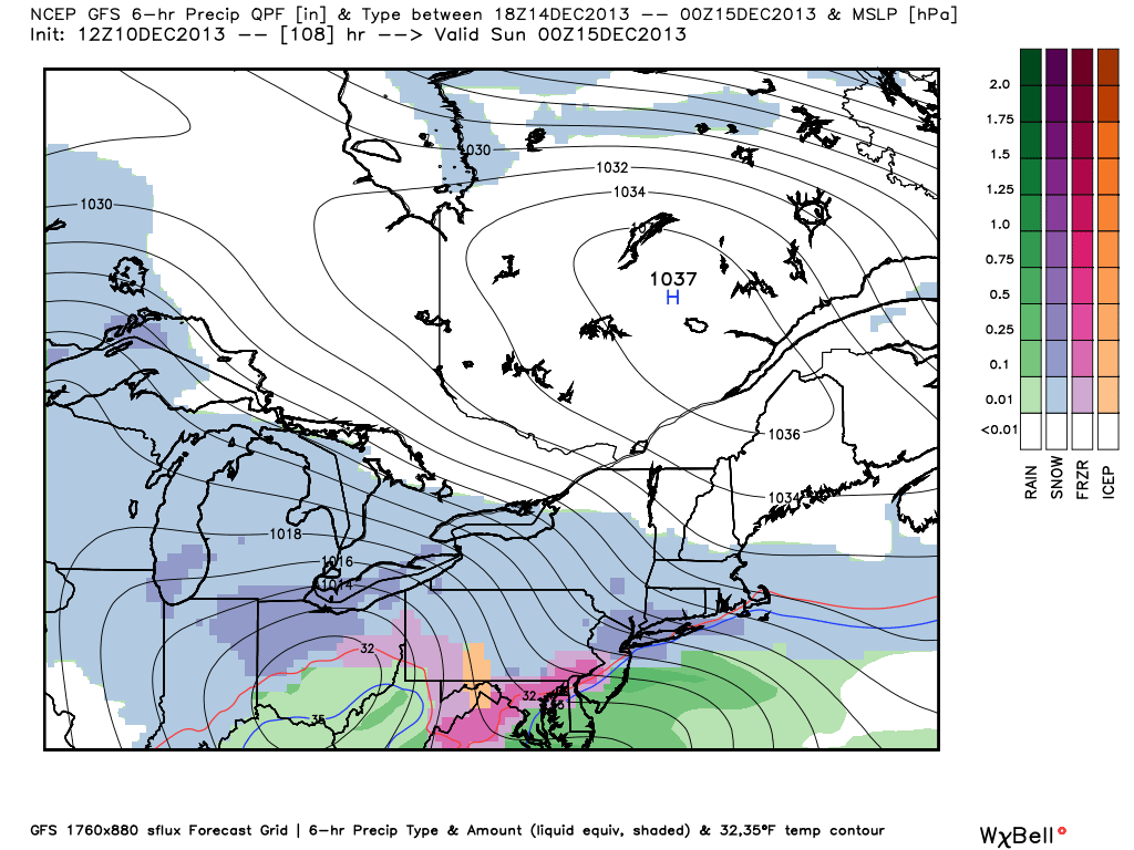
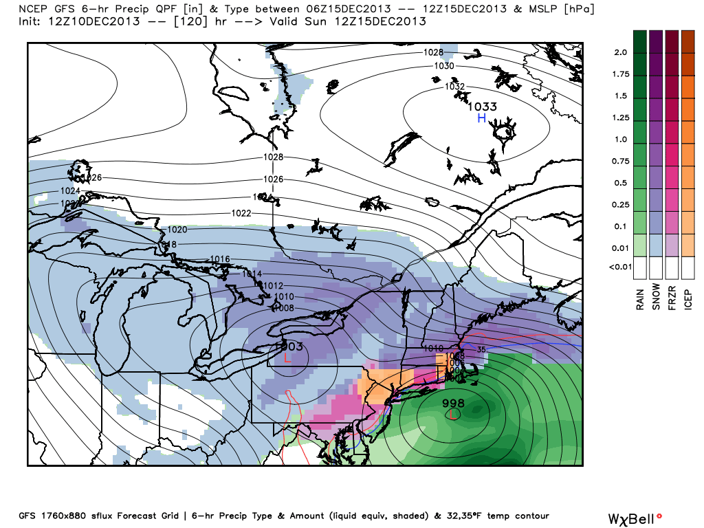
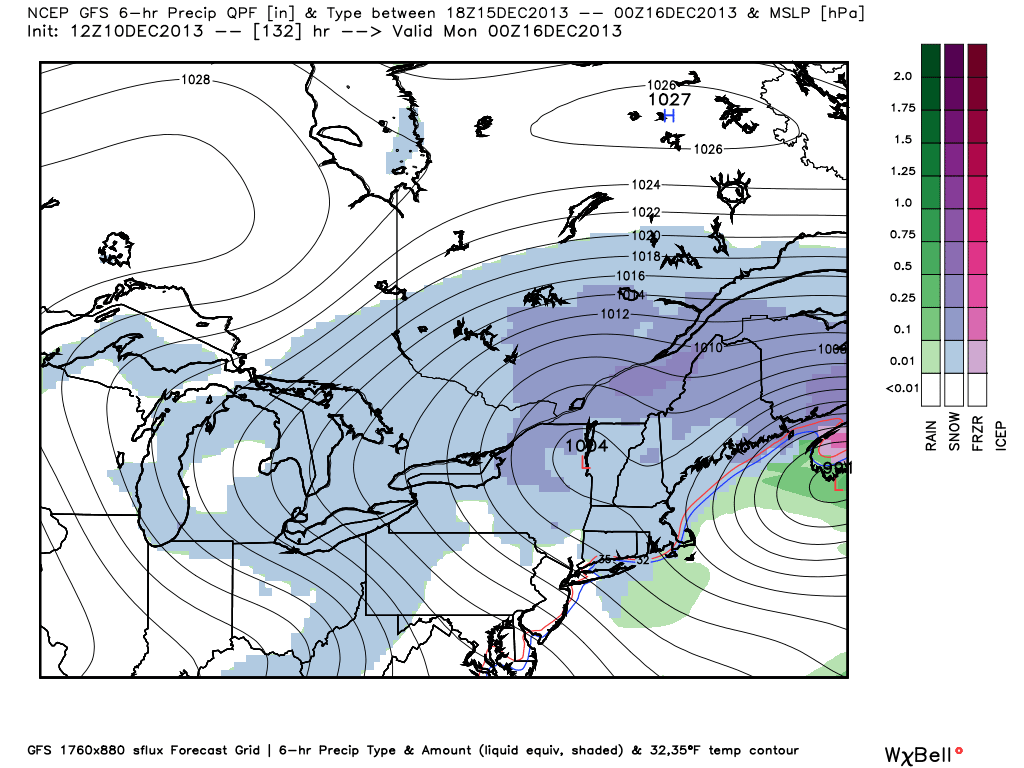
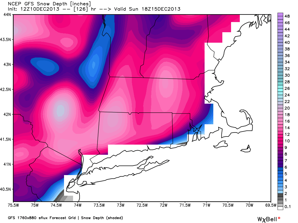
GFS
CANADIAN
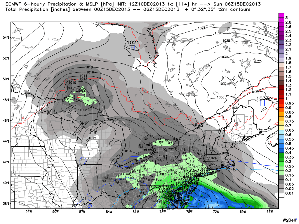
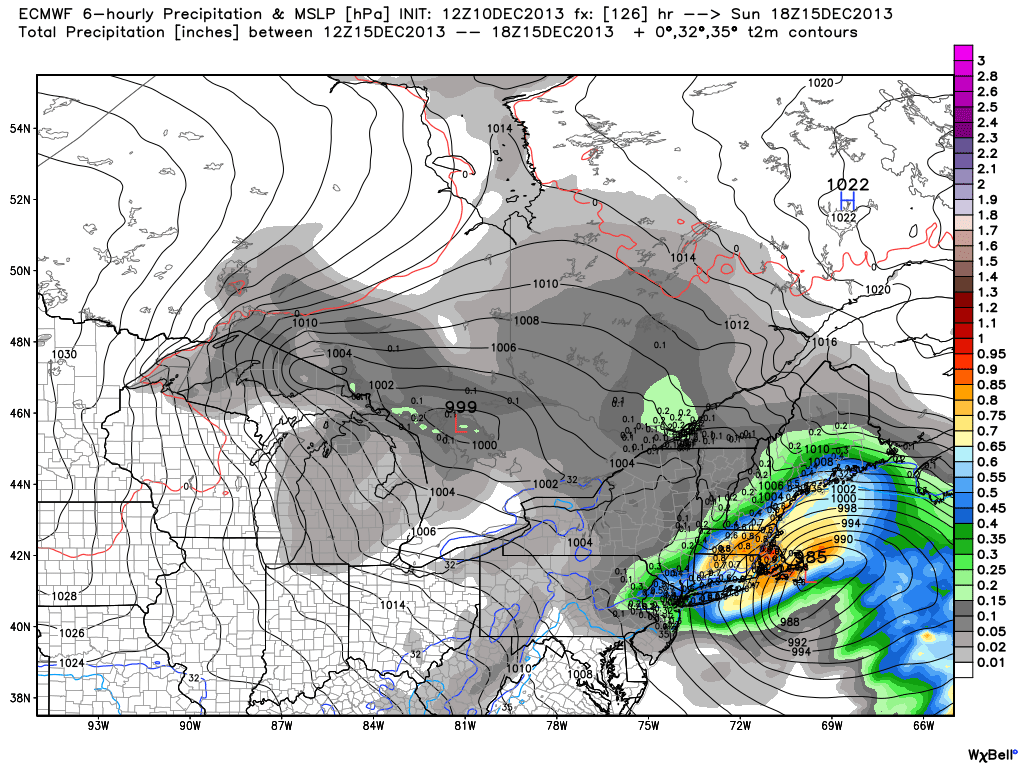
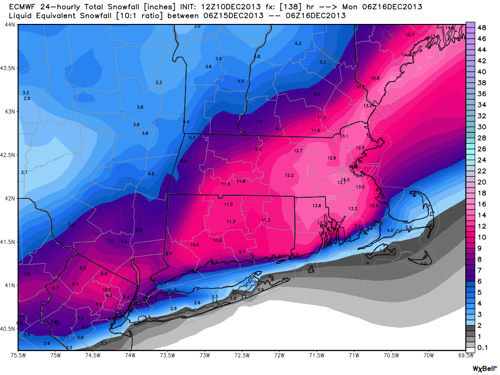
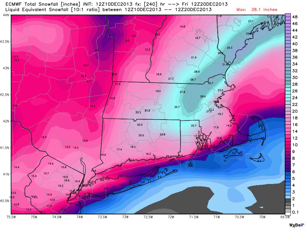
ECMWF
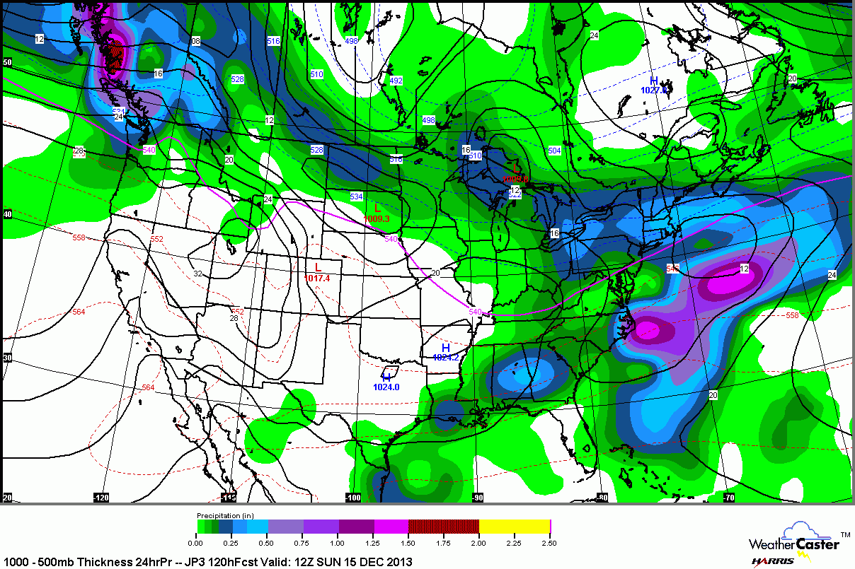
JAPANESE (JMA)
GFS ENSEMBLES

THE BOTTOM LINE
It’s early in the game, but the signal is there for a potentially substantial winter storm this weekend. Even though it’s going to be bitter cold for the rest of the workweek, the high pressure system that will bring the cold weather will not stay locked in to the north of New England. Therefore, the storm track is critical, and the early odds favor it coming close enough for some mix/rain from the coast to I-95. Since it is so early, there is time for the models to change considerably. I’m sure there will be some back and forth with the storm’s track based on how the models are handling the cold weather heading for the Northeast which has a fresh snowpack on the ground. Is there hope for a big snowstorm? Yes. We’ll see which way the models trend on Wednesday.


