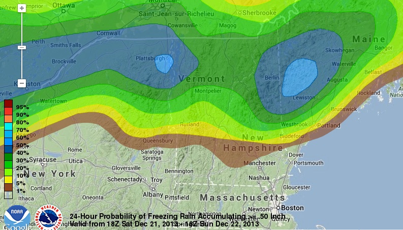
While the Mid-Atlantic and Southern New England see near-record warmth this weekend, part of Northern New England will be dealing with a potentially destructive ice storm. A cold front drifting through Northern Vermont, New Hampshire, and Maine this weekend will shift the wind to the north and bring in sub-freezing air near the surface. A few thousand feet up in the atmosphere the temperature will remain well above freezing, and precipitation will fall as rain that freezes on contact. The potential exists for more than 0.5″ of ice accretion on Saturday in Vermont, and Saturday night into Sunday in Northern New Hampshire and Maine. The glaze could lead to downed branches and power lines, and later power outages.

The greatest threat of a major icing event is in far northern New York, northern Vermont, New Hampshire north of Concord, and interior Maine near Augusta. The area from Concord to Manchester to Keene will be right on the edge of the icing event, but for the most part the temperature is expect to stay above freezing long enough to only allow for 0.01-0.10″ of ice accretion.
The wind will be relatively light (less than 15 mph) during the event, and that may help to limit the tree damage and power disruption. Travel, however, is likely to be very slick in Northern New England this weekend.


