A quick-hitting storm may lay down a blanket of snow in Southern New England ahead of a surge of Arctic air in the mid to late workweek. While the storm is not expected to be a big one, any snow on the ground will only enhance the cold blast Wednesday into the weekend. The high temperature may not reach 30° on Thursday for the first time since early February – the day after the blizzard. It will stay very cold into the weekend.
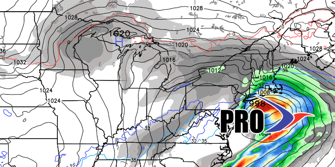
There is the potential for a storm in the middle of the weekend. It’s not a lock, but it could be a more significant snow event (especially inland) than the past few systems that have affected Southern New England. The storm will have to take a track south of SNE to produce all snow. The very cold air will be on the way out as the storm moves through the Mid-Atlantic. The timing looks like late Saturday into early Sunday. We will give more details on the forecast throughout the week.
Yet another shot of cold air is ahead for early next week. Overall, the pattern looks fairly active through week two. After a bitter and dry start to the week, it does not look as cold, but still chilly through most of the week. A few precipitation events are possible between midweek and December 22.


