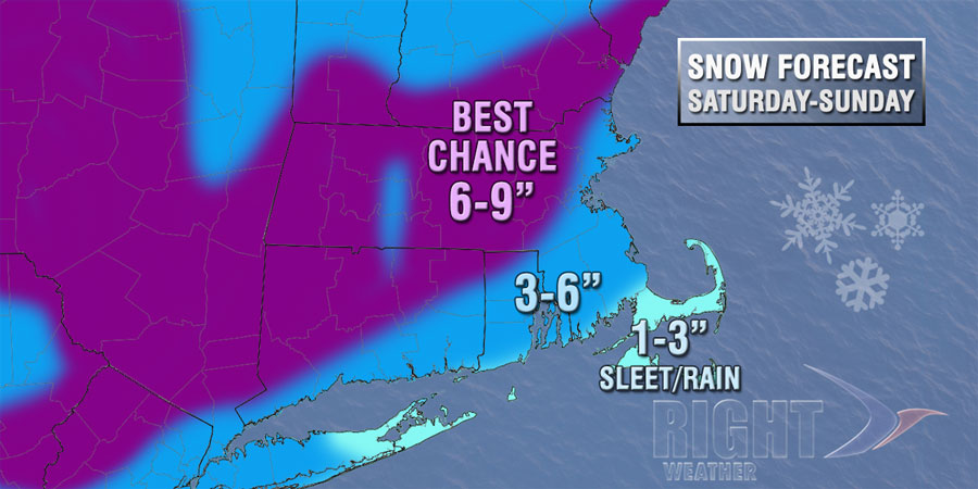
Here is a first look at the accumulation map for Saturday into Sunday. We think there is about 20 miles of uncertainty with these different zones. Therefore, it would not surprise us if we had to drag the 6-9″ line closer to I-95 if it looks like a colder scenario or drag the 1-3″ line toward the I-95 corridor if the storm tracked closer to the coast.
We’ll have an updated computer model trends forecast later Thursday.