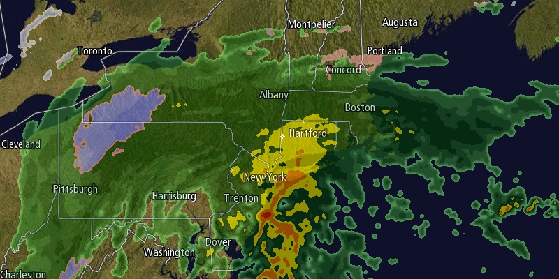
The last weekend of 2013 will end with a miserable Sunday afternoon and evening. A storm moving through the Mid-Atlantic will spread rain into Southern New England during the afternoon, and the rain may be heavy at times during the evening. Clouds will thicken in the morning, and rain should develop around midday in RI and SE MA. The rain will be steady by mid to late afternoon, and it will have a big effect on the tailgating and Patriots game in Foxboro. The high temperature will be in the upper 30s to low 40s. Southeasterly winds will increase near the coast to 20-35 mph by late in the day, with 30-40 mph sustained winds and 50 mph gusts possible on Cape Cod and the islands.

The rain will continue through the evening before ending around midnight. Rain totals will likely be between 0.75-1.5″ in Southern New England. The ski resorts of Northern New England will see accumulating snow, and more than a half-foot is possible in parts of New Hampshire and Maine. The temperature will fall to near freezing by late Sunday night as the storm departs. A few icy spots are possible.
Monday looks like a relatively quiet and seasonable winter day. It will be partly to mostly sunny with highs in the mid to upper 30s. There will be a 10-20 mph northwesterly breeze. The temperature will drop into the mid to upper teens by early Tuesday. It is the start of a cold stretch that will last through the rest of the week. It will be fair New Year’s Eve and Day, but a storm is in the forecast for Thursday into Friday.
Highs will be in the 20s on Tuesday afternoon under partly cloudy skies. It will feel colder because of the northwest wind. New Year’s Eve looks brisk and cold. The temperature will be in the upper teens to low 20s at midnight. Lows will be in the teens Wednesday morning. It will be very cold for anyone taking the polar bear plunge on New Year’s Day. Highs will only be in the upper 20s.
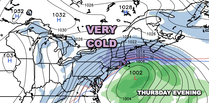
There is the potential for a significant winter storm Thursday into Friday. Computer models are in decent agreement on a storm forming south of Southern New England and coming close enough to bring snow. There are still many questions about the timing of the storm and how much snow it will bring to Southern New England. We will continue to keep you updated on the latest forecast for the storm.


