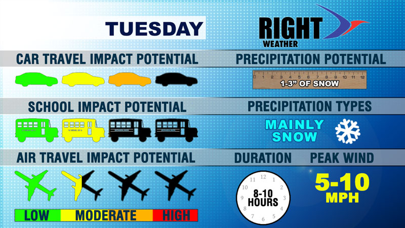
We continue to be eased into winter in Southern New England. There has not been a major storm yet, and Tuesday’s snow will fall into the light to moderate range. A fast-moving disturbance will spread snow into SNE by mid to late morning. The snow will be steady for a while in the afternoon before ending late in the day or early in the evening.
Travel Impact Potential

Car
The temperature will fall into the upper 20s to low 30s during the snow. Side roads could be come snow-covered, and untreated surfaces may be slick. It will be enough to have at least a minor impact on the afternoon commute. It does not look like a storm that will lead to snow on highways that have been pretreated.
School
There are no concerns for the morning. With snow arriving around midday there may be a slower than normal ride home from school.
Air Travel
The storm will have very little wind, and the snow should not be heavy enough to significantly delay travel into or out of Northeast airports.
Precipitation potential
1-3″ of snow in most of Southern New England. Many should see 2-3″, with a chance of isolated 4″ amounts if a heavier band sets up in E CT and NW RI.
Duration
8-10 hours – a quick-hitter that will be followed by bitter cold weather in the teens to low 20s by early Wednesday morning
Peak wind
At 5-10 mph it is safe to say the wind will be a non-factor for this storm.


