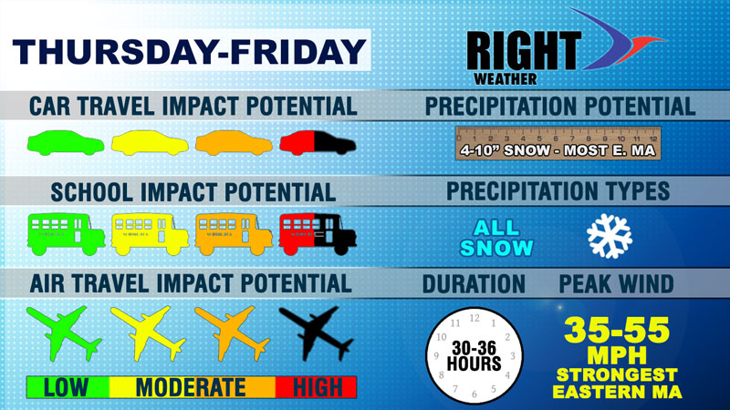
A long-duration storm will bring accumulating snow, gusty wind, and frigid conditions to Southern New England from before dawn on Thursday through midday Friday. The brunt of the storm may stay offshore, but the joint developing storm and Arctic cold front will lead to light to moderate snow that lasts for a while. Here is a look at some of the impacts from the storm.
Car Travel – High Impact
Untreated roads will be slick with temperatures in the teens and 20s Thursday, and single digits to low teens on Friday. It will get even colder late Friday into early Saturday. Plow trucks should be able to keep up with the light to moderate snowfall rate.
Schools – High Impact
Many students return to school on Thursday after the winter break. There may be snow on the ground by early Thursday morning, and the long-duration of the storm will likely effect the school day for some on Thursday and Friday. It’s possible school could be canceled both days in some communities.
Air Travel – Moderate Impact
There will likely be some delays at the Northeast airports, but it is not a paralyzing storm. Planes will need to be de-iced because of the frigid conditions on Friday.
Peak Wind – Moderate Impact
The strongest winds are likely on Cape Cod and the islands where gusts over 50 mph are possible late Thursday night and/or Friday morning. The snow will be dry and unlikely to stick to trees, which should help to limit power outages.
Coastal Flooding – Minor to Moderate Impact
Tides are astronomically high Thursday and Friday. Several high tide cycles will be affected, but the offshore storm track helps to lessen the severity of the wind and duration of the storm. Minor to moderate coastal flooding is possible on east facing shores and north facing shores.


