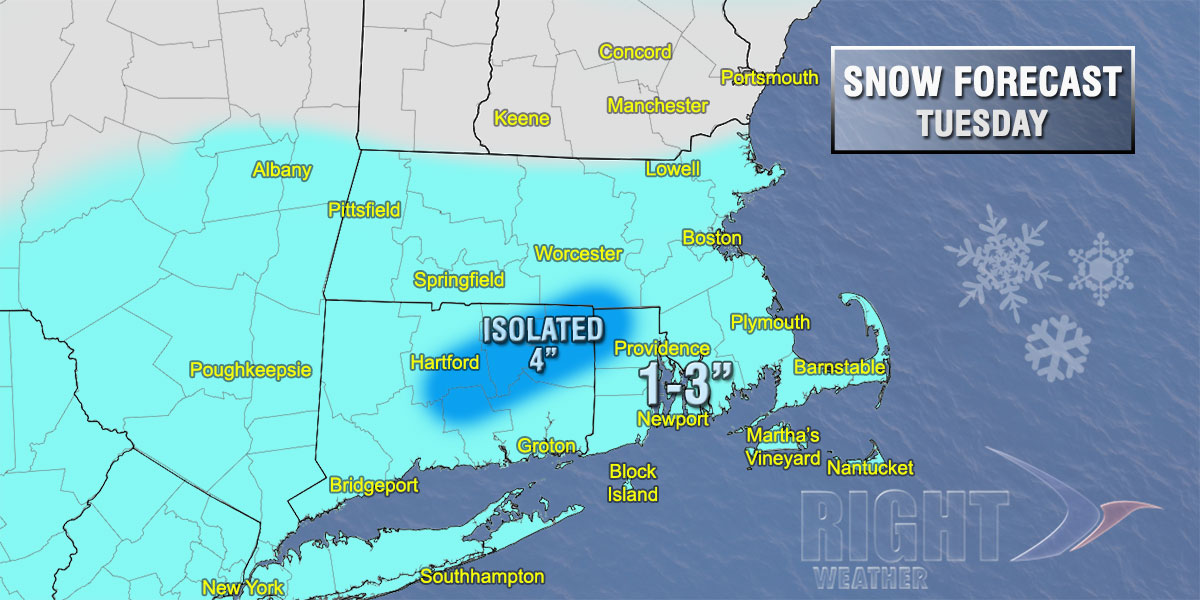
There may be a time Tuesday where you begin to question the 1-3″ snowfall forecast. The storm will be a quick-hitter, but a burst of moderate to heavy snow is possible around midday as the fast-moving jet stream disturbance passes by. The burst should not last for more than 1-2 hours, and the snow will quickly taper off late in the day. We are still anticipating a widespread 1-3″ accumulation for RI, CT, and SE MA, with the chance of a few 4″ amounts in E CT and W/NW RI if the steady snow lasts a bit longer than expected.
The temperature during the snow will be in the upper 20s to low 30s, then it will turn much colder Tuesday night as the skies clear. Lows will be in the teens to low 20s Wednesday morning. Very cold and dry weather is ahead for the mid to late workweek.


