It may not be a total blockbuster, but the storm heading for Southern New England Thursday into Friday is no joke, either. Wind-driven snow and frigid temperatures are likely, and there is also the potential for coastal flooding in Eastern Massachusetts. The New Year will begin with quiet and cold weather on Wednesday. It will be mostly sunny through midday, then clouds will drift in late in the day. There will be a 10-15 mph breeze, and highs in the upper 20s.
- New Year’s Special: Join Right Weather Pro for just $33.99/year (15% off regular price)
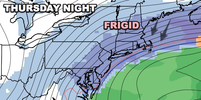
- Thursday – Friday Storm Impacts Graphic
Clouds will thicken Wednesday evening as a strip of snow shoots east along an Arctic boundary pushing into the Northeastern United States. The snow will reach Southern New England after midnight, and 1-2″ may accumulate by dawn. Lows will be in the teens to low 20s on Wednesday night.
The most uncertain part of the forecast is during the day Thursday. There are some signs that the steadiest snow will push north of CT, RI, and SE MA. If that occurs, you can expect occasional light snow with minimal accumulation between sunrise and sunset. The temperature will hold in the teens to mid 20s. The wind will increase to 20-30 mph near the coast by late in the day. If the steady snow does not move north of RI, CT, and SE MA, then an extra 2-4″ may fall during the day. That would put the storm total at 3-6″ heading into Thursday night when there is the best chance of steady snow as the storm intensifies.

The storm will likely be well offshore, but the interaction between the Arctic cold front to the west and the developing storm in the Atlantic Ocean will lead to a very large area of light to moderate snow on the western side of the storm. Southern New England will be in that light to moderate snow, and it will be driven by winds that increase to 20-35 mph, with gusts over 50 mph possible by late at night in Eastern MA. The snow will be very dry and fluffy as the temperature nose-dives into the single digits to low teens by dawn on Friday. 3-6″ of snow is possible Friday night, with the best chance of 6″ in Eastern MA.

The storm will move away from New England on Friday, and the accumulating snow should end in CT, RI and interior SE MA shortly after dawn. Accumulating snow may linger on Cape Cod through midday. The wind will stay very active, and the temperature will hold in the single digits to low teens through the morning. The coldest weather of the season, and possibly in years, arrives late Friday into early Saturday. Sub-zero temperatures may be widespread in Southern New England by late Friday night. The wind will not completely diminish, and -15 to -30 wind chills are possible before dawn.
After the brutally cold start, Saturday will be bright and chilly. Highs will likely reach the low to mid 20s in the afternoon. Sunday looks decent, with highs near 40. Another storm heads for Southern New England on Monday, but that one looks like mainly rain.


