The temperature soared well into the 40s on Monday ahead of the next surge of Arctic air that will move into Southern New England Monday night. There were passing rain showers with the milder weather, and the cold air will arrive without any snow. Skies will clear after midnight, and the temperature will drop to 10-15° by dawn Tuesday.

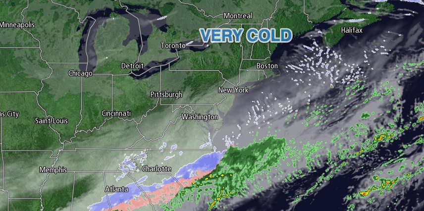
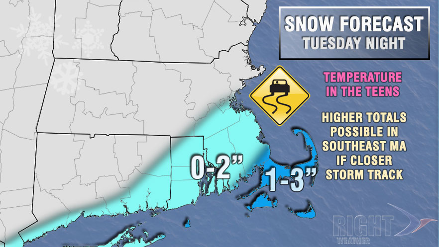
Tuesday looks unseasonably cold, with highs only in the upper teens to low 20s under mostly sunny skies. There will be a 10-20 mph west-northwest breeze that makes it feel about 10° colder. It will become mostly cloudy Tuesday night as a storm system streams out of the Southern United States into the Atlantic Ocean. While the storm will bring snow to the Southeastern U.S., it will most likely just brush by Southern New England with possible snow showers and flurries near the coast. The best chance of seeing more than a coating to an inch of snow is on Cape Cod and the islands where 1-3″ is possible. The trend has been for the storm to track a bit closer to the coast, but it’s still not something to be overly concerned about. Lows will be in the teens.
Wednesday afternoon should be partly cloudy and continued cold, with highs in the low to mid 20s. It will not be as cold on Thursday, with lows in the teens and highs making a run at 30. A weakening cold front will pass through on Friday. There may be a few snow showers with highs in the 30s.
Another system will make a run at Southern New England this weekend. Rain and/or snow is possible in the mid-weekend, from Saturday afternoon into Sunday morning. The strength and track of the system is unclear at this time. It is too soon to say whether it will be snow, rain or a mix, and how intense it will be. It does not look like a huge deal. The weather looks fairly quiet for the end of the weekend, with highs in the 30s on Sunday.


