After getting a look at the afternoon computer model runs, the consensus at this time is for a fairly minor event in Southern New England. The temperature near the ground will not be very cold, and the storm does not look like it will intensify soon enough to bring more than a few hours of steady precipitation – if at all. However, about 20% of the ECMWF Ensemble members show the potential for more than 2″ of snow in the I-95 corridor, so the forecast still bears watching. We will update you in the morning.
MORNING UPDATE
We mentioned the upcoming pattern being “boom or bust” and “high potential” for snow in New England in the Long Range Forecast. There is sure to be some buzz on Tuesday morning about the chance of snow on Saturday. The ECMWF model is indicating a fast-developing Nor’easter that brings much snow to SNE northwest of I-95. Let’s take a look at what the other models are saying about the potential for a storm with a trough digging in the Northeast.
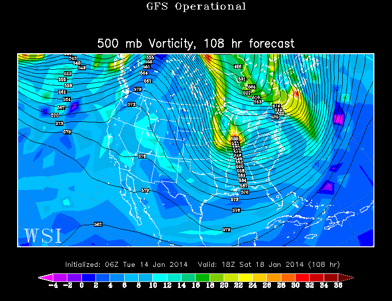
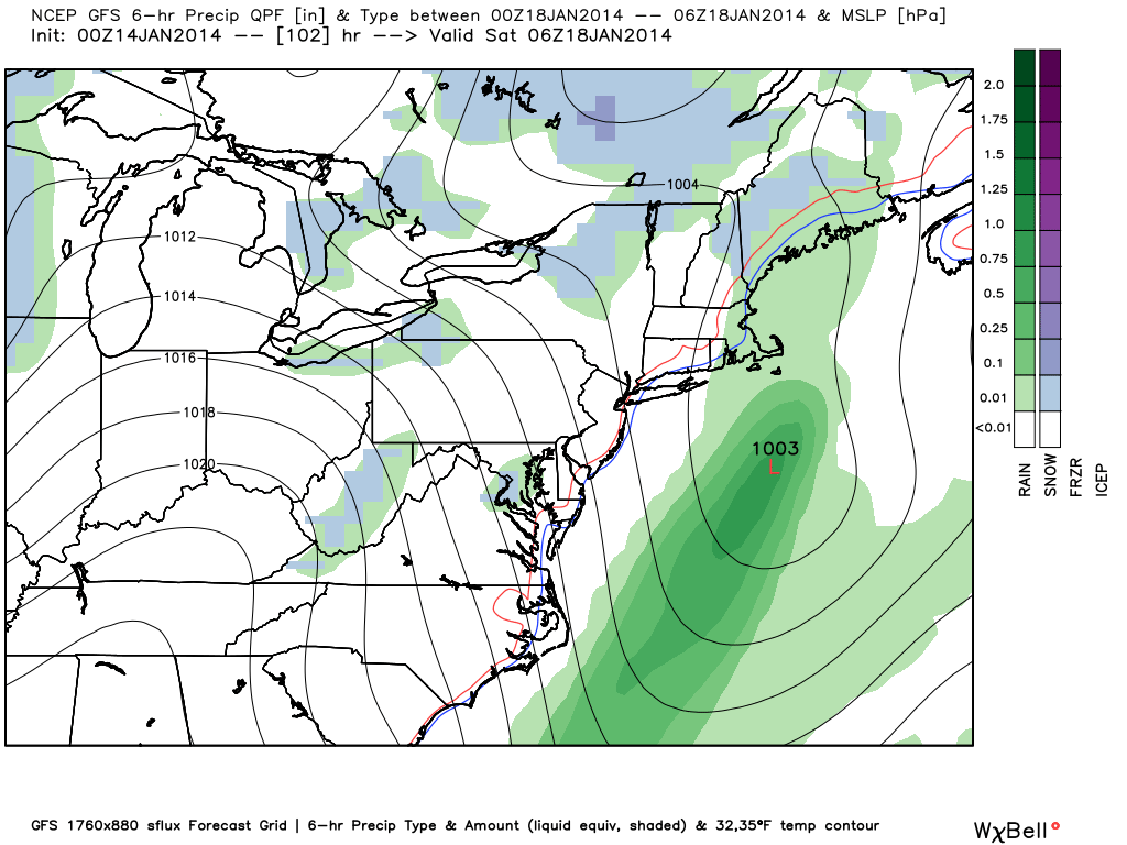
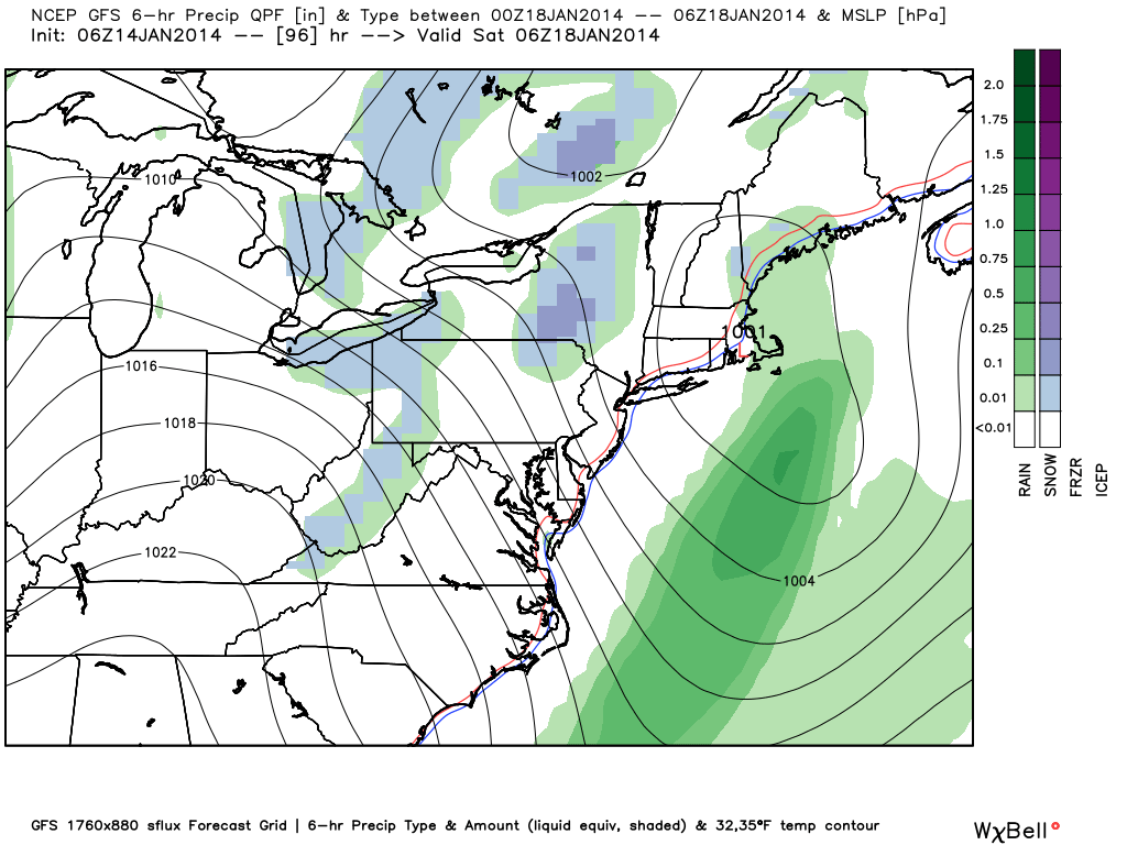
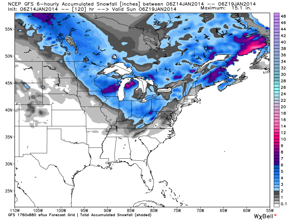
GFS Model
GFS 500 MB – Not as deep of a trough with a front-running vorticity max that jumps out into the Gulf of Maine and develops a weaker storm quicker.00Z GFS – A weaker storm developing south of Nantucket. Too little, too late for snow by the time the storm gets going.06Z GFS – Same as 00Z. A weaker storm developing south of Nantucket. Too little, too late for snow by the time the storm gets going.GFS Snow Forecast – not much for Southern New England because the storm develops too late.
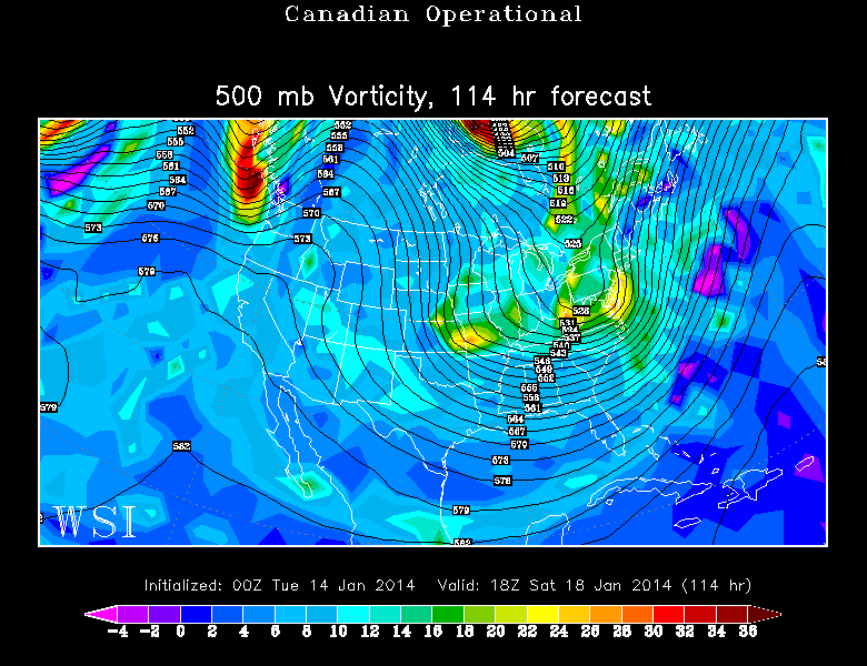
Canadian Model
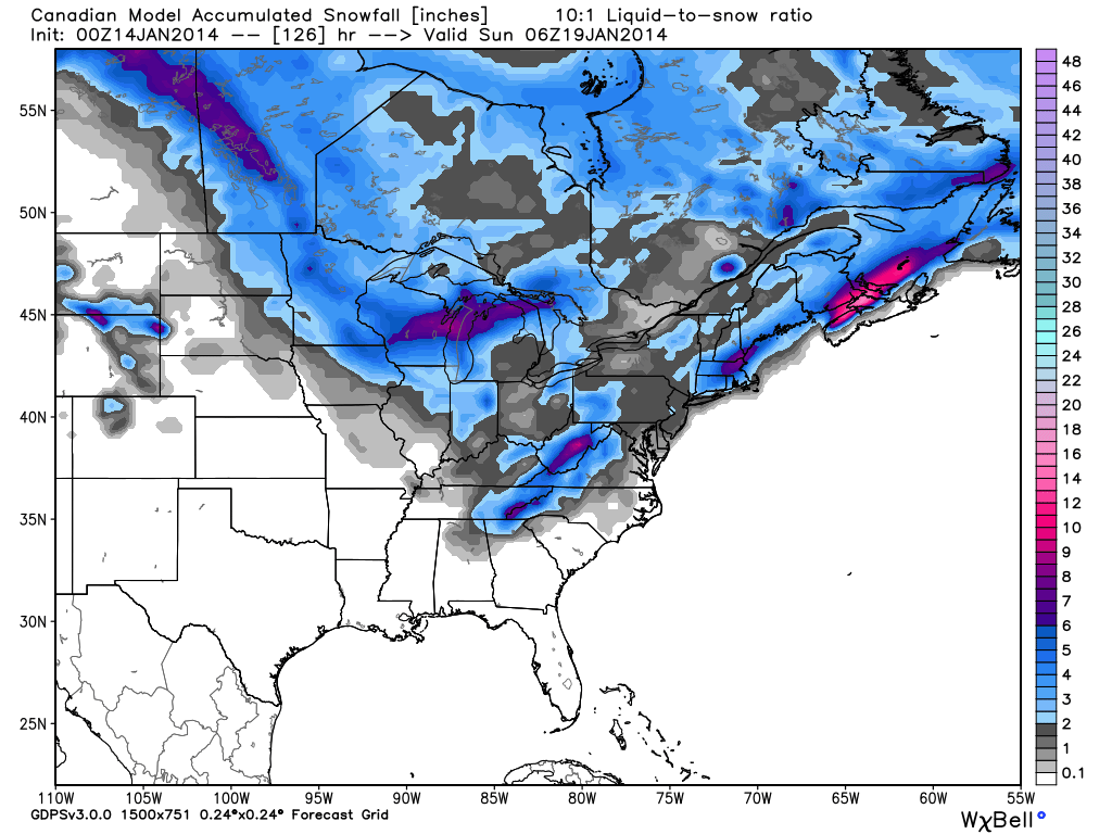
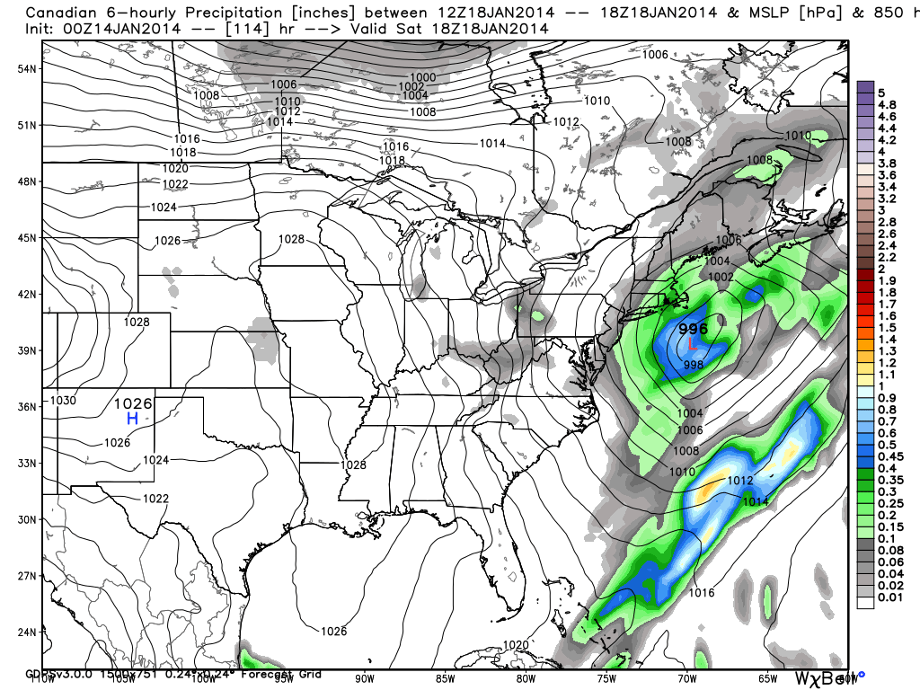
00Z Canadian – a slight compromise between the GFS and ECMWF, but leaning more toward the ECMWF. A digging trough at 500 mb that should support a storm near SNE.00z Canadian snow totals – Interior SNE snowstorm on Saturday. Not a blockbuster, but an area of 6″00Z Canadian – Not as robust as the ECMWF. A decent little storm not too far offshore. Snow inland, wintry mix near the coast.
ECMWF Model
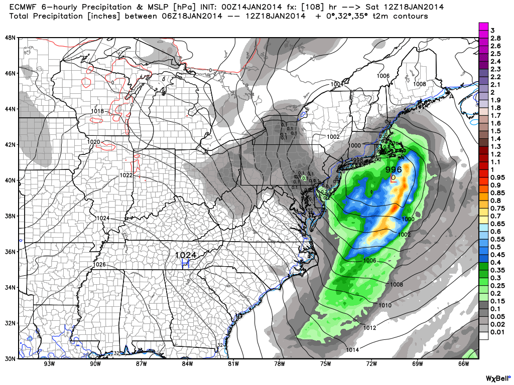
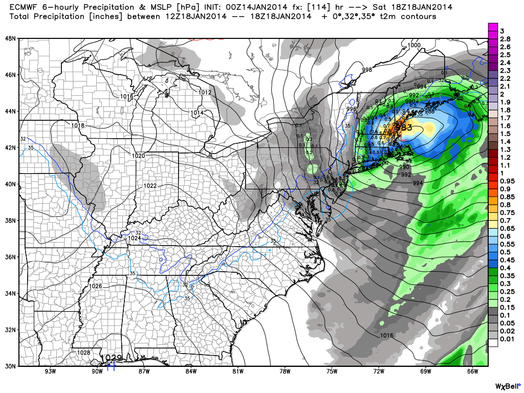
00Z ECMWF – A sharp, digging trough in the Northeast. Supports rapidly developing storm near SNE.00Z ECMWF – The storm forming near the SNE coast00Z ECMWF – The storm rapidly intensifying as it reaches the Gulf of Maine00Z ECMWF – Heavy interior SNE snows, with a big snowstorm in Maine. Mixed rain/snow for I-95 corridor.
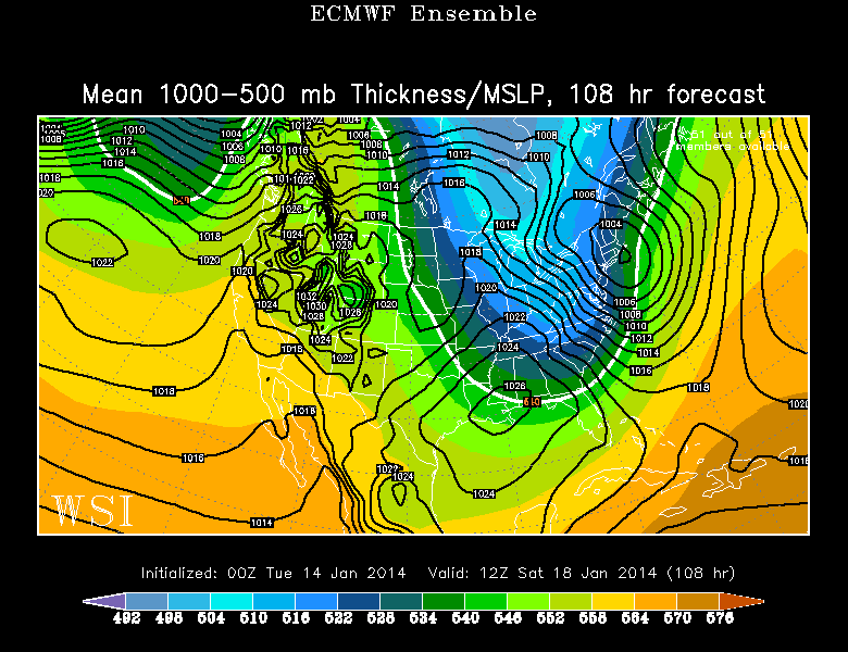
EPS Ensembles
Notice how the Deterministic run has much more snow than the Ensemble Mean for Worcester – the ensembles do not completely agree with the big storm idea from the DeterministicECMWF Ensembles – A storm near the SNE is likely this weekend
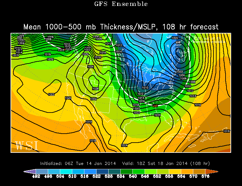
GEFS Ensembles
GEFS Ensembles – A faster storm developing farther north. Not much of an impact in SNE
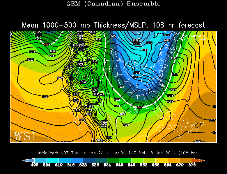
Canadian Ensemble
Canadian Ensemble Mean – Once again, it looks like a compromise between the GFS and ECMWF, with some snow on Saturday, but not a blockbuster
The Bottom Line
The forecast needs to be watched very closely for Saturday. The ECMWF is probably extreme with such a rapidly developing storm near the coast. At this point, we favor something closer to the Canadian solution, which brings more of a moderate event. The GFS seems to be having trouble handling the digging trough and jet stream energy in the Northeast. Look for a quick update to this post later today after the new information comes in.