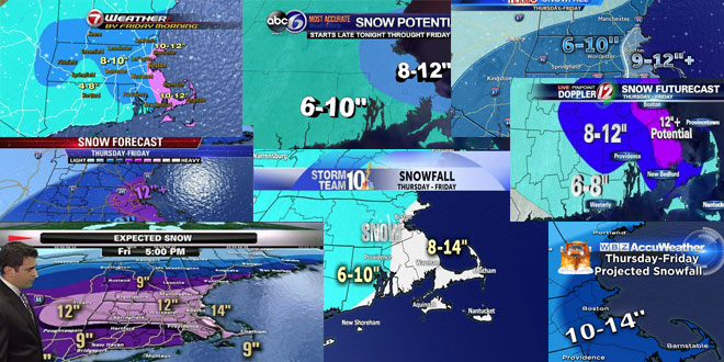
Evening update: TV Station snow forecast roundup

The snow forecast for Tuesday night in Wednesday increased during the day on Monday. There are Winter Storm Warnings and Blizzard Watches in effect in Southern New England. This promises to be another very cold snowstorm with temperatures in the teens. The hype machine is reaching overdrive at the area news outlets. Here is a sampling of the Southern New England television station forecasts as of 6:30 pm on Monday.

Snow map: Highest totals over SE Mass. No rain/snow line battle with this. Plenty of cold & a fluff factor. #7news pic.twitter.com/YcWuWFP1Fj
— Chris Lambert (@clamberton7) January 20, 2014
You ALL are reading this right? Amounts can change in 24 hours based on final track… but here's my latest #Fox25 pic.twitter.com/ROUa9aYEoo
— Kevin Lemanowicz (@klemanowicz) January 20, 2014
Upon further review: Nudged my forecast up a bit. Still 24 hours away from the start, things can still change! pic.twitter.com/su9qHpRJ3d
— Mark Searles (@NBC10_Mark) January 20, 2014
5PM UPDATE…solid 6-10" for most…bit more possible SE, bit less well NW #wbz pic.twitter.com/wSJsozetxh
— Terry Eliasen (@TerryWBZ) January 20, 2014
snowfall forecast tomorrow afternoon through Wednesday AM… #FirstAlertCT pic.twitter.com/LJ5YiVDzlp
— Brad Field (@BradNBCCT) January 20, 2014


