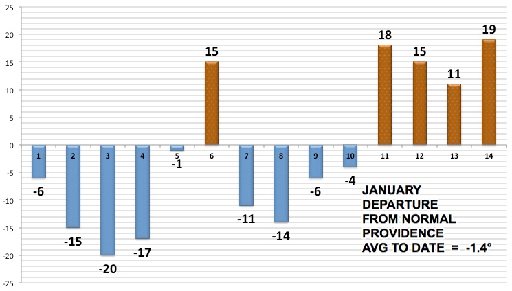
The temperature pendulum has swung from one extreme to the other in Southern New England during the first two weeks of 2014. The year started with a brutal cold snap that featured the coldest weather since 2004. The temperature was 20 or more degrees colder than normal on January 3 in the midst of a three-day stretch that averaged about 17 degrees below normal at the major climate sites. After a brief warm-up on January 6, there was another cold shot that lasted from January 7-9 as the polar vortex plowed into the Eastern United States. January 10 was a transition day with near-normal temperatures. Since then, it has been much warmer than normal with two rainstorms in the last four days.

The cause of the wild temperature swings is an undulating jet stream pattern that has dipped into the Southern United States and lifted north into Canada. Interestingly, when all the extremes are averaged, the month is running just 0.5-1.5° colder than normal through the first two weeks. With warmer than normal weather ahead for the next few days, the average after 17 days should be near or slightly above normal. Overall, it looks like the Eastern U.S. is heading for a cold end to January, with the jet stream moving south again by the middle to late next week.
It has also been a wet start to the year, with the four major climate sites receiving 70-100% of the normal monthly rain in the first two weeks.


