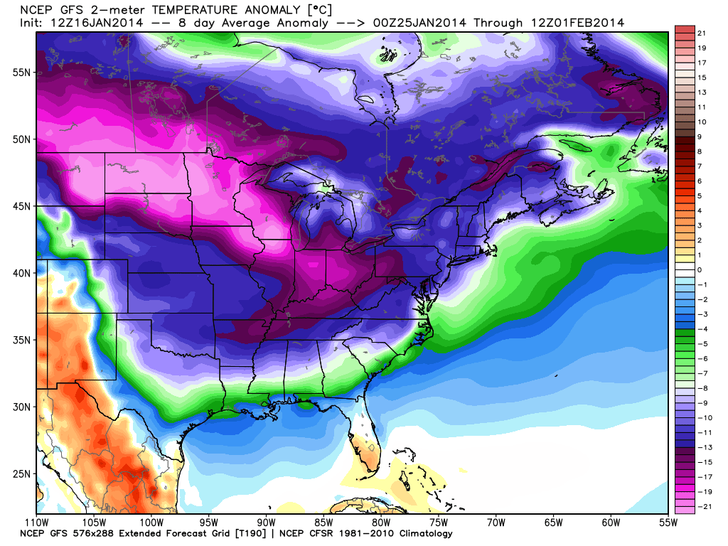
The “halftime” of this winter is just about over. The polar vortex will likely make at least a partial return to the Eastern United States in the next couple of weeks. The overall outlook is for another Arctic Outbreak that will stretch from the Upper Midwest to the East Coast in the last week of the month. The devil is in the details regarding the snow forecast. In this pattern there should be multiple shots at snow along the Eastern Seaboard. If the jet stream sets up just right, then there could be 2-3 times the normal (4″) amount of snow in the next couple of weeks.
There will be a parade of Alberta Clippers that drop out of Canada and move through the Great Lakes into the Mid-Atlantic and Northeast. Some of those disturbances could be energized by the southern branch of the jet stream and develop into bigger storms over the Atlantic Ocean. A quick-developing system may bring snow/rain on Saturday. It does not look like a big deal. Another system is possible in the middle of next week, but the trend for that system is heading east – out to sea. Snow-lovers may need patience with this pattern. Eventually it should bear fruit, but it may not happen until the week after next.


