It’s pretty easy to divide January into thirds in Southern New England. 9 of the first 10 days of the month were colder than normal. The month was running nearly 8° colder than normal through January 10. From January 11-20, every day was warmer than normal. The average departure was 10.8° warmer than normal! Now, the pendulum is swinging back to the bitter cold end, with the last three days averaging more than 12° below normal.
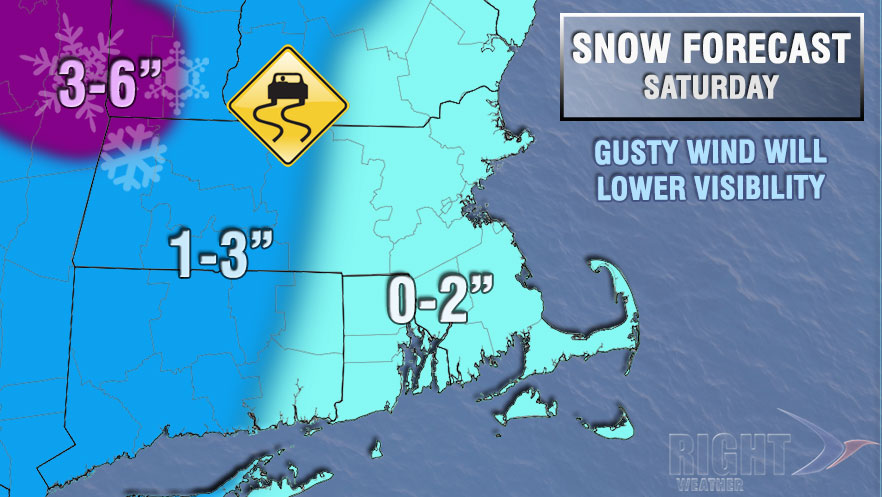
The cold snap will continue into next week. The only hint of a warm-up will come when snow showers and squalls threaten on Saturday and late Sunday night into Monday morning. It’s possible that it will snow with a southwest wind both times. It does not happen often, and, occasionally, the snow showers can be enhanced near the coat because of the wind off the ocean. There is a chance that the showers Sunday night into Monday are rain instead of snow. Neither system looks very impressive, and only minor accumulations are expected on Saturday.
More very cold weather is in the forecast for most of next week. It will likely be dry from late Monday through Tuesday. We’ll watch an offshore system in the midweek, but, now, it looks like it will stay away. A huge, sprawling, and cold area of high pressure will be in control of the weather in most of the country. Late next week into the following week we expect the southern branch of the jet stream to get active. There will still be cold air to the north, and some “battleground” storms are possible in the first week of February. While the odds of exclusively snow events are lowered with the Arctic air relenting, it will most likely be an active pattern that brings the threat of wintry weather.


