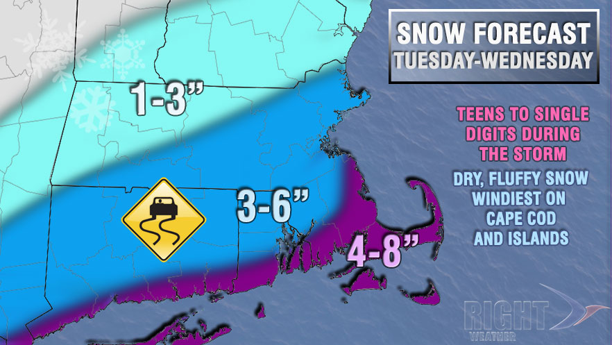
The storm that we have eyed for the middle of the week looks like it will have a decent impact in Southern New England. The trend is for the storm to track closer to the coast, and accumulating, plowable snow is likely in most or all of Southern New England. The highest snow totals are likely near the coast with this one. It will be another cold storm, with snow across the board, and temperatures falling into the teens and single digits Tuesday night. The wind will be strongest near the coast, and, in a worst-case scenario, there could be near-blizzard conditions for a time on Cape Cod and the Islands.
Timeline
Tuesday: Clouds thicken, snow develops by sunset. Highs: Near 20
Tuesday night: Snow. Breezy to windy. Falling temperatures. Lows: 6-12
Wednesday: Snow tapers to flurries early. Windy and cold. Highs: Teens


