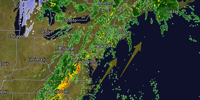
A potentially active weather pattern in the next week will begin with a windy, wet, and mild rainstorm on Saturday. The temperature will rise from the low to mid 30s late Friday night to the mid to upper 50s by late Saturday. Rain will develop from west to east during the day, and the heaviest rain is likely Saturday evening. 1-2″ of rain is possible before it ends after midnight Saturday night. The National Weather Service Southerly winds will increase to 20-30 mph, with stronger gusts likely near the coast. Peak gusts over 50 mph near the coast may cause isolated power outages Saturday evening.

The second half of the weekend looks much nicer. Sunday will be partly cloudy with highs in the mid 40s. There will be a 10-25 mph westerly breeze. The wind will relax Sunday night as high pressure moves south of Southern New England. The weather will be quiet on Monday before the action picks up in the middle of the week. Monday will be mostly sunny with highs in the mid to upper 40s.
The forecast for the middle of next week is uncertain. Right now, it looks like there will rain on Tuesday, followed by the potential for snow or rain late Wednesday into early Thursday. Tuesday will be relatively mild, with highs again near 50. It looks like there could be a quick-developing storm south of Southern New England on Wednesday. We’ll continue to keep you updated on the possibility of snow on Wednesday as more information becomes available.


