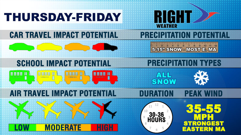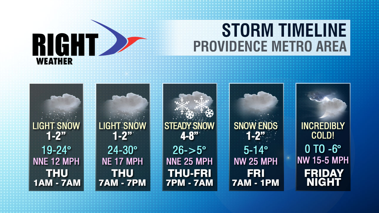
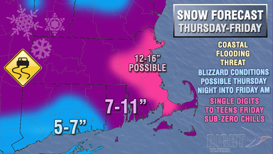
The storm that will eventually bring hefty snowfall totals to Southern New England will be slow to get cranking on Thursday. Snow is likely for most of the day, but it will be relatively light. There may even be a complete lull in most of CT and SW RI during the day. The steadiest snow during the day will be in Eastern Massachusetts.

The snow will be light, dry “champagne powder” instead of the usual wet, heavier snow that typically falls in Southern New England. The temperature will stay in the 20s on Thursday, then drop like a rock Thursday night as the storm begins to crank. The worst of the storm is likely from about 8pm Thursday until 8am Friday. Several inches of wind-blown snow will accumulate, and the highest totals are likely in Eastern MA. The temperature will fall into the single digits to low teens by early Friday morning. Wind chills will be well below zero.
The snow should wind down Friday morning, but the temperature will not rise above the low to mid teens. Any “warm-up” will be short-lived and followed by the coldest weather in at least a couple of years. Lows will be below zero in much of Southern New England Saturday morning.