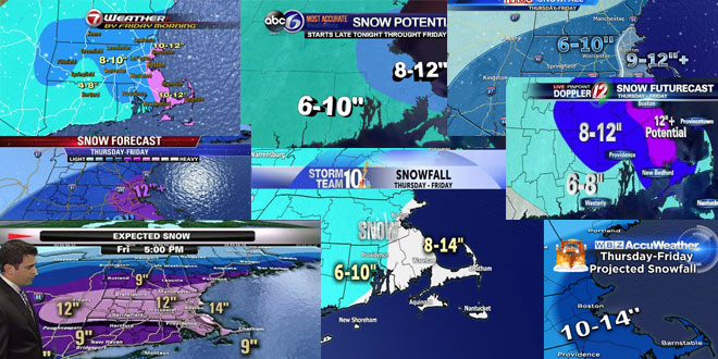
Another fast-moving very cold snowstorm is heading for Southern New England Tuesday night into Wednesday morning. A couple of days ago, this storm looked like it may slide out to sea, but that forecast changed, and the storm will likely come close enough for a moderate storm in most of RI, MA, and CT. Here is a roundup of the midday Tuesday snow forecast maps from Southern New England TV Stations.
Right Weather Pro members can follow the forecast changes and ask questions on the Live Blog.
Models trending farther N w/ a bit more moisture- so upping snowfall estimates. Fluffy snow, Highest totals SE #WCVB pic.twitter.com/l2fbHvjkIs
— Cindy Fitzgibbon (@Met_CindyFitz) January 20, 2014
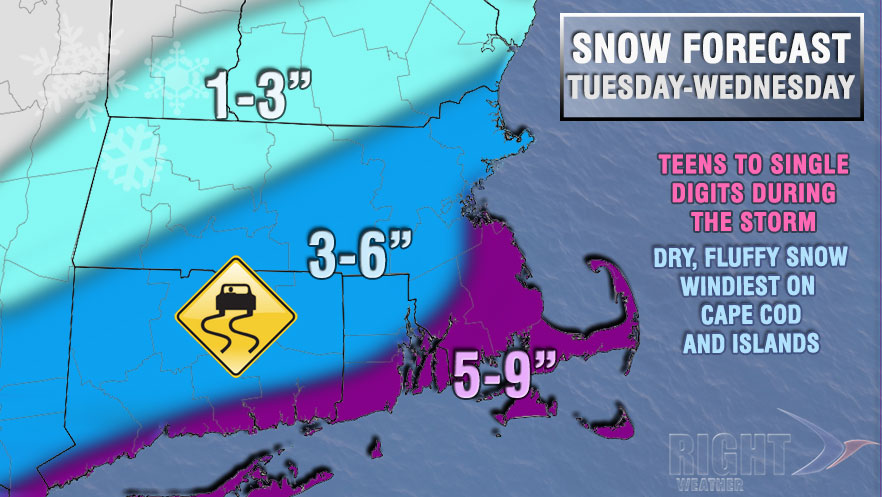
Here’s my updated snow accumulation map for Tuesday PM-Wed AM #ctwx #connecticut #snow pic.twitter.com/DCXI7oAUPN
— Gil Simmons NEWS8 CT (@gilsimmons) January 20, 2014
Arctic front arrives later today… Low pressure develops on that front and delivers steady snow Tues PM to Weds AM. pic.twitter.com/vVP1DONfQv
— Joe Furey (@StormFurey) January 20, 2014
Fresh out of the Weather Office oven…updated (higher) snowfall projections for Tuesday night and Wed AM #wbz pic.twitter.com/AtEhVl3wop
— Terry Eliasen (@TerryWBZ) January 20, 2014


