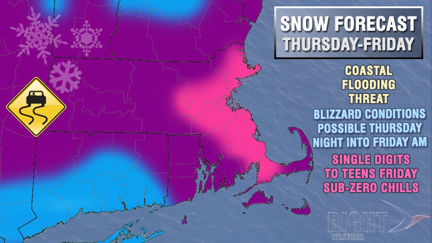
A moderate to major winter storm is bearing down on Southern New England for Thursday and Friday. It is important to note that although the snow will begin before dawn on Thursday, the brunt of the storm is not expected until Thursday night into Friday morning. In most places, the first 1-3″ of snow will fall between 1 am – 7 pm Thursday, with the bulk of the snow coming afterwards.
The players are on the field for the Thursday-Friday storm in the Northeast. http://t.co/pg1PvN0UOh pic.twitter.com/Obn53zCKhn
— Right Weather (@RightWeather) January 1, 2014
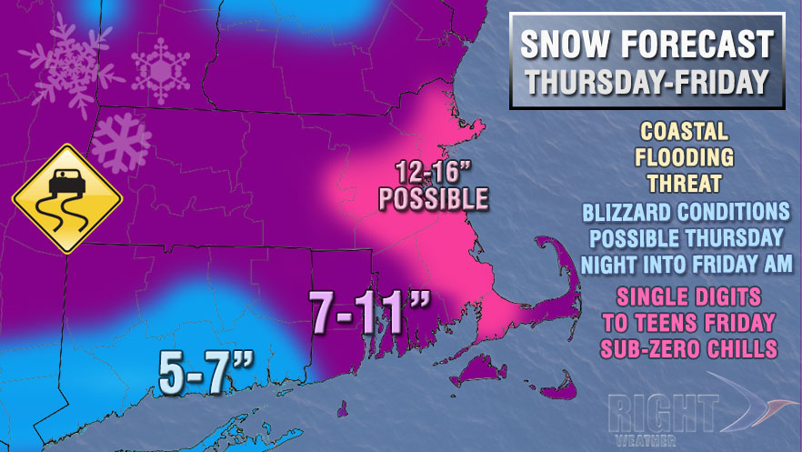
The greatest potential for more than a foot of snow is in the Boston metro area. That area may see the steadiest snow combined with very cold temperatures at the surface and aloft to allow for a very dry/fluffy snow.
Most of Southern New England will see a high-end moderate impact from the storm – not to the level of some of the all-time great SNE snowstorms. The storm track should be just far enough offshore to spare CT, RI, and interior SE MA from 12-18″ of snow. A slight shift northwestward in the track of the storm would cause the higher snow totals to creep inland.
We will continue to keep you updated on this impending storm. For the latest in-depth analysis, and to get your specific forecast questions answered, join Right Weather Pro for just $33.99/year – 15% off the normal price for a limited time.


