Low temperatures ranged from 5 to 15° in most of Southeastern New England on Friday, and it looks like the temperature will be similarly cold early Saturday morning. Skies will be mainly clear, and with light winds, dry air and a fresh snowpack the temperature will drop quickly Friday night.
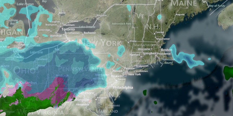
Most of the weekend looks quiet, but there is still the possibility of light snow Sunday night into Monday morning. Saturday will be sunny in the morning, with increasing clouds in the afternoon. Highs will be in the low 30s. A storm system moving off the Mid-Atlantic coast will stay away from Southern New England. It will be cold Saturday night, with lows in the teens Sunday morning. Sunday afternoon will become mostly cloudy with highs in the low 30s.
We’re keeping our eye on a jet stream disturbance heading for the Ohio Valley and Northeast by late in the weekend. This disturbance, while not likely to produce a major storm, may have enough energy to trigger light snow Sunday night into Monday morning in New England. It’s too early to say if it will be snow showers and flurries or an accumulating snow that could impact the Monday morning commute. We will post an accumulation map, if necessary, as soon as we are confident in more than a dusting of snow.

Monday may begin with a bit of snow, with skies gradually clearing during the day. Highs will be in the upper 20s as cold air remains entrenched over the Northeast. The middle of next week looks fairly quiet before a storm threatens late in the workweek. Tuesday and Wednesday looks partly cloudy and cold. Lows will be in the teens, and highs will be in the 20s to low 30s.
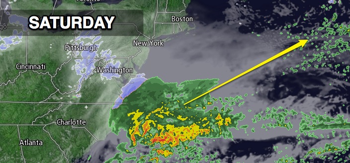
A storm could bring a myriad of wintry precipitation (snow, sleet, rain) on Thursday. It is early in the game, but the pattern favors a storm developing in the Southeast and moving up or off the Eastern Seaboard. The storm track will be critical because the cold air will finally start to wane in the Northeast, and a track close to the coast would yield mixed precipitation or rain. We’ll keep you posted.


