We have been eyeing the potential for a storm on Thursday for a few days. The latest computer model runs are some of the most aggressive in bringing a potent storm to the Mid-Atlantic and New England. Even though there will be more than a week of below 35° weather leading up to the storm, the high pressure providing the cold air will be sliding into the Canadian Maritimes, and the storm will definitely have to take a “sweet spot” track to produce heavy snow in the I-95 corridor.
Here is a comparison of the computer model runs from Saturday night to Sunday morning.
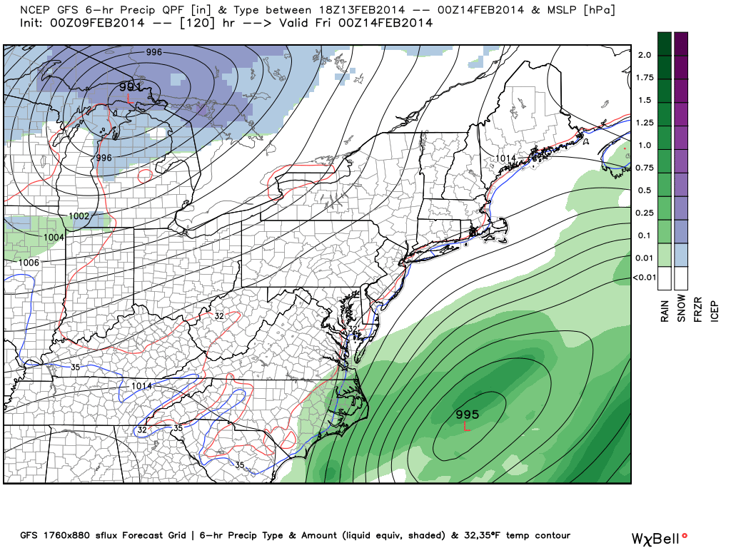
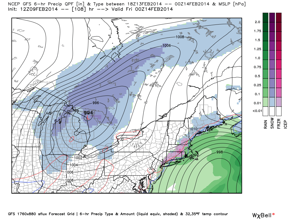
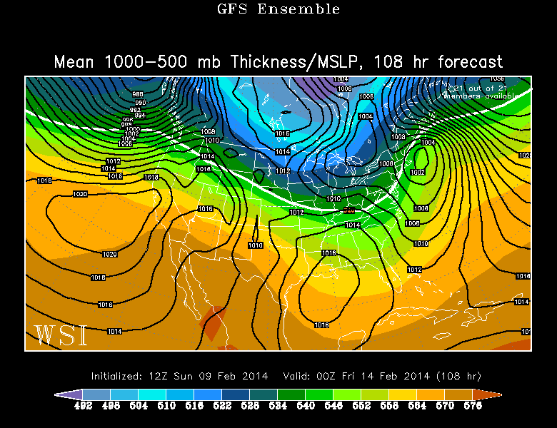
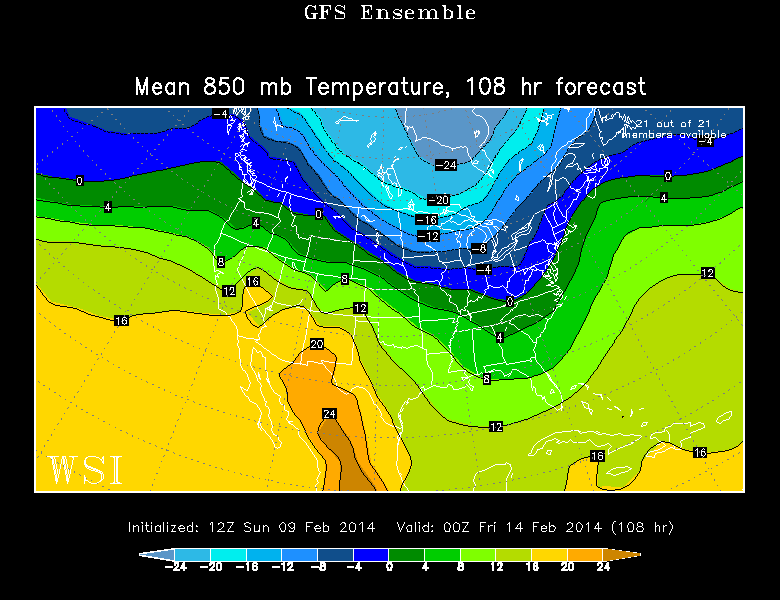
GFS Model + Ensembles
GFS – Saturday night run – The storm is out in the Atlantic Ocean and completely misses Southern New EnglandGFS – Sunday morning – Some precipitation, but not a high-impact storm. Rain in the I-95 corridor, snow inland. A few inches in Worcester.GFS Ensemble Mean – Sunday morning – Decent agreement on a storm near SNE on Thursday eveningGFS Ensemble Mean – 850mb Temperature – Sunday morning – 850mb is a pressure level that usually correlates to roughly 5,000 feet off the surface in SNE. A temperature of more than 0°C will not yield snow. In this scenario, the 0° line is right in the I-95 corridor.GEFS Members – Sunday morning – Several members have a storm, but those with the stronger storm are also closer to the coast – which would bring mainly rain.
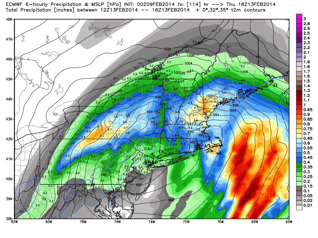
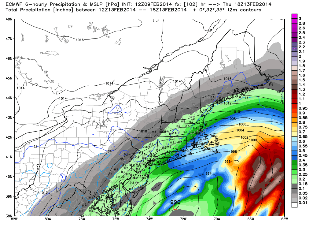
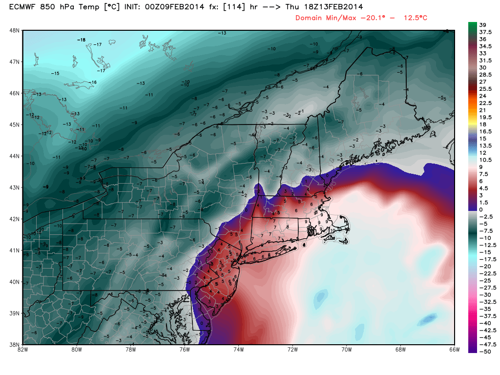
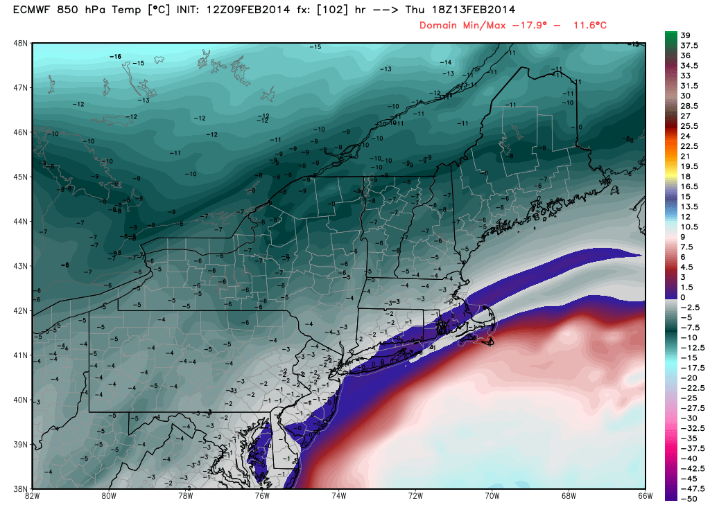
ECMWF Model
ECMWF – Saturday evening run – An inland storm track that brings all rain to Southern New England.ECMWF – Sunday morning run – The storm is considerably farther east and still fairly strong as it passes by Southern New England. It is not cold enough, however, for exclusively snow in all of SNE. It would be snow inland.ECMWF – 850mb Temperature – Saturday night run – Warmth pushes well inland yielding all rain.ECMWF – 850mb Temperature – Sunday morning run – Temperature at around 5000 ft. is marginal for snow in the I-95 corridor. If it were coming down heavy, it would most likely stay as snow.
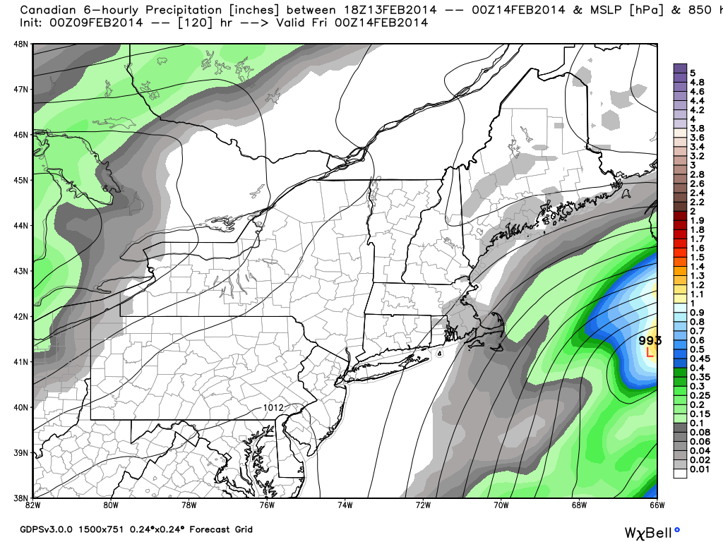
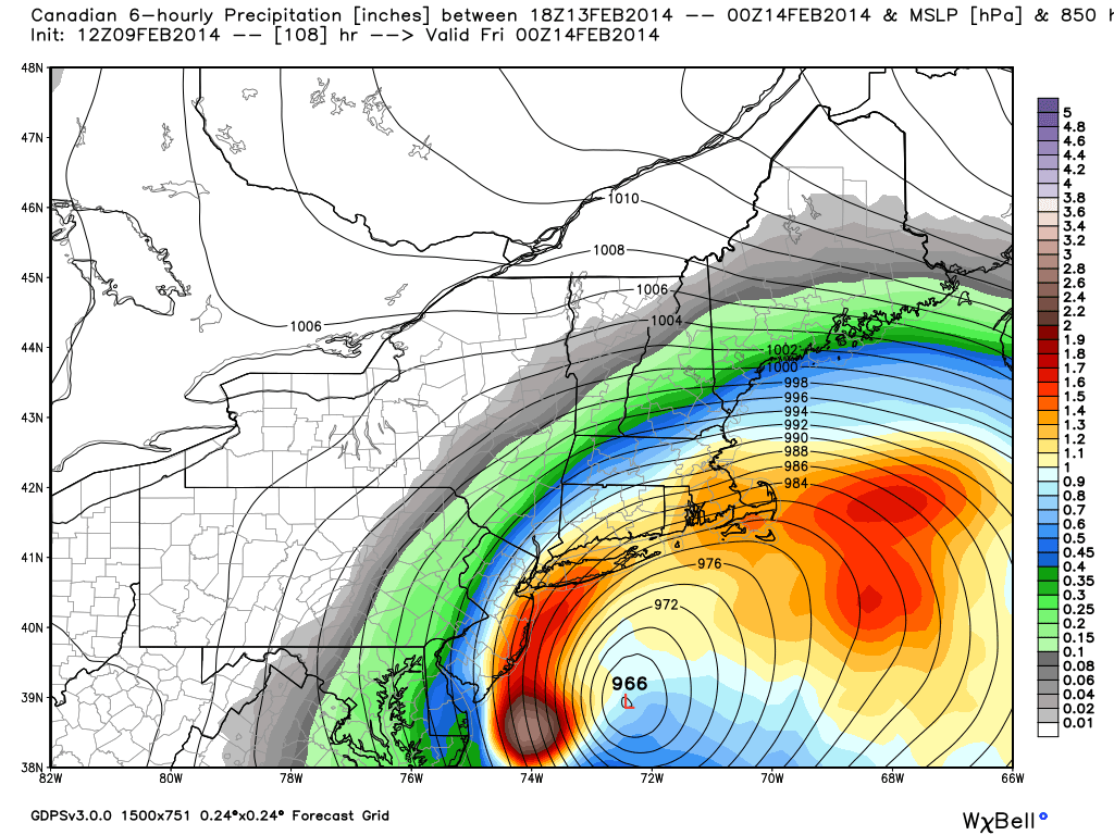
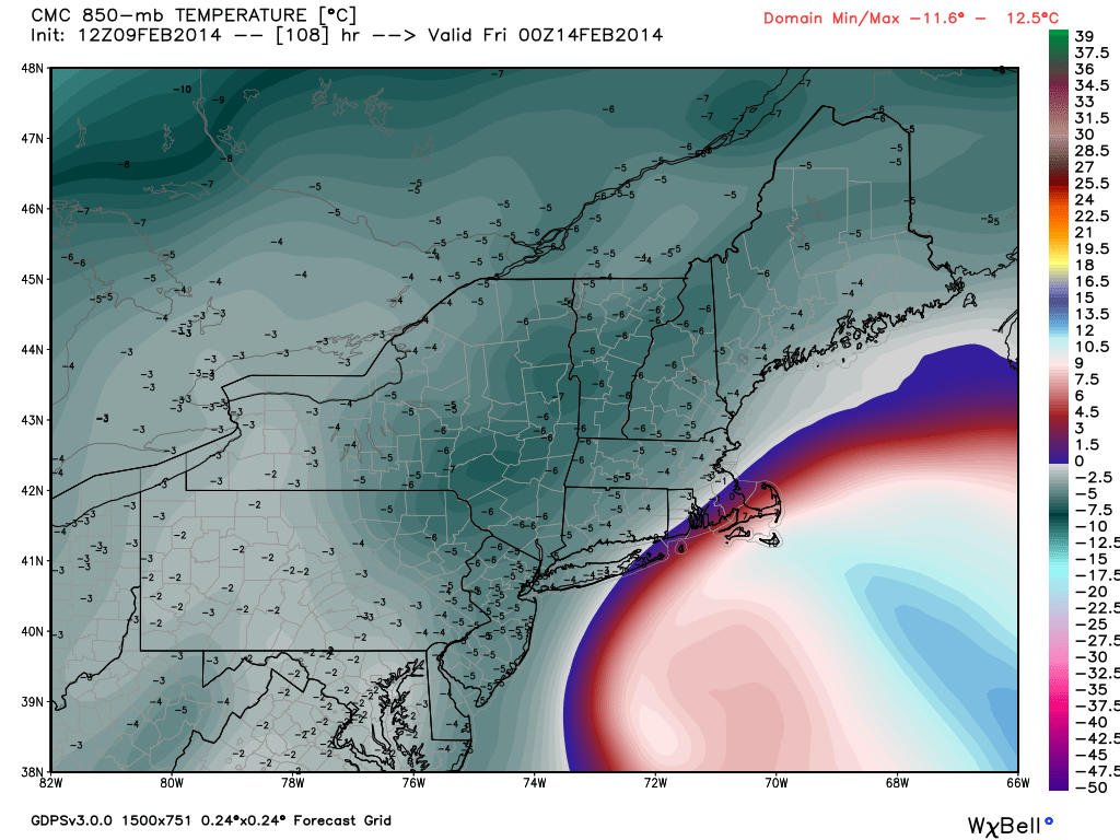
Canadian Model
CMC – Saturday night run – Weaker storm out to sea with little impact in SNE.CMC – Sunday morning run – Huge storm, most likely a blizzard, for part of Southern New England and Long Island. This particular model run has caught the attention of many meteorologists, and rightfully so!CMC – 850mb Temperature – Sunday morning run – Rain /snow line is close to Providence. The Cape and Islands would see some rain with this track.
Japanese Model
JMA – Sunday morning run – This model is a little quicker with the storm arriving late Wednesday night. Track is favorable for snow or a mix in the I-95 corridor.
The Bottom Line
The models have converged on a track that is offshore, but close enough for a significant impact in Southern New England. This is just one computer model run.It would not surprise me if the models backed off this higher-impact scenario with the next run due out tonight. As you can see by looking at the different ensemble members, there is still a lot of uncertainty with the track and intensity of the storm. Even the timing is still in question, with some models having the storm peak Thursday morning, while others favor Thursday evening.
There is not much wiggle room with this storm’s track. The very cold weather will be on the way out, and if it is a big snowstorm, it will have to take a track that keeps just enough cold air around while also allowing the heavy precipitation to reach Southern New England. It’s happened before, but the odds favor rain getting involved in the I-95 corridor and near the coast.