Clear skies and light winds combined with snow on the ground and dry air will lead to a very cold night Tuesday in Southern New England. Some in the countryside may see the temperature drop to near zero, and elsewhere the low will be in the single digits to low teens. Wednesday will mostly sunny and chilly, with highs in the mid to upper 20s.
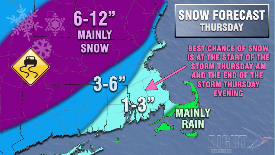
A large winter storm developing in the Southeastern United States will head northeast Wednesday night into Thursday. Freezing rain could lead to a paralyzing ice storm in the parts of the Southeast, and the interior Mid-Atlantic will pick up heavy snow. Clouds will increase Wednesday night, and snow or mixed precipitation will develop in Southern New England around dawn on Thursday. The temperature will stay in the 20s Wednesday night before rising to the 30s near the coast early Thursday.

The storm looks like it will bring more rain than snow to most of Southeastern New England. The National Weather Service has issued a Winter Storm Watch for part of Southern New England. A brief burst of snow and mixed precipitation may lead to a minor accumulation before a change to rain from south to north during the morning. The temperature will rise into the mid to upper 30s during the afternoon as rain continues. The rain may be heavy at times, and poor drainage flooding is possible due to ice-clogged storm drains.
The wind will increase to 20-30 mph near the coast, and gusts to 50 mph are possible in Eastern Massachusetts. The wind will gust to around 40 mph near the RI coast. Minor coastal flooding is possible during high tide in Eastern MA.
The precipitation may change back to snow before ending Thursday evening. A minor accumulation is possible, and there could be some icy spots early Friday morning as the temperature falls into the 20s.
Friday looks partly cloudy and cool, with highs in the 30s. Snow showers are possible Friday night into Saturday as a disturbance moves in from the west.
We will have another Live Blog on Wednesday to give updates on the forecast.


