
The average high temperature over the past four days in Southern New England was near 50°. The average high temperature in the upcoming week will be about 20° colder as winter makes a roaring return on the Northeastern United States. In addition to the cold weather, flakes may fly during three different events in the week ahead.
The first snowflakes are possible Sunday night as a weak disturbance passes through. Snow showers may develop late at night. It certainly does not look like a big deal, and a coating of snow is possible before dawn. The best chance of seeing a coating is near the coast. The temperature will drop into the upper 20s to low 30s by dawn Monday.
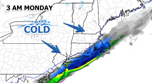
Monday will be partly cloudy, brisk, and chilly. The temperature will struggle to get to the mid 30s, with wind chills in the 20s. It will be mainly clear to partly cloudy Monday night. The low temperature will be in the upper teens to low 20s Tuesday morning.
Tuesday looks like another dry and cold day. The temperature may not get above 30°, even with some sunshine. There will be a 10-15 mph westerly breeze that will make if feel like the upper teens to low 20s. Clouds will thicken Tuesday night as a storm develops off the Mid-Atlantic coast early Wednesday morning. The low temperature will be near 20.
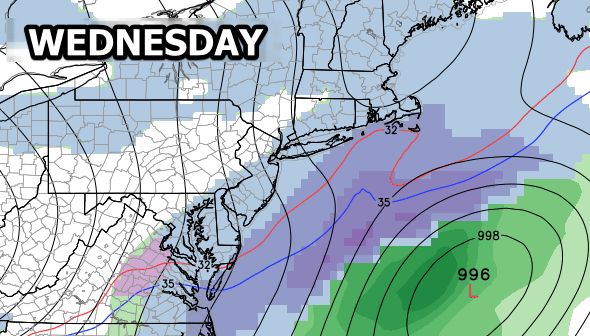
The storm scooting off the Mid-Atlantic coast may come close enough to spread light snow into Southern New England during the day Wednesday. At this point, it does not look like more than an inch or two will accumulate, and it may have trouble sticking to pavement with the midday sun angle.
More very cold weather is in the forecast for late in the workweek. Highs Thursday and Friday will be in the 20s to low 30s, and lows will be in the upper single digits to mid teens. Both days should be partly to mostly sunny.
We’re eyeing the potential for a storm next weekend. It is a long way out, but the pattern may be favorable for a storm to develop in the Southeastern United States and head up or off the Eastern Seaboard toward Southern New England. With cold air in place, if a storm develops, there would likely be some snow in Southern New England.
Cover photo by 02809photo.com


