Today’s Long Range Forecast video is long, but, I think, quite interesting. It is one that winter and snow lovers may want to record and replay in the Dog Days of summer. The pattern in the next two weeks has the potential to be epic in the Northeast. At a minimum, it will bring above normal snow to Southern New England. If it reaches its full potential, there will be more cumulative snow in the next eight days than there was during the Blizzard of 2013, which happened last February 8-9.
The midweek storm trended a bit colder this weekend. There is a good chance of several inches of snow in Southeastern New England early Wednesday. It will probably wreak havoc with the morning commute. Snow may change to sleet relatively quickly near the coast, and we’ll get into that in more detail in another post.
The weather looks cold and dry from Wednesday night through Saturday night as high pressure from Canada settles overhead. The storm in the forecast for late in the weekend could be a doozy. The models are indicating a slower-moving intense storm between Sunday and Tuesday – most likely late Sunday into Monday. The track of the storm will be critical, and we expect it to be cold enough for another several inches of snow before any mixed precipitation gets involved. If it tracks offshore, mixing may never be an issue. The point is we do not envision a track that brings rain before snow accumulates.
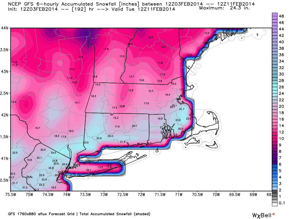
Ignore the fact that it has nothing on Cape Cod. It has to do with how the model grid is setup.
Looking further down the road…there may be more storminess later next week. The overall cool and active weather pattern will last through Valentine’s Day.
See the video for more on the high potential winter weather pattern.


