So far this February we’re averaging a snow event every three days in Southern New England. Right on queue, there is another snow threat for Tuesday. While this may end up being more of a non-event, there is still a scenario where Southern New England picks up another plowable snow. The snow forecast below is based on a weak storm tracking along or just south of the coast. The temperature would be in the low 30s, the snow would fall during the midday, with a sun angle comparable to late October, and the precipitation would not be terribly heavy. Factoring all those things into the equation, the snow would have a tough time sticking on treated surfaces. The timing looks like mid to late morning to mid to late afternoon or early evening.
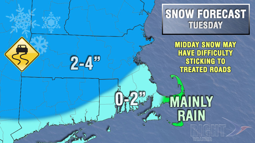
So, what would it take to have a snowier Tuesday? If the storm tracks 50-100 miles farther south it will lock in the cold air and a southern track would also show a stronger disturbance with the potential to develop into a storm that could bring 2-5″ of snow during the day. The odds of this happening are lower than the our favored scenario, but not extremely low. This forecast definitely bears watching.


