Southern New England is in the midst of another very cold stretch of weather. The temperature has not been above 35° in the Providence area since Monday, and it will likely stay below 35° into the middle of next week. The low temperature Saturday morning was 11° in Providence, and the high was 31° with partly sunny skies.

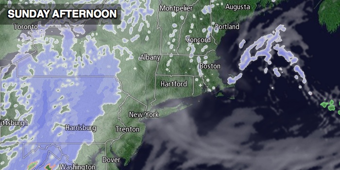
Sunday will be partly to mostly cloudy. Highs will be in the upper 20s to low 30s after a morning low temperature generally in the teens. A few snow showers or flurries are possible, especially in Eastern Massachusetts and in the afternoon.
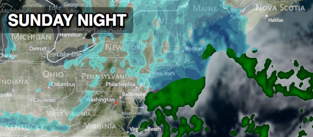
Steadier light snow or snow showers will arrive Sunday evening as an Arctic front brings a reinforcing shot of cold weather for early next week. The best chance of snow Sunday night is in the evening, but flurries and snow showers may linger after midnight. We are expecting a dusting to an inch of accumulation in all of Southern New England. Lows will be in the 20s.
Monday should feature increasing sunshine with highs in the mid to upper 20s. The weather will be cold and dry through the midweek. Tuesday will be mostly sunny with highs only in the 20s. It will be frigid Tuesday night under clear skies with no breeze. Lows will be in the single digits to low teens Wednesday morning. The weather will stay dry through Wednesday as a storm develops in the Southeast. Highs will be in the upper 20s to low 30s on Wednesday.
The storm in the Southeast will head for New England Wednesday night. The cold area of high pressure will slide east and that may prevent the storm from bringing exclusively snow to Southern New England. It looks like there will be a mix of snow and rain in this highly track-dependent storm. If the storm stays far enough offshore, it will bring mainly snow. If it hugs the coast or moves inland, it looks like mainly a rain maker. We will keep you posted.
The storm will likely linger on Thursday, at least through the morning. There may be a break in the action late Thursday through Friday, which would be great news for anyone with Valentine’s Day plans.


