Light snow Monday will serve as the opening act to a couple of bigger ticket events later in the week. A storm scooting south of Southern New England will spread light snow into Southern New England during the day. The steadiest snow will be near the coast. Accumulations should be minor, with relatively light snow, temperatures in the upper 20s to low 30s, and the timing during the day. Those factors will especially help to limit accumulation on paved surfaces.

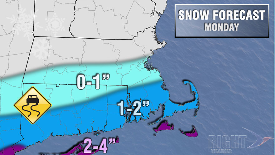
Snow will develop during or just after the morning commute. Light snow is likely into the early afternoon before tapering to flurries or ending by the evening commute. The best chance of a couple of inches of snow is near the coast, with a shot at 3-4″ of snow on the islands. The Providence area will most likely pick up 1-2″ of snow. Boston will be on the northern fringe of the snow, and should see less than an inch. The wind will not be a big factor on Monday. You can expect a 5-15 mph northerly breeze. The temperature will fall into the low to mid 20s by late Monday night. Any slush or water will freeze, and black ice is possible on untreated surfaces.
Heavier snow and mixed wintry precipitation will reach Southern New England with the next storm Tuesday night into Wednesday. A third storm is likely next weekend.


