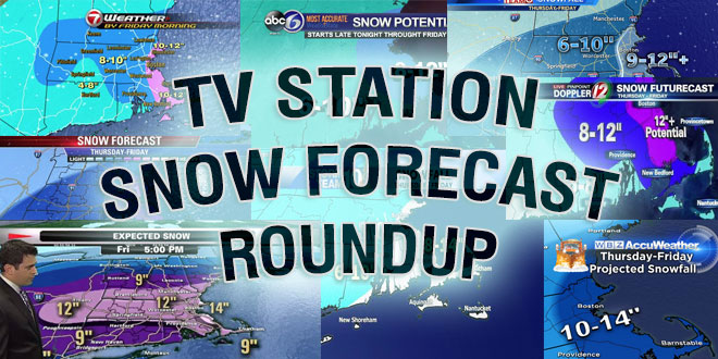
TV Station Snow Forecast Roundup

A meteorological bomb will explode in the Atlantic Ocean Wednesday morning. The track of the incredibly intense storm will be critical for snow totals in Southern New England. It’s a very tough snowfall forecast that a lot of TV meteorologists probably thought they would not have to make again until next winter. Here is a look at some of the TV Station snow forecasts from Boston, Providence, and Hartford.
Snowstorm? Depends on where u r: pic.twitter.com/XnjmLZIISs
— Pete Bouchard (@PeteNBCBoston) March 24, 2014
https://twitter.com/JoeJoyceNECN/status/448166838413705216
Coating-2" of snow should do it across CT. Slight chance for somewhat higher amounts E CT if storm takes last minute jog west. #FirstAlertCT
— Ryan Hanrahan (@ryanhanrahan) March 24, 2014
Our latest snowfall forecast. Highest amounts Cape Cod/Islands, Down East ME and Nova Scotia. pic.twitter.com/AEQ26CzWdY
— Mike Seidel (@mikeseidel) March 24, 2014
A few deg above freezing this pm despite sun. Arctic air in place but track too far east. No changes to snowfall map. pic.twitter.com/miKHh3dAsY
— Lee Goldberg (@LeeGoldbergABC7) March 24, 2014
Latest on the storm including snow amounts here –> http://t.co/lpcgeK6vcH #ri #ma
— T.J. Del Santo ⚡🔭 (@tjdelsanto) March 24, 2014


