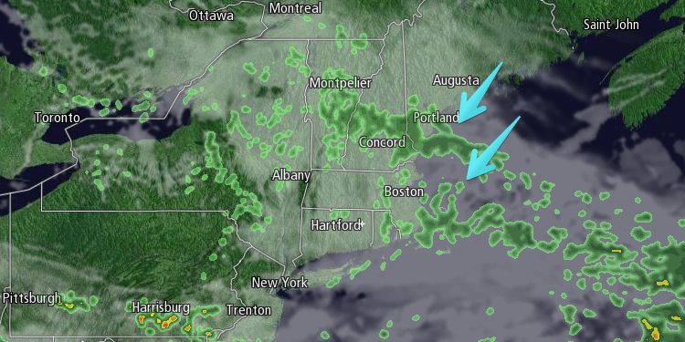
Nice weather managed to hang on through most of the day in Rhode Island. Highs reached the 80s near Providence before a wind shift to the northeast brought cooler weather in the afternoon. While it was still pleasant in Rhode Island, it turned cloudy and damp late in the day in Southeastern Massachusetts. The temperature tumbled into the mid to upper 50s.
Tuesday night looks cloudy with scattered showers and a possible thunderstorm. It will continue to cool into the low 50s overnight. Patchy fog and mist is possible. Wednesday morning will be dreary, with occasional showers, drizzle, and mist, and temperatures holding in the low to mid 50s. There will be a 10-20 mph northeasterly breeze. Skies may brighten by mid to late afternoon, but the temperature will most likely not make it out of the 50s – about 15° below normal for late-May.

Wednesday night will be clear and cool, with lows in the low to mid 40s. Thursday should be a nice day. There will be plenty of sunshine, and highs will be in the mid to upper 60s. A light wind will give way to a late-day sea breeze.
It will likely stay dry into Friday. An approaching cold front could trigger afternoon or evening showers and thunderstorms. Highs will be in the mid to upper 60s, with a southwest breeze. Saturday looks mostly cloudy, and relatively cool, with highs in the mid 60s. Sunday should feature more sunshine, and it will be a bit warmer. Highs will be near 70.


