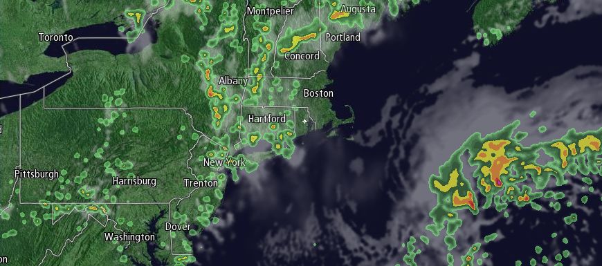
Friday was not a miserable day in Rhode Island, but it was not a banner day, either. Highs were in the low to mid 60s – several degrees cooler than normal for late-May. The weather will improve over the Memorial Day weekend, with the nicest day likely on Monday.

Saturday will become partly cloudy. It will still be a bit cool for late-May, with highs in the mid to upper 60s. The coolest weather will be along the Eastern Massachusetts coast thanks to a northeast breeze. The best chance of seeing showers on Saturday is in Western New England during the afternoon. Connecticut and Western Massachusetts, two areas that saw heavy showers on Friday, will be under the gun for more pop-up showers on Saturday. There is a slight chance of showers in RI and SE MA.
A disturbance will move east on Sunday, and the primary shower threat shifts east to include Rhode Island and Southeastern Massachusetts. It will be partly cloudy with highs in the mid to upper 60s. Showers and storms are possible from late morning through the afternoon. There could be some slow-moving storms with heavy downpours. We’ll continue keeping an eye on it.
A warm front will move through early Monday, and with a bit of luck the temperature will soar through the 70s on Monday afternoon. The wind will shift to the west, and highs may reach 80° away from the coast if the sky clears by mid-morning. It will be a breezy to windy day, with westerly winds between 15-30 mph.
The longest the warm weather will last is through midday Tuesday as a cold front is poised to bring another change in the middle of next week. The timing of the front is questionable at this point, and if it arrives sooner than expected, then it will be just one warm day (Monday) before the temperature drops with showers in the middle of the week. Otherwise, highs should be well into the 70s before showers threaten Tuesday afternoon or evening.


