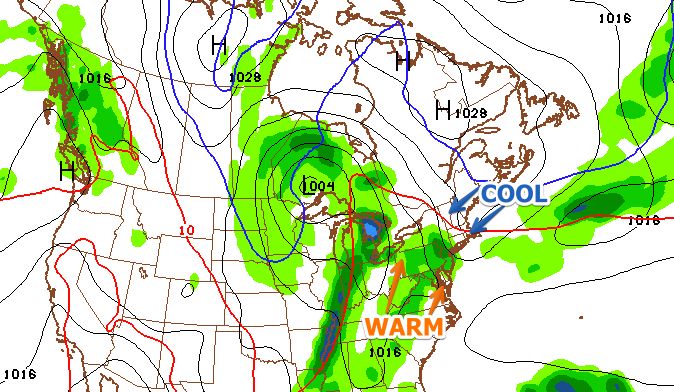
The Long-Range Forecast is a day later than normal this week because of a prior commitment on Thursday. There has not been much change since Monday in the overall outlook for the next couple of weeks. The devil is in the details with a couple of potentially significant weather events between May 12-20. The first was the possibility of a big warm-up early next week. At this point, it looks like a back-door cold front will shorten than warm-up considerably, and it may lead to relatively cool weather by Tuesday afternoon and Wednesday. The timing of the front is still questionable, but we are confident that it will make it into RI and SE MA. It looks like the warmest weather in the next couple of weeks may be between Saturday afternoon and Monday afternoon. At least Mother’s Day looks gorgeous.
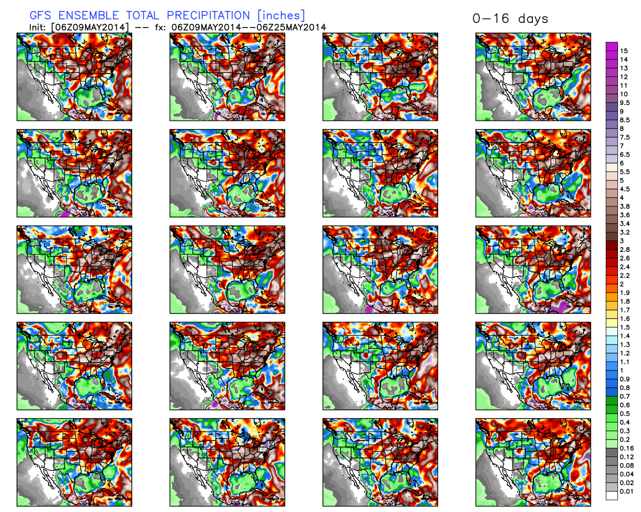
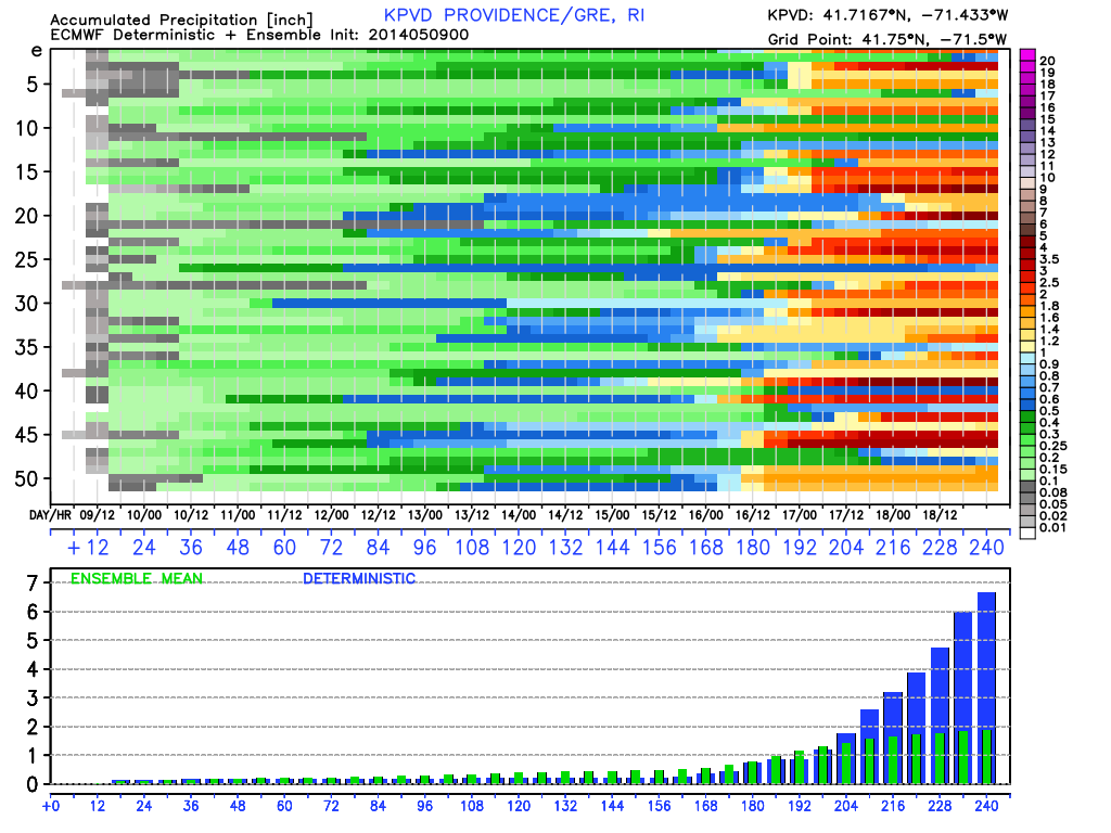
The other potentially big weather event that we mentioned on Monday is the possibility of a slow-moving rainy pattern between May 15-20. The latest runs of the GFS are producing an extended period of unsettled weather that could lead to several inches of rain in a seven-day period. While it’s possible, once again, the key in a situation like that is exactly where the jet stream buckles and allows a slow-moving storm to form. The aforementioned GFS runs are bullish on a dreary pattern. The European model is not as aggressive with a long-lived rain event, but still brings at least one rainstorm between May 15-22.
With all that in mind, here are our thoughts on what to expect over the next couple of weeks.
- Saturday could break out into warm sunshine, but clouds/showers are still a threat. We like Mother’s Day as the safe bet for outdoor activities.
- Monday looks warm, with a shower/t-storm threat in the afternoon
- We expect the back door cold front to arrive on Tuesday putting an end to the relatively warm weather. It looks like it may get to RI before the temperature reaches the 70s, and it may fall back into the 50s by late in the day.
- High pressure east of New England will keep it comfortable and dry Wednesday through, at least, midday Thursday. Highs will range from the upper 50s in E MA to the low to mid 60s in RI.
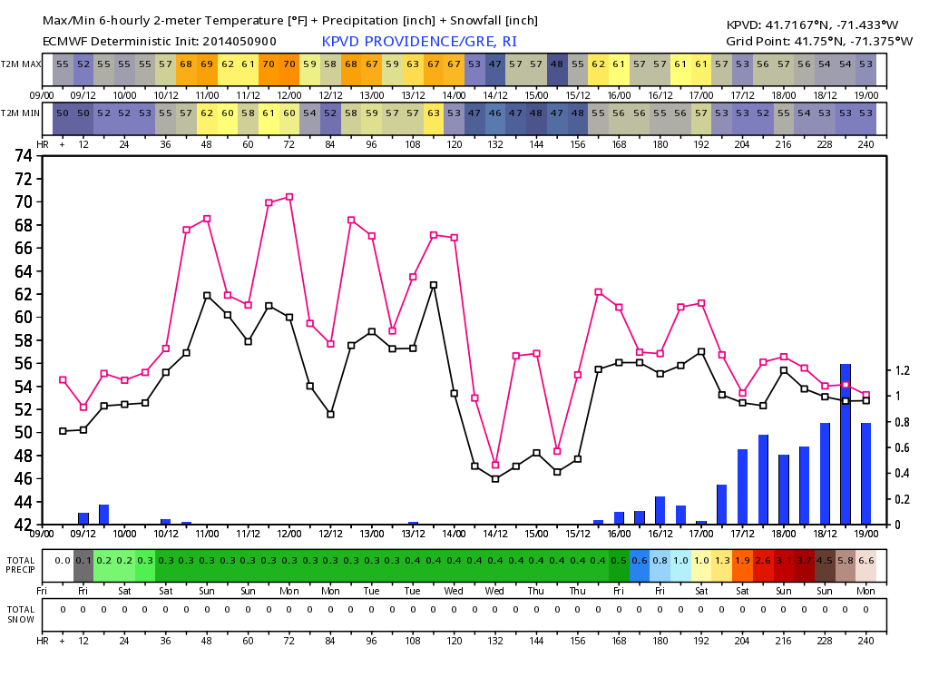
- A slow-moving system will bring rain between late Thursday and next weekend. It remains to be seen if the system will be just progressive enough to only have an impact late in the workweek or if it will stall and stay unsettled through next weekend. Right now, the outlook is rather bleak, and, in a worst-case scenario, there could be several inches of rain.
- Temperature-wise, the nice/warm weather is reserved for this weekend and Monday. If the pattern gets unsettled, the temperature departure from normal may stay positive, but only because of a warmer than normal low temperatures. There will likely not be any 70° warmth in a wet pattern. Believe it or not, a 70° normal high temperature is only 10 days away.
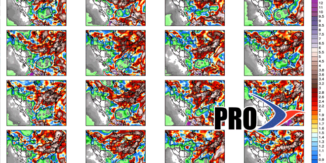
- See the graphics below for more.