
The sensational start to June will continue early in the workweek. Sunday night will be mainly clear and comfortable. The temperature may fall into the 40s in the countryside. It will stay in the low to mid 50s in Providence. The wind will shift to the southwest on Monday. That wind direction means inland locations will warm into the upper 70s to low 80s. The Rhode Island coast, Buzzards Bay, Cape Cod, and the islands, will be the coolest, with highs in the low to mid 70s.
Monday night will be mainly clear with lows in the mid to upper 50s. Tuesday should be dry in RI and Southeast MA, but an approaching cold front could trigger a few afternoon showers and thunderstorms in Central and Western Massachusetts. It will be warm and a bit muggy. Highs will be in the 70s near the South Coast, and low to mid 80s in the rest of Southern New England.
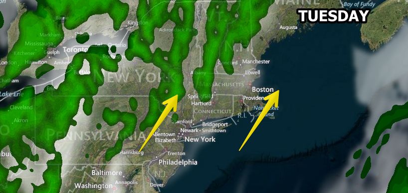
The middle of the week looks unsettled. Showers and thunderstorms are likely Tuesday night and/or Wednesday morning. There is a lower chance of rain Wednesday afternoon. Highs will be in the 70s. Another system will threaten Southern New England with more showers on Thursday – especially along the South Coast. Highs will be in the 70s again.
Looking ahead to next weekend, dry and seasonable weather is in the forecast for Friday through Sunday. Highs will be in the 70s, lows will be in the 50s.


