So far, this June has been nothing special. There have been a few nice days, but most of this week was unsettled, and we’re looking at slow improvement over the weekend. Clouds will be stubborn on Saturday, and there is a slight chance that the weather will not improve much on Sunday, either. It all hinges on how quickly a storm moves east of New England. It would be awful if the Father’s Day weekend weather goes down the tubes.
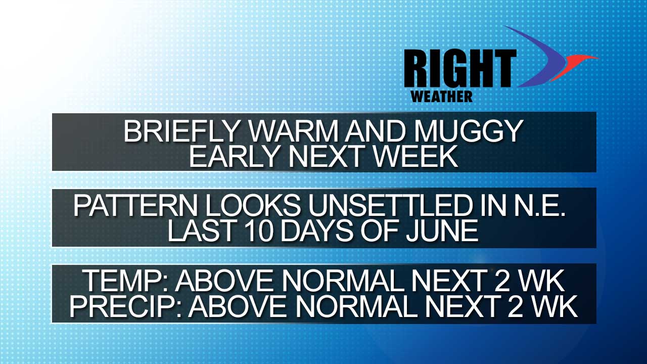
Looking ahead to next week, there will be a warm-up Monday-Wednesday. It will get muggier Tuesday into Wednesday. Highs will be in the low to mid 80s inland, and 70s to low 80s near the coast. Lows will be in the 60s Tuesday and Wednesday. The warm-up will likely end with thunderstorms in the midweek.
High pressure will move from Central Canada to the Northeast United States late next workweek. Right now, it looks like the high will push far enough south that fair/dry weather spreads in from Thursday into or through next weekend. If the front gets hung up and the high stays north we could be in for an unsettled pattern from June 19-22. The jet stream typically weakens as we head into summer, and big high pressure cells moving from Ontario to New England become less of a sure thing. That may not bode well for late next week. Eventually, the pattern that’s been in place all spring will start to change.
In the grand scheme, I do not see a lot of hot weather ahead through the first week of summer – which begins on June 21. Around that same time, the normal high temperature reaches 80°. So, basically, if the weather’s not bad – it’s good! The two things we’re looking for in the Long-Range Forecasts for the rest of the summer are heat waves and tropical systems. A heat wave seems rather unlikely, and even though the GFS model continues developing a tropical storm off the Southeast Coast in late-June, that is also unlikely.
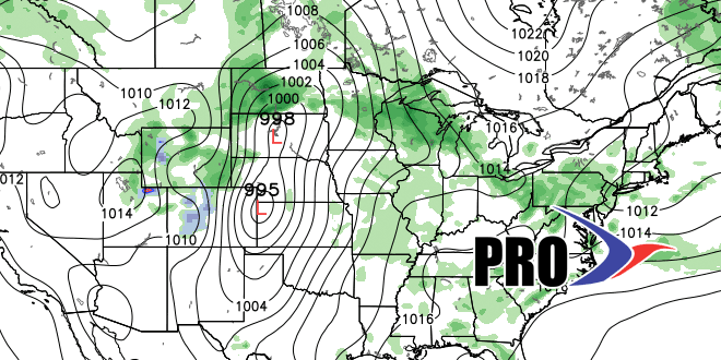
The day to day weather will be highly contingent on whether we’re on the warm or cool side of the jet stream. In late-June, it looks like we’ll be on the “cool” side of the jet stream, which is not a bad place to be as long as high pressure is in control of the weather. However, I think we’ll be close enough to the boundary between cool/dry and hot/humid weather that we’ll see some showers from time to time in late-June.