Long-Range Forecast – June 20

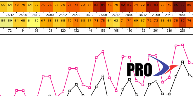
June is still running slightly warmer than normal, but there has been a noticeable absence of very warm to hot weather. The high temperature for the year is in the mid 80s in Boston and Providence. The last time we had to wait this long into the year for a high in the upper 80s was 2003, and if it does not reach 88 degrees by the end of the month, then it will be the first time since 1982 that the high temperature did not top 87 degrees before July. So, that begs the question, will it reach 88 degrees in the next 10 days? There is a decent chance of that happening as the pattern shifts to something that more closely resembles summer in Southern New England.
That pattern shift will not happen this weekend, as high pressure from central Canada keeps it dry and a bit cooler than normal in Southern New England. The humidity will rise a bit in the middle of next week, but the temperature may not get above the low to mid 80s through Wednesday. A midweek cold front will threaten the area with showers and/or thunderstorms Wednesday and/or Thursday. It will be replaced by another area of high pressure from central Canada that will move south over Southern New England into next weekend.
It’s at that point that the pattern may shift so something more summery in Southern New England. The high pressure cell may quickly slide south allowing for the wind to swing around to the west-southwest next weekend. That will bring in very warm and humid weather. There are some discrepancies among the models, and the hot stretch may be delayed by a wave of low pressure forming along the front in the midweek. We are, however, fairly confident in the warm-up, and there is a decent shot of 90° inland before the end of the month.
Looking ahead to the week of the 4th, the weather looks very warm and humid early in the week, but a series of fronts could bring showers and then more comfortable weather during the midweek. It’s still too early to talk about specifics for Independence Day, and, right now, all kinds of weather are still in play.
At one point the pattern looked fairly unsettled for the last ten days of the month. Now, it looks pretty dry. We have scaled back our precipitation forecast for late June and early July.


