We are well into the month of June and the high temperature for the month is still just 86° in Providence. It’s the first time since 1998 that we have had to wait this long before reaching the upper 80s, and if it does not make it to 87° by Wednesday, then it will be the longest we have had to wait for a temperature above 86° since 1982, when it finally reached 87° on July 9. Having said that, it has not been a very cool month. The temperature at TF Green is averaging just 0.2° below normal, and it will probably get to above normal for the month again by Thursday.
Looking ahead, the weather will be unsettled on Thursday, then likely mainly dry into and through the weekend. There is a slight chance at hot weather early next week if the wind can swing around to the west-southwest. Any warm-up will likely be short-lived as showers/storms threaten again in the midweek – which has been a pattern for the past several weeks.
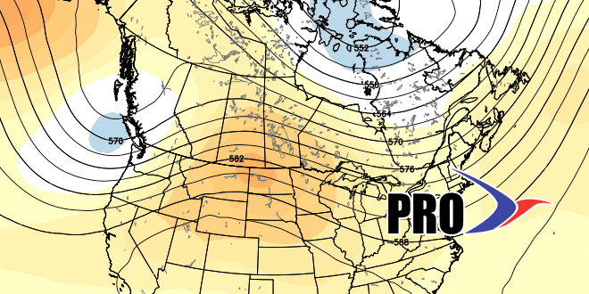
It’s still too early to talk specifically about the weather on the 4th. It does not look like it will be unbearably hot, with a trough persisting in the Eastern United States. The overall pattern for early July looks similar to the current pattern, which means we are unlikely to duplicate the scorching start to the month that we felt last year when six of the first eight days were 88° or warmer, and five were in the 90s.


